Sauri elevation
Sauri (Zamfara, Tsafe), Nigeria elevation is 612 meters and Sauri elevation in feet is 2008 ft above sea level [src 1]. Sauri is a populated place (feature code) with elevation that is 315 meters (1033 ft) bigger than average city elevation in Nigeria.
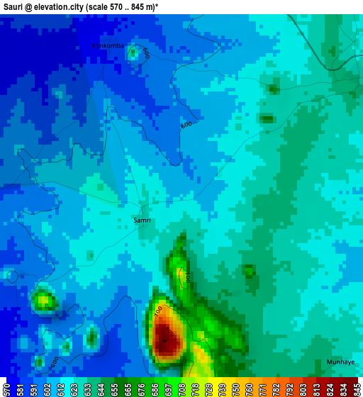
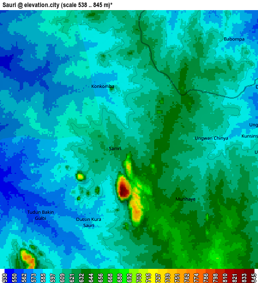
Below is the Elevation map of Sauri, which displays elevation range with different colors. Scale of the first map is from 570 to 845 m (1870 to 2772 ft) with average elevation of 617.1 meters (=2025 ft) [note 1]
These maps also provides idea of topography and contour of this city, they are displayed at different zoom levels. More info about maps, scale and edge coordinates you can find below images.
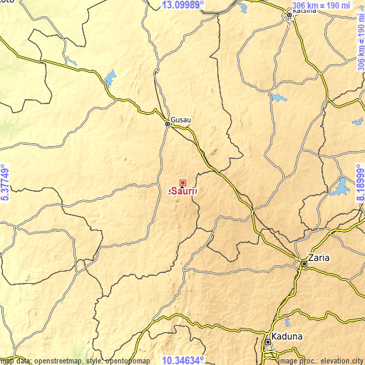
| \ | Map #1 | Map #2 | Topo.Map |
| Scale [m] | 570..845 m | 538..845 m | × |
| Scale [ft] | 1870..2772 ft | 1765..2772 ft | × |
| Average | 617.1 m = 2025 ft | 604.5 m = 1983 ft | × |
| Width | 9.57 km = 5.9 mi | 19.14 km = 11.9 mi | 306.2 km = 190.3 mi |
| Height | 9.57 km = 5.9 mi | 19.14 km = 11.9 mi | 306.2 km = 190.3 mi |
| ↑Max Latitude | 11.769575° | 11.812593° | 13.09989° |
| Latitude at center | 11.72655° | 11.72655° | 11.72655° |
| ↓Min Latitude | 11.683519° | 11.64048° | 10.34634° |
| ← Min Longitude | 6.739795° | 6.695849° | 5.37749° |
| Longitude center | 6.78374° | 6.78374° | 6.78374° |
| →Max Longitude | 6.827685° | 6.871631° | 8.18999° |
Nearby cities:
Cities around Sauri sort by population:
• Gusau elevation 451 m
51 km,  345°
345°
• Funtua 709 m
61.8 km,  111°
111°
• Sofo-Birnin-Gwari 657 m
79.1 km,  180°
180°
• Bakori 656 m
72.3 km, 105°
• Kankara 595 m
72 km,  71°
71°
• Tsafe 565 m
29.7 km,  30°
30°
• Kwatarkwashi 483 m
46.2 km,  5°
5°
• Dan Sadau 502 m
57.3 km,  213°
213°
• Sabuwa 680 m
71.6 km,  149°
149°
• Bungudu 413 m
65.3 km,  337°
337°
• Dandume 709 m
47.7 km,  128°
128°
• Faskari 629 m
26.8 km,  91°
91°
Multilingual:
 En español:
Sauri elevación 612 m.
 En France:
Sauri élévation 612 m.


Sources and notes:
- [note 1] Map square and city borders are not equal. Map elevation data is calculated only from area inside that square.
- [src 1] Elevation data from geonames database provided with same terms of usage.
- [src 2] The elevation map of Sauri is generated using elevation data from NASA's 3 arcsec (90m) resolution SRTM data.
- [src 3] Base (background) map © OpenStreetMap contributors tiles are generated by Geofabrik and OpenTopoMap.
Copyright & License:
This Sauri Elevation Map is licensed under CC BY-SA. You may reuse any part from this page, if you give a proper credit by linking to this URL:
 More info on terms of use page.