Idah elevation
Idah (Kogi), Nigeria elevation is 73 meters and Idah elevation in feet is 240 ft above sea level [src 1]. Idah is a seat of a second-order administrative division (feature code) with elevation that is 224 meters (735 ft) smaller than average city elevation in Nigeria.
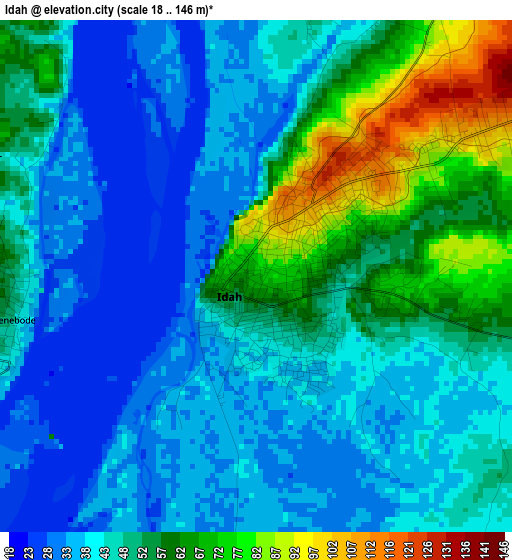
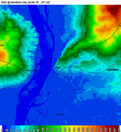
Below is the Elevation map of Idah, which displays elevation range with different colors. Scale of the first map is from 18 to 146 m (59 to 479 ft) with average elevation of 47.8 meters (=157 ft) [note 1]
These maps also provides idea of topography and contour of this city, they are displayed at different zoom levels. More info about maps, scale and edge coordinates you can find below images.
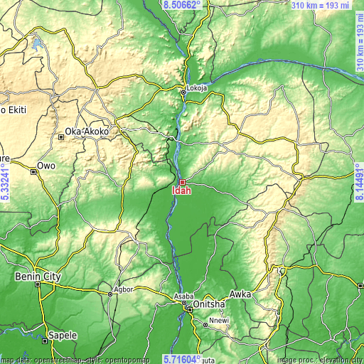
| \ | Map #1 | Map #2 | Topo.Map |
| Scale [m] | 18..146 m | 18..271 m | × |
| Scale [ft] | 59..479 ft | 59..889 ft | × |
| Average | 47.8 m = 157 ft | 64.9 m = 213 ft | × |
| Width | 9.7 km = 6 mi | 19.39 km = 12 mi | 310.3 km = 192.8 mi |
| Height | 9.7 km = 6 mi | 19.39 km = 12 mi | 310.3 km = 192.8 mi |
| ↑Max Latitude | 7.157055° | 7.200656° | 8.50662° |
| Latitude at center | 7.11345° | 7.11345° | 7.11345° |
| ↓Min Latitude | 7.069841° | 7.026228° | 5.71604° |
| ← Min Longitude | 6.694715° | 6.650769° | 5.33241° |
| Longitude center | 6.73866° | 6.73866° | 6.73866° |
| →Max Longitude | 6.782605° | 6.826551° | 8.14491° |
Nearby cities:
Cities around Idah sort by population:
• Auchi elevation 188 m
52.7 km,  264°
264°
• Ajaokuta 52 m
50.8 km,  349°
349°
• Agenebode 55 m
5 km, 259°
• Ogurugu 54 m
43.2 km,  147°
147°
• Adoru 90 m
49.2 km,  107°
107°
• Illushi 32 m
50.7 km,  193°
193°
• Adani 59 m
51.3 km,  144°
144°
• Adogo 222 m
52.5 km,  327°
327°
• Fugar 241 m
26.6 km, 264°
• Onyedega 32 m
26.6 km,  195°
195°
• Ugwolawo 114 m
24.5 km,  56°
56°
• Ajaka 210 m
11.7 km,  54°
54°
Multilingual:
 En español:
Idah elevación 73 m.
 En France:
Idah élévation 73 m.


Sources and notes:
- [note 1] Map square and city borders are not equal. Map elevation data is calculated only from area inside that square.
- [src 1] Elevation data from geonames database provided with same terms of usage.
- [src 2] The elevation map of Idah is generated using elevation data from NASA's 3 arcsec (90m) resolution SRTM data.
- [src 3] Base (background) map © OpenStreetMap contributors tiles are generated by Geofabrik and OpenTopoMap.
Copyright & License:
This Idah Elevation Map is licensed under CC BY-SA. You may reuse any part from this page, if you give a proper credit by linking to this URL:
 More info on terms of use page.