Mberubu elevation
Mberubu (Enugu, Nkanu East), Nigeria elevation is 82 meters and Mberubu elevation in feet is 269 ft above sea level [src 1]. Mberubu is a populated place (feature code) with elevation that is 215 meters (705 ft) smaller than average city elevation in Nigeria.
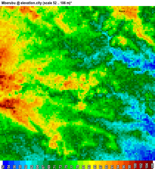
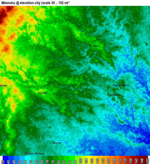
Below is the Elevation map of Mberubu, which displays elevation range with different colors. Scale of the first map is from 52 to 106 m (171 to 348 ft) with average elevation of 75 meters (=246 ft) [note 1]
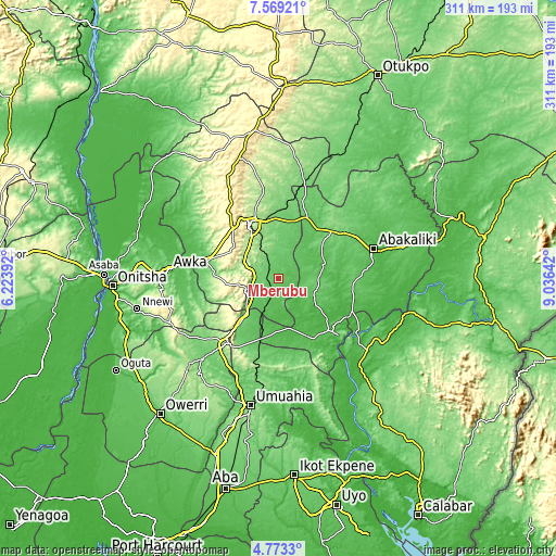
These maps also provides idea of topography and contour of this city, they are displayed at different zoom levels. More info about maps, scale and edge coordinates you can find below images.
| \ | Map #1 | Map #2 | Topo.Map |
| Scale [m] | 52..106 m | 39..152 m | × |
| Scale [ft] | 171..348 ft | 128..499 ft | × |
| Average | 75 m = 246 ft | 74.7 m = 245 ft | × |
| Width | 9.72 km = 6 mi | 19.43 km = 12.1 mi | 310.9 km = 193.2 mi |
| Height | 9.72 km = 6 mi | 19.43 km = 12.1 mi | 310.9 km = 193.2 mi |
| ↑Max Latitude | 6.216789° | 6.260474° | 7.56921° |
| Latitude at center | 6.1731° | 6.1731° | 6.1731° |
| ↓Min Latitude | 6.129408° | 6.085712° | 4.7733° |
| ← Min Longitude | 7.586225° | 7.542279° | 6.22392° |
| Longitude center | 7.63017° | 7.63017° | 7.63017° |
| →Max Longitude | 7.674115° | 7.718061° | 9.03642° |
Nearby cities:
Cities around Mberubu sort by population:
• Enugu elevation 192 m
33.2 km,  334°
334°
• Awgu 133 m
20.2 km,  236°
236°
• Udi 437 m
28.1 km,  304°
304°
• Amagunze 92 m
17.7 km,  8°
8°
• Ake-Eze 52 m
29 km,  169°
169°
• Isiaka 75 m
35.7 km,  195°
195°
• Ezillo 71 m
35.2 km,  36°
36°
• Nkwoagu Isuochi 319 m
33 km,  232°
232°
• Obiozara 53 m
21.1 km,  131°
131°
• Isu 100 m
19.1 km,  97°
97°
• Agbani 151 m
17.4 km, 328°
• Ndeaboh 83 m
16.9 km, 203°
Multilingual:
 En español:
Mberubu elevación 82 m.
 En France:
Mberubu élévation 82 m.


Sources and notes:
- [note 1] Map square and city borders are not equal. Map elevation data is calculated only from area inside that square.
- [src 1] Elevation data from geonames database provided with same terms of usage.
- [src 2] The elevation map of Mberubu is generated using elevation data from NASA's 3 arcsec (90m) resolution SRTM data.
- [src 3] Base (background) map © OpenStreetMap contributors tiles are generated by Geofabrik and OpenTopoMap.
Copyright & License:
This Mberubu Elevation Map is licensed under CC BY-SA. You may reuse any part from this page, if you give a proper credit by linking to this URL:
 More info on terms of use page.