Ukata elevation
Ukata (Niger, Mariga), Nigeria elevation is 420 meters and Ukata elevation in feet is 1378 ft above sea level [src 1]. Ukata is a populated place (feature code) with elevation that is 123 meters (404 ft) bigger than average city elevation in Nigeria.
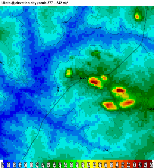
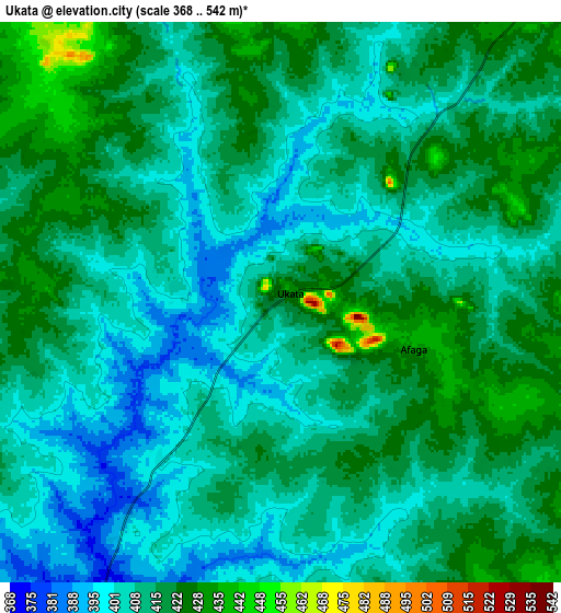
Below is the Elevation map of Ukata, which displays elevation range with different colors. Scale of the first map is from 377 to 542 m (1237 to 1778 ft) with average elevation of 407.4 meters (=1337 ft) [note 1]
These maps also provides idea of topography and contour of this city, they are displayed at different zoom levels. More info about maps, scale and edge coordinates you can find below images.
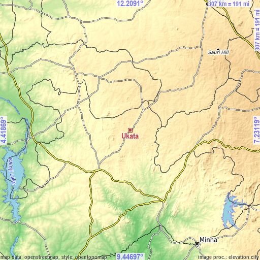
| \ | Map #1 | Map #2 | Topo.Map |
| Scale [m] | 377..542 m | 368..542 m | × |
| Scale [ft] | 1237..1778 ft | 1207..1778 ft | × |
| Average | 407.4 m = 1337 ft | 411.7 m = 1351 ft | × |
| Width | 9.6 km = 6 mi | 19.2 km = 11.9 mi | 307.1 km = 190.8 mi |
| Height | 9.6 km = 6 mi | 19.2 km = 11.9 mi | 307.1 km = 190.8 mi |
| ↑Max Latitude | 10.874379° | 10.917532° | 12.2091° |
| Latitude at center | 10.83122° | 10.83122° | 10.83122° |
| ↓Min Latitude | 10.788054° | 10.744883° | 9.44697° |
| ← Min Longitude | 5.780995° | 5.737049° | 4.41869° |
| Longitude center | 5.82494° | 5.82494° | 5.82494° |
| →Max Longitude | 5.868885° | 5.912831° | 7.23119° |
Nearby cities:
Cities around Ukata sort by population:
• Kontagora elevation 339 m
61.3 km,  219°
219°
• Rijau 358 m
69.2 km,  296°
296°
• Ibeto 344 m
83.7 km,  242°
242°
• Bena 555 m
51.8 km,  13°
13°
• Wasagu 501 m
60.7 km,  356°
356°
• Mando 435 m
82 km,  98°
98°
• Kusheriki 421 m
75.2 km,  116°
116°
• Kagara 287 m
85.7 km,  146°
146°
• Birnin Gwari 441 m
80.3 km, 103°
• Ribah 388 m
72.9 km,  329°
329°
• Sakaba 356 m
36.1 km,  316°
316°
• Bangi 427 m
0.3 km,  37°
37°
Multilingual:
 En español:
Ukata elevación 420 m.
 En France:
Ukata élévation 420 m.


Sources and notes:
- [note 1] Map square and city borders are not equal. Map elevation data is calculated only from area inside that square.
- [src 1] Elevation data from geonames database provided with same terms of usage.
- [src 2] The elevation map of Ukata is generated using elevation data from NASA's 3 arcsec (90m) resolution SRTM data.
- [src 3] Base (background) map © OpenStreetMap contributors tiles are generated by Geofabrik and OpenTopoMap.
Copyright & License:
This Ukata Elevation Map is licensed under CC BY-SA. You may reuse any part from this page, if you give a proper credit by linking to this URL:
 More info on terms of use page.