Mariano Escobedo elevation
Mariano Escobedo (Michoacán, Cuitzeo), Mexico elevation is 1857 meters and Mariano Escobedo elevation in feet is 6093 ft above sea level [src 1]. Mariano Escobedo is a populated place (feature code) with elevation that is 543 meters (1781 ft) bigger than average city elevation in Mexico.
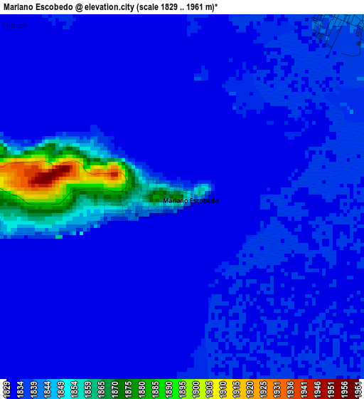
Below is the Elevation map of Mariano Escobedo, which displays elevation range with different colors. Scale of the first map is from 1829 to 1961 m (6001 to 6434 ft) with average elevation of 1837.3 meters (=6028 ft) [note 1]
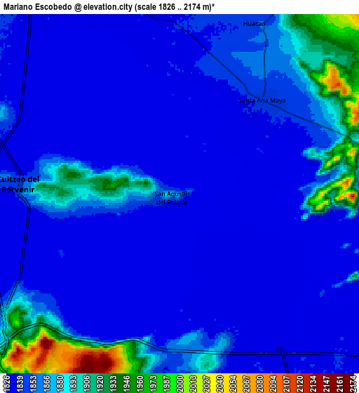
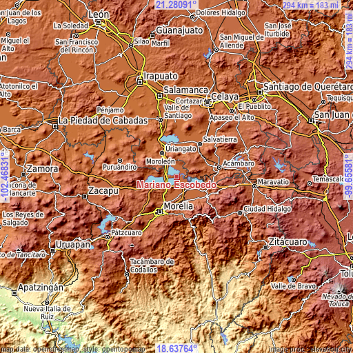
These maps also provides idea of topography and contour of this city, they are displayed at different zoom levels. More info about maps, scale and edge coordinates you can find below images.
| \ | Map #1 | Map #2 | Topo.Map |
| Scale [m] | 1829..1961 m | 1826..2174 m | × |
| Scale [ft] | 6001..6434 ft | 5991..7133 ft | × |
| Average | 1837.3 m = 6028 ft | 1856.6 m = 6091 ft | × |
| Width | 9.19 km = 5.7 mi | 18.37 km = 11.4 mi | 293.9 km = 182.6 mi |
| Height | 9.19 km = 5.7 mi | 18.37 km = 11.4 mi | 293.9 km = 182.6 mi |
| ↑Max Latitude | 20.006109° | 20.047397° | 21.28091° |
| Latitude at center | 19.96481° | 19.96481° | 19.96481° |
| ↓Min Latitude | 19.9235° | 19.88218° | 18.63764° |
| ← Min Longitude | -101.106005° | -101.149951° | -102.46831° |
| Longitude center | -101.06206° | -101.06206° | -101.06206° |
| →Max Longitude | -101.018115° | -100.974169° | -99.65581° |
Nearby cities:
Cities around Mariano Escobedo sort by population:
• Cuitzeo del Porvenir elevation 1845 m
8.5 km,  274°
274°
• Santa Ana Maya 1844 m
6.3 km,  41°
41°
• Cuto del Porvenir 1913 m
13.6 km,  218°
218°
• San Agustín del Pulque 1847 m
1.2 km,  258°
258°
• San Juan Benito Juárez (San Juan Tararameo) 1846 m
8.8 km,  232°
232°
• Cuamio 1840 m
12.1 km,  309°
309°
• San Agustín del Maíz 1842 m
13 km,  235°
235°
• Lázaro Cárdenas (La Purísima) 1846 m
11.3 km,  158°
158°
• La Ortiga 1854 m
6.4 km,  92°
92°
• Cuparátaro 1862 m
13 km,  192°
192°
• Felipe Carrillo Puerto 1857 m
7.8 km, 161°
• Doctor Miguel Silva (San Guillermo) 1848 m
11.7 km, 270°
Multilingual:
 En español:
Mariano Escobedo, San Lorenzo elevación 1857 m.
 En France:
Mariano Escobedo élévation 1857 m.
 Auf Deutsch:
Mariano Escobedo höhe über dem Meeresspiegel ist 1857 m.

Sources and notes:
- [note 1] Map square and city borders are not equal. Map elevation data is calculated only from area inside that square.
- [src 1] Elevation data from geonames database provided with same terms of usage.
- [src 2] The elevation map of Mariano Escobedo is generated using elevation data from NASA's 3 arcsec (90m) resolution SRTM data.
- [src 3] Base (background) map © OpenStreetMap contributors tiles are generated by Geofabrik and OpenTopoMap.
Copyright & License:
This Mariano Escobedo Elevation Map is licensed under CC BY-SA. You may reuse any part from this page, if you give a proper credit by linking to this URL:
 More info on terms of use page.