Cuitzeo del Porvenir elevation
Cuitzeo del Porvenir (Michoacán, Cuitzeo), Mexico elevation is 1845 meters and Cuitzeo del Porvenir elevation in feet is 6053 ft above sea level [src 1]. Cuitzeo del Porvenir is a seat of a second-order administrative division (feature code) with elevation that is 531 meters (1742 ft) bigger than average city elevation in Mexico.
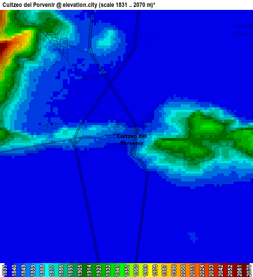
Below is the Elevation map of Cuitzeo del Porvenir, which displays elevation range with different colors. Scale of the first map is from 1831 to 2070 m (6007 to 6791 ft) with average elevation of 1847.2 meters (=6060 ft) [note 1]
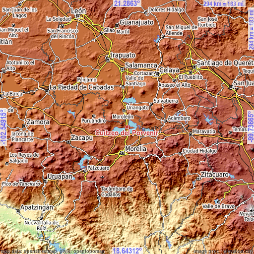
These maps also provides idea of topography and contour of this city, they are displayed at different zoom levels. More info about maps, scale and edge coordinates you can find below images.
| \ | Map #1 | Map #2 | Topo.Map |
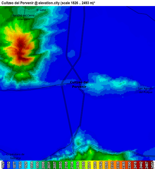
| Scale [m] | 1831..2070 m | 1826..2493 m | × |
| Scale [ft] | 6007..6791 ft | 5991..8179 ft | × |
| Average | 1847.2 m = 6060 ft | 1885.5 m = 6186 ft | × |
| Width | 9.18 km = 5.7 mi | 18.37 km = 11.4 mi | 293.9 km = 182.6 mi |
| Height | 9.18 km = 5.7 mi | 18.37 km = 11.4 mi | 293.9 km = 182.6 mi |
| ↑Max Latitude | 20.011547° | 20.052834° | 21.2863° |
| Latitude at center | 19.97025° | 19.97025° | 19.97025° |
| ↓Min Latitude | 19.928942° | 19.887623° | 18.64312° |
| ← Min Longitude | -101.186845° | -101.230791° | -102.54915° |
| Longitude center | -101.1429° | -101.1429° | -101.1429° |
| →Max Longitude | -101.098955° | -101.055009° | -99.73665° |
Nearby cities:
Cities around Cuitzeo del Porvenir sort by population:
• Cuto del Porvenir elevation 1913 m
11.2 km,  180°
180°
• Mariano Escobedo 1857 m
8.5 km,  94°
94°
• San Agustín del Pulque 1847 m
7.3 km,  96°
96°
• Copándaro de Galeana 1849 m
11.4 km,  220°
220°
• San Juan Benito Juárez (San Juan Tararameo) 1846 m
6.1 km,  165°
165°
• Cuamio 1840 m
7.1 km,  352°
352°
• Capacho 1847 m
9.2 km,  266°
266°
• San Agustín del Maíz 1842 m
8.2 km,  196°
196°
• Cuaracurío 1839 m
10.1 km,  357°
357°
• San José Cuaro 1861 m
11.6 km,  280°
280°
• Jamaica 1895 m
12.8 km, 176°
• Doctor Miguel Silva (San Guillermo) 1848 m
3.3 km,  261°
261°
Multilingual:
 En español:
Cuitzeo del Porvenir elevación 1845 m.
 En France:
Cuitzeo del Porvenir élévation 1845 m.
 Auf Deutsch:
Cuitzeo del Porvenir höhe über dem Meeresspiegel ist 1845 m.
 На русском:
Cuitzeo del Porvenir высота над уровнем моря 1845 м
Sources and notes:
- [note 1] Map square and city borders are not equal. Map elevation data is calculated only from area inside that square.
- [src 1] Elevation data from geonames database provided with same terms of usage.
- [src 2] The elevation map of Cuitzeo del Porvenir is generated using elevation data from NASA's 3 arcsec (90m) resolution SRTM data.
- [src 3] Base (background) map © OpenStreetMap contributors tiles are generated by Geofabrik and OpenTopoMap.
Copyright & License:
This Cuitzeo del Porvenir Elevation Map is licensed under CC BY-SA. You may reuse any part from this page, if you give a proper credit by linking to this URL:
 More info on terms of use page.