Cuisillos elevation
Cuisillos (Jalisco, Tala), Mexico elevation is 1275 meters and Cuisillos elevation in feet is 4183 ft above sea level [src 1]. Cuisillos is a populated place (feature code) with elevation that is 39 meters (128 ft) smaller than average city elevation in Mexico.
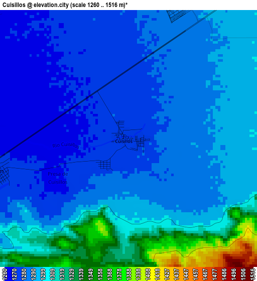
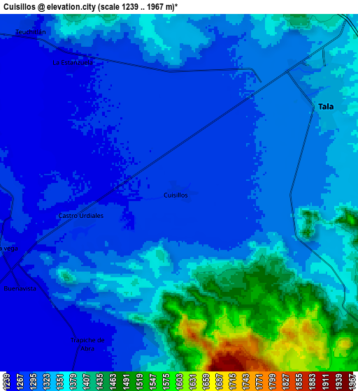
Below is the Elevation map of Cuisillos, which displays elevation range with different colors. Scale of the first map is from 1260 to 1516 m (4134 to 4974 ft) with average elevation of 1293.9 meters (=4245 ft) [note 1]
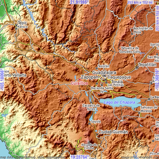
These maps also provides idea of topography and contour of this city, they are displayed at different zoom levels. More info about maps, scale and edge coordinates you can find below images.
| \ | Map #1 | Map #2 | Topo.Map |
| Scale [m] | 1260..1516 m | 1239..1967 m | × |
| Scale [ft] | 4134..4974 ft | 4065..6453 ft | × |
| Average | 1293.9 m = 4245 ft | 1334.9 m = 4380 ft | × |
| Width | 9.15 km = 5.7 mi | 18.29 km = 11.4 mi | 292.7 km = 181.9 mi |
| Height | 9.15 km = 5.7 mi | 18.29 km = 11.4 mi | 292.7 km = 181.9 mi |
| ↑Max Latitude | 20.650607° | 20.691724° | 21.91995° |
| Latitude at center | 20.60948° | 20.60948° | 20.60948° |
| ↓Min Latitude | 20.568342° | 20.527192° | 19.28764° |
| ← Min Longitude | -103.818355° | -103.862301° | -105.18066° |
| Longitude center | -103.77441° | -103.77441° | -103.77441° |
| →Max Longitude | -103.730465° | -103.686519° | -102.36816° |
Nearby cities:
Cities around Cuisillos sort by population:
• Tala elevation 1338 m
9.1 km,  57°
57°
• El Refugio 1302 m
7.8 km,  27°
27°
• Teuchitlán 1269 m
11.4 km,  317°
317°
• Ahuisculco 1337 m
8.7 km,  121°
121°
• La Estanzuela 1264 m
8.5 km, 320°
• Castro Urdiales 1275 m
5 km,  254°
254°
• Buenavista 1250 m
9.3 km,  240°
240°
• Navajas 1482 m
13 km,  130°
130°
• San Juan de los Arcos 1308 m
5.7 km,  94°
94°
• La Vega 1263 m
9.2 km, 251°
• Trapiche de Abra 1260 m
9.1 km,  211°
211°
• Punta de la Vega 1275 m
13.1 km,  260°
260°
Multilingual:
 En español:
Cuisillos elevación 1275 m.
 En France:
Cuisillos élévation 1275 m.
 Auf Deutsch:
Cuisillos höhe über dem Meeresspiegel ist 1275 m.

Sources and notes:
- [note 1] Map square and city borders are not equal. Map elevation data is calculated only from area inside that square.
- [src 1] Elevation data from geonames database provided with same terms of usage.
- [src 2] The elevation map of Cuisillos is generated using elevation data from NASA's 3 arcsec (90m) resolution SRTM data.
- [src 3] Base (background) map © OpenStreetMap contributors tiles are generated by Geofabrik and OpenTopoMap.
Copyright & License:
This Cuisillos Elevation Map is licensed under CC BY-SA. You may reuse any part from this page, if you give a proper credit by linking to this URL:
 More info on terms of use page.