Teuchitlán elevation
Teuchitlán (Jalisco), Mexico elevation is 1269 meters and Teuchitlán elevation in feet is 4163 ft above sea level [src 1]. Teuchitlán is a seat of a second-order administrative division (feature code) with elevation that is 45 meters (148 ft) smaller than average city elevation in Mexico.
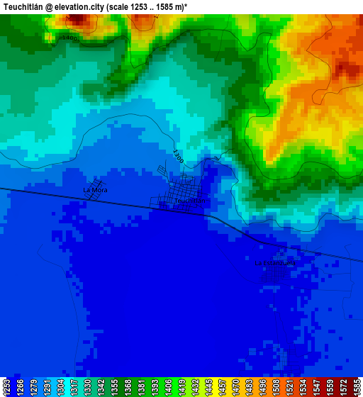
Below is the Elevation map of Teuchitlán, which displays elevation range with different colors. Scale of the first map is from 1253 to 1585 m (4111 to 5200 ft) with average elevation of 1317.5 meters (=4323 ft) [note 1]
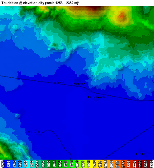
These maps also provides idea of topography and contour of this city, they are displayed at different zoom levels. More info about maps, scale and edge coordinates you can find below images.
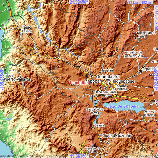
| \ | Map #1 | Map #2 | Topo.Map |
| Scale [m] | 1253..1585 m | 1253..2382 m | × |
| Scale [ft] | 4111..5200 ft | 4111..7815 ft | × |
| Average | 1317.5 m = 4323 ft | 1396.2 m = 4581 ft | × |
| Width | 9.14 km = 5.7 mi | 18.29 km = 11.4 mi | 292.5 km = 181.8 mi |
| Height | 9.14 km = 5.7 mi | 18.29 km = 11.4 mi | 292.6 km = 181.8 mi |
| ↑Max Latitude | 20.725867° | 20.766963° | 21.99456° |
| Latitude at center | 20.68476° | 20.68476° | 20.68476° |
| ↓Min Latitude | 20.643642° | 20.602513° | 19.36356° |
| ← Min Longitude | -103.893145° | -103.937091° | -105.25545° |
| Longitude center | -103.8492° | -103.8492° | -103.8492° |
| →Max Longitude | -103.805255° | -103.761309° | -102.44295° |
Nearby cities:
Cities around Teuchitlán sort by population:
• Tala elevation 1338 m
15.8 km,  102°
102°
• Ahualulco de Mercado 1325 m
13.2 km,  278°
278°
• El Refugio 1302 m
11.5 km, 97°
• Cuisillos 1275 m
11.4 km,  137°
137°
• Portes Gil 1307 m
9.7 km,  252°
252°
• La Estanzuela 1264 m
3 km,  126°
126°
• Castro Urdiales 1275 m
10.1 km,  162°
162°
• Buenavista 1250 m
13 km,  181°
181°
• La Vega 1263 m
11.3 km, 184°
• El Carmen 1279 m
7.3 km,  242°
242°
• Santa Cruz de Bárcenas 1407 m
16 km,  263°
263°
• Punta de la Vega 1275 m
11.6 km,  206°
206°
Multilingual:
 En español:
Teuchitlán elevación 1269 m.
 En France:
Teuchitlán élévation 1269 m.
 Auf Deutsch:
Teuchitlán höhe über dem Meeresspiegel ist 1269 m.

Sources and notes:
- [note 1] Map square and city borders are not equal. Map elevation data is calculated only from area inside that square.
- [src 1] Elevation data from geonames database provided with same terms of usage.
- [src 2] The elevation map of Teuchitlán is generated using elevation data from NASA's 3 arcsec (90m) resolution SRTM data.
- [src 3] Base (background) map © OpenStreetMap contributors tiles are generated by Geofabrik and OpenTopoMap.
Copyright & License:
This Teuchitlán Elevation Map is licensed under CC BY-SA. You may reuse any part from this page, if you give a proper credit by linking to this URL:
 More info on terms of use page.