El Huizache elevation
El Huizache (Guanajuato, Cortazar), Mexico elevation is 1804 meters and El Huizache elevation in feet is 5919 ft above sea level [src 1]. El Huizache is a populated place (feature code) with elevation that is 490 meters (1608 ft) bigger than average city elevation in Mexico.
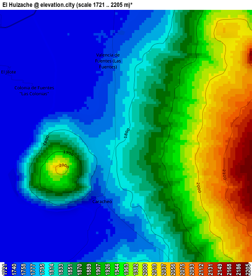
Below is the Elevation map of El Huizache, which displays elevation range with different colors. Scale of the first map is from 1721 to 2205 m (5646 to 7234 ft) with average elevation of 1851.9 meters (=6076 ft) [note 1]
These maps also provides idea of topography and contour of this city, they are displayed at different zoom levels. More info about maps, scale and edge coordinates you can find below images.
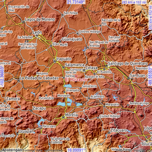
| \ | Map #1 | Topo.Map |
| Scale [m] | 1721..2205 m | × |
| Scale [ft] | 5646..7234 ft | × |
| Average | 1851.9 m = 6076 ft | × |
| Width | 9.16 km = 5.7 mi | 293 km = 182.1 mi |
| Height | 9.16 km = 5.7 mi | 293.1 km = 182.1 mi |
| ↑Max Latitude | 20.460518° | 21.73149° |
| Latitude at center | 20.41934° | 20.41934° |
| ↓Min Latitude | 20.378151° | 19.09591° |
| ← Min Longitude | -101.003725° | -102.36603° |
| Longitude center | -100.95978° | -100.95978° |
| →Max Longitude | -100.915835° | -99.55353° |
Nearby cities:
Cities around El Huizache sort by population:
• Cortazar elevation 1739 m
7.2 km,  357°
357°
• Villagrán 1734 m
11.3 km,  339°
339°
• Jaral del Progreso 1730 m
11.9 km,  243°
243°
• Tierra Fría 1730 m
9.5 km,  299°
299°
• Cañada de Caracheo 1799 m
5.1 km,  163°
163°
• San José del Cerrito de Camargo 1736 m
8.6 km,  269°
269°
• La Gavia 2355 m
8.6 km,  108°
108°
• Providencia 1737 m
9.5 km,  220°
220°
• De Parral 1732 m
6.5 km,  309°
309°
• Merino 1746 m
11.5 km,  43°
43°
• Santa Fe de la Purísima 1747 m
11 km, 39°
• Colonia la Calzada (La Olla) 1736 m
9.3 km,  0°
0°
Multilingual:
 En español:
El Huizache elevación 1804 m.
 En France:
El Huizache élévation 1804 m.
 Auf Deutsch:
El Huizache höhe über dem Meeresspiegel ist 1804 m.

Sources and notes:
- [note 1] Map square and city borders are not equal. Map elevation data is calculated only from area inside that square.
- [src 1] Elevation data from geonames database provided with same terms of usage.
- [src 2] The elevation map of El Huizache is generated using elevation data from NASA's 3 arcsec (90m) resolution SRTM data.
- [src 3] Base (background) map © OpenStreetMap contributors tiles are generated by Geofabrik and OpenTopoMap.
Copyright & License:
This El Huizache Elevation Map is licensed under CC BY-SA. You may reuse any part from this page, if you give a proper credit by linking to this URL:
 More info on terms of use page.