Villagrán elevation
Villagrán (Guanajuato), Mexico elevation is 1734 meters and Villagrán elevation in feet is 5689 ft above sea level [src 1]. Villagrán is a seat of a second-order administrative division (feature code) with elevation that is 420 meters (1378 ft) bigger than average city elevation in Mexico.
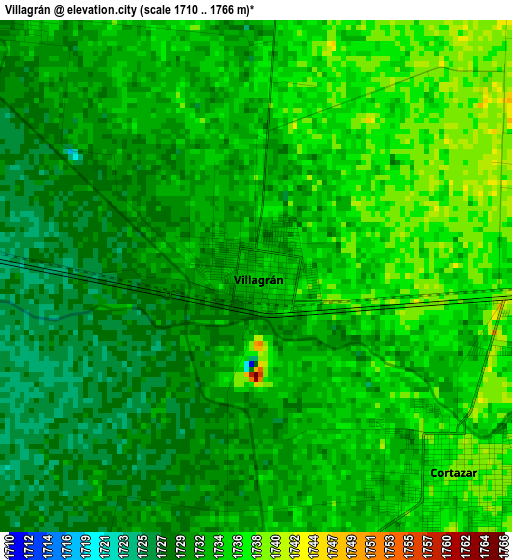
Below is the Elevation map of Villagrán, which displays elevation range with different colors. Scale of the first map is from 1710 to 1766 m (5610 to 5794 ft) with average elevation of 1732.5 meters (=5684 ft) [note 1]
These maps also provides idea of topography and contour of this city, they are displayed at different zoom levels. More info about maps, scale and edge coordinates you can find below images.
| \ | Map #1 | Map #2 | Topo.Map |
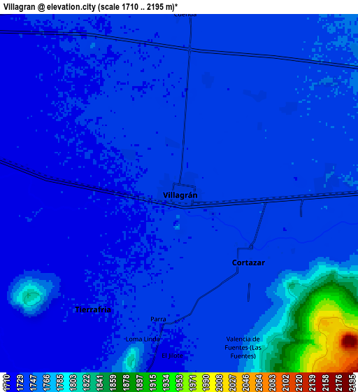
| Scale [m] | 1710..1766 m | 1710..2195 m | × |
| Scale [ft] | 5610..5794 ft | 5610..7201 ft | × |
| Average | 1732.5 m = 5684 ft | 1746.6 m = 5730 ft | × |
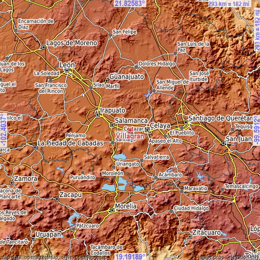
| Width | 9.15 km = 5.7 mi | 18.31 km = 11.4 mi | 292.9 km = 182 mi |
| Height | 9.15 km = 5.7 mi | 18.31 km = 11.4 mi | 292.9 km = 182 mi |
| ↑Max Latitude | 20.555673° | 20.596815° | 21.82583° |
| Latitude at center | 20.51452° | 20.51452° | 20.51452° |
| ↓Min Latitude | 20.473356° | 20.432181° | 19.19189° |
| ← Min Longitude | -101.041395° | -101.085341° | -102.4037° |
| Longitude center | -100.99745° | -100.99745° | -100.99745° |
| →Max Longitude | -100.953505° | -100.909559° | -99.5912° |
Nearby cities:
Cities around Villagrán sort by population:
• Cortazar elevation 1739 m
5 km,  133°
133°
• Mexicanos 1724 m
7.8 km,  281°
281°
• Sarabia 1722 m
6.7 km, 277°
• Tierra Fría 1730 m
7.3 km,  216°
216°
• Colonia 18 de Marzo 1734 m
6 km,  318°
318°
• Los Ángeles 1746 m
7.3 km,  53°
53°
• Suchitlán 1730 m
3.4 km,  307°
307°
• Fraccionamiento Praderas de la Venta 1734 m
2.4 km,  353°
353°
• San Salvador Torrecillas 1743 m
6.5 km,  39°
39°
• De Parral 1732 m
6.6 km,  189°
189°
• El Caracol 1739 m
6 km,  14°
14°
• Colonia la Calzada (La Olla) 1736 m
4.2 km,  108°
108°
Multilingual:
 En español:
Villagran elevación 1734 m.
 En France:
Villagrán élévation 1734 m.
 Auf Deutsch:
Villagrán höhe über dem Meeresspiegel ist 1734 m.

Sources and notes:
- [note 1] Map square and city borders are not equal. Map elevation data is calculated only from area inside that square.
- [src 1] Elevation data from geonames database provided with same terms of usage.
- [src 2] The elevation map of Villagrán is generated using elevation data from NASA's 3 arcsec (90m) resolution SRTM data.
- [src 3] Base (background) map © OpenStreetMap contributors tiles are generated by Geofabrik and OpenTopoMap.
Copyright & License:
This Villagrán Elevation Map is licensed under CC BY-SA. You may reuse any part from this page, if you give a proper credit by linking to this URL:
 More info on terms of use page.