Huejuquilla el Alto elevation
Huejuquilla el Alto (Jalisco), Mexico elevation is 1742 meters and Huejuquilla el Alto elevation in feet is 5715 ft above sea level [src 1]. Huejuquilla el Alto is a seat of a second-order administrative division (feature code) with elevation that is 428 meters (1404 ft) bigger than average city elevation in Mexico.
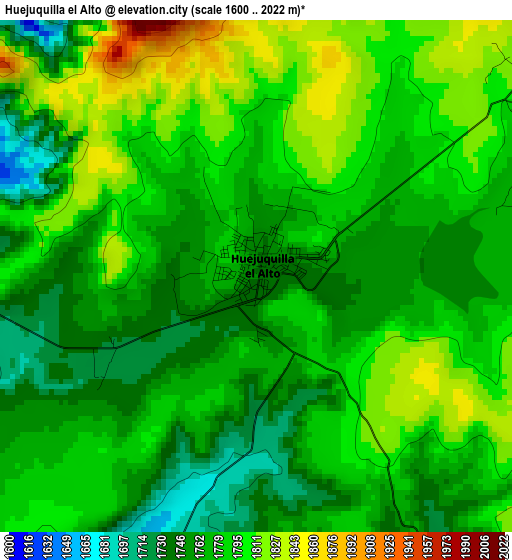
Below is the Elevation map of Huejuquilla el Alto, which displays elevation range with different colors. Scale of the first map is from 1600 to 2022 m (5249 to 6634 ft) with average elevation of 1779.6 meters (=5839 ft) [note 1]
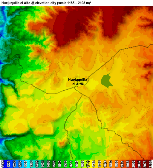
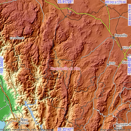
These maps also provides idea of topography and contour of this city, they are displayed at different zoom levels. More info about maps, scale and edge coordinates you can find below images.
| \ | Map #1 | Map #2 | Topo.Map |
| Scale [m] | 1600..2022 m | 1185..2108 m | × |
| Scale [ft] | 5249..6634 ft | 3888..6916 ft | × |
| Average | 1779.6 m = 5839 ft | 1762.5 m = 5782 ft | × |
| Width | 9.02 km = 5.6 mi | 18.04 km = 11.2 mi | 288.6 km = 179.3 mi |
| Height | 9.02 km = 5.6 mi | 18.04 km = 11.2 mi | 288.6 km = 179.3 mi |
| ↑Max Latitude | 22.666027° | 22.706573° | 23.91728° |
| Latitude at center | 22.62547° | 22.62547° | 22.62547° |
| ↓Min Latitude | 22.584901° | 22.54432° | 21.32141° |
| ← Min Longitude | -103.941715° | -103.985661° | -105.30402° |
| Longitude center | -103.89777° | -103.89777° | -103.89777° |
| →Max Longitude | -103.853825° | -103.809879° | -102.49152° |
Nearby cities:
Cities around Huejuquilla el Alto sort by population:
• Valparaíso elevation 1895 m
37.3 km,  64°
64°
• Monte Escobedo 2208 m
49.3 km,  136°
136°
• Villa Guerrero 1774 m
77.9 km,  156°
156°
• Huejúcar 1842 m
76.5 km,  112°
112°
• Jesús María 426 m
76.2 km,  236°
236°
• Mezquitic 1357 m
31.6 km,  146°
146°
• Jiménez del Teul 1888 m
70.6 km,  8°
8°
• Tepetongo 1939 m
78.9 km,  103°
103°
• Temastián (La Cantera) 1870 m
81.6 km, 151°
• San Andrés Cohamiata 1951 m
60 km,  216°
216°
• Lobatos 2006 m
55 km,  66°
66°
• J. Jesús González Ortega (San Mateo) 1998 m
51.3 km, 55°
Multilingual:
 En español:
Huejuquilla el Alto elevación 1742 m.
 En France:
Huejuquilla el Alto élévation 1742 m.
 Auf Deutsch:
Huejuquilla el Alto höhe über dem Meeresspiegel ist 1742 m.
 На русском:
Huejuquilla el Alto высота над уровнем моря 1742 м
Sources and notes:
- [note 1] Map square and city borders are not equal. Map elevation data is calculated only from area inside that square.
- [src 1] Elevation data from geonames database provided with same terms of usage.
- [src 2] The elevation map of Huejuquilla el Alto is generated using elevation data from NASA's 3 arcsec (90m) resolution SRTM data.
- [src 3] Base (background) map © OpenStreetMap contributors tiles are generated by Geofabrik and OpenTopoMap.
Copyright & License:
This Huejuquilla el Alto Elevation Map is licensed under CC BY-SA. You may reuse any part from this page, if you give a proper credit by linking to this URL:
 More info on terms of use page.