Minatitlán elevation
Minatitlán (Colima), Mexico elevation is 872 meters and Minatitlán elevation in feet is 2861 ft above sea level [src 1]. Minatitlán is a populated place (feature code) with elevation that is 442 meters (1450 ft) smaller than average city elevation in Mexico.
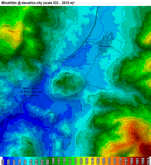
Below is the Elevation map of Minatitlán, which displays elevation range with different colors. Scale of the first map is from 533 to 2015 m (1749 to 6611 ft) with average elevation of 908.8 meters (=2982 ft) [note 1]
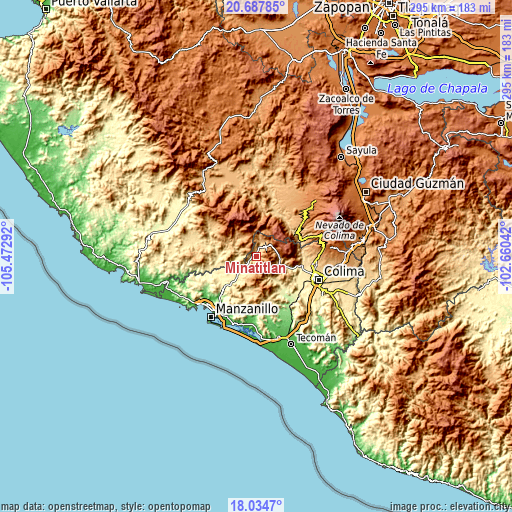
These maps also provides idea of topography and contour of this city, they are displayed at different zoom levels. More info about maps, scale and edge coordinates you can find below images.
| \ | Map #1 | Map #2 | Topo.Map |
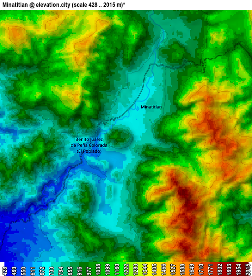
| Scale [m] | 533..2015 m | 428..2015 m | × |
| Scale [ft] | 1749..6611 ft | 1404..6611 ft | × |
| Average | 908.8 m = 2982 ft | 1036.2 m = 3400 ft | × |
| Width | 9.22 km = 5.7 mi | 18.44 km = 11.5 mi | 295 km = 183.3 mi |
| Height | 9.22 km = 5.7 mi | 18.44 km = 11.5 mi | 295 km = 183.3 mi |
| ↑Max Latitude | 19.408123° | 19.449566° | 20.68785° |
| Latitude at center | 19.36667° | 19.36667° | 19.36667° |
| ↓Min Latitude | 19.325206° | 19.283732° | 18.0347° |
| ← Min Longitude | -104.110615° | -104.154561° | -105.47292° |
| Longitude center | -104.06667° | -104.06667° | -104.06667° |
| →Max Longitude | -104.022725° | -103.978779° | -102.66042° |
Nearby cities:
Cities around Minatitlán sort by population:
• Coquimatlán elevation 344 m
32.3 km,  123°
123°
• Comala 625 m
32.5 km,  97°
97°
• Minatitlán 769 m
2.9 km,  37°
37°
• Zapotitlán de Vadillo 1147 m
33.6 km,  52°
52°
• Cuautitlán 604 m
32.1 km,  287°
287°
• Pueblo Juárez (La Magdalena) 271 m
26.3 km,  147°
147°
• Jalipa 81 m
34.3 km,  217°
217°
• Zacualpan 651 m
25.4 km,  90°
90°
• Camotlán de Miraflores 367 m
24 km,  227°
227°
• Tolimán 744 m
30.5 km,  31°
31°
• Telcruz 1176 m
13.7 km,  333°
333°
• Chacala 414 m
23.1 km,  259°
259°
Multilingual:
 En español:
Minatitlán elevación 872 m.
 En France:
Minatitlán élévation 872 m.
 Auf Deutsch:
Minatitlán höhe über dem Meeresspiegel ist 872 m.

Sources and notes:
- [note 1] Map square and city borders are not equal. Map elevation data is calculated only from area inside that square.
- [src 1] Elevation data from geonames database provided with same terms of usage.
- [src 2] The elevation map of Minatitlán is generated using elevation data from NASA's 3 arcsec (90m) resolution SRTM data.
- [src 3] Base (background) map © OpenStreetMap contributors tiles are generated by Geofabrik and OpenTopoMap.
Copyright & License:
This Minatitlán Elevation Map is licensed under CC BY-SA. You may reuse any part from this page, if you give a proper credit by linking to this URL:
 More info on terms of use page.