Zapotitlán de Vadillo elevation
Zapotitlán de Vadillo (Jalisco), Mexico elevation is 1147 meters and Zapotitlán de Vadillo elevation in feet is 3763 ft above sea level [src 1]. Zapotitlán de Vadillo is a seat of a second-order administrative division (feature code) with elevation that is 167 meters (548 ft) smaller than average city elevation in Mexico.
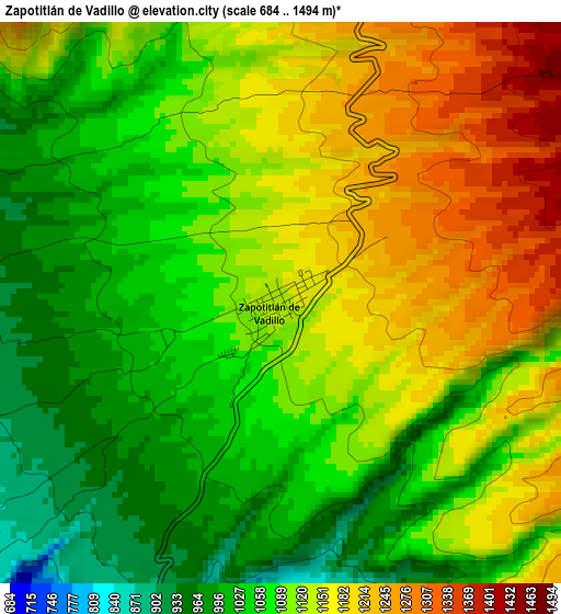
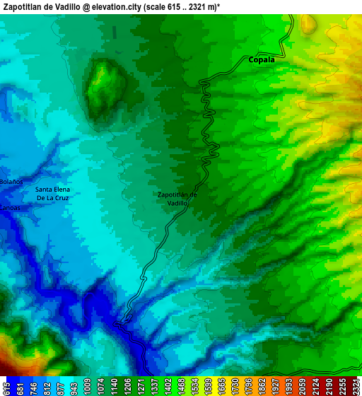
Below is the Elevation map of Zapotitlán de Vadillo, which displays elevation range with different colors. Scale of the first map is from 684 to 1494 m (2244 to 4902 ft) with average elevation of 1104.8 meters (=3625 ft) [note 1]
These maps also provides idea of topography and contour of this city, they are displayed at different zoom levels. More info about maps, scale and edge coordinates you can find below images.
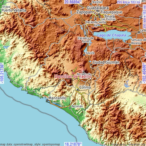
| \ | Map #1 | Map #2 | Topo.Map |
| Scale [m] | 684..1494 m | 615..2321 m | × |
| Scale [ft] | 2244..4902 ft | 2018..7615 ft | × |
| Average | 1104.8 m = 3625 ft | 1139.3 m = 3738 ft | × |
| Width | 9.21 km = 5.7 mi | 18.42 km = 11.4 mi | 294.7 km = 183.1 mi |
| Height | 9.21 km = 5.7 mi | 18.42 km = 11.4 mi | 294.7 km = 183.1 mi |
| ↑Max Latitude | 19.590707° | 19.632103° | 20.86894° |
| Latitude at center | 19.5493° | 19.5493° | 19.5493° |
| ↓Min Latitude | 19.507883° | 19.466455° | 18.21878° |
| ← Min Longitude | -103.855055° | -103.899001° | -105.21736° |
| Longitude center | -103.81111° | -103.81111° | -103.81111° |
| →Max Longitude | -103.767165° | -103.723219° | -102.40486° |
Nearby cities:
Cities around Zapotitlán de Vadillo sort by population:
• Comala elevation 625 m
25.3 km,  167°
167°
• San Gabriel 1266 m
22.6 km,  11°
11°
• Suchitlán 1058 m
22 km,  151°
151°
• Copala 1435 m
8 km,  30°
30°
• Zacualpan 651 m
20.7 km,  183°
183°
• Jiquilpan 1301 m
25.7 km, 7°
• Cofradía de Suchitlán 1295 m
19.4 km,  143°
143°
• Tuxcacuesco 727 m
24.6 km,  312°
312°
• Tolimán 744 m
12.3 km,  297°
297°
• Alista 1352 m
9.8 km, 13°
• El Jazmín 1705 m
15.7 km,  42°
42°
• Las Primaveras [Invernadero] 1145 m
16.3 km,  351°
351°
Multilingual:
 En español:
Zapotitlán de Vadillo elevación 1147 m.
 En France:
Zapotitlán de Vadillo élévation 1147 m.
 Auf Deutsch:
Zapotitlán de Vadillo höhe über dem Meeresspiegel ist 1147 m.
 На русском:
Zapotitlán de Vadillo высота над уровнем моря 1147 м
Sources and notes:
- [note 1] Map square and city borders are not equal. Map elevation data is calculated only from area inside that square.
- [src 1] Elevation data from geonames database provided with same terms of usage.
- [src 2] The elevation map of Zapotitlán de Vadillo is generated using elevation data from NASA's 3 arcsec (90m) resolution SRTM data.
- [src 3] Base (background) map © OpenStreetMap contributors tiles are generated by Geofabrik and OpenTopoMap.
Copyright & License:
This Zapotitlán de Vadillo Elevation Map is licensed under CC BY-SA. You may reuse any part from this page, if you give a proper credit by linking to this URL:
 More info on terms of use page.