Nurío elevation
Nurío (Michoacán, Paracho), Mexico elevation is 2182 meters and Nurío elevation in feet is 7159 ft above sea level [src 1]. Nurío is a populated place (feature code) with elevation that is 868 meters (2848 ft) bigger than average city elevation in Mexico.
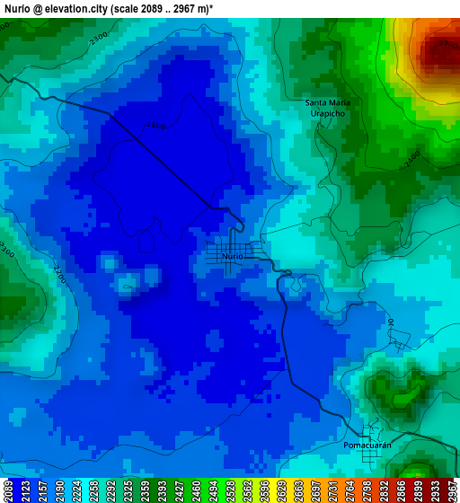
Below is the Elevation map of Nurío, which displays elevation range with different colors. Scale of the first map is from 2089 to 2967 m (6854 to 9734 ft) with average elevation of 2228.5 meters (=7311 ft) [note 1]
These maps also provides idea of topography and contour of this city, they are displayed at different zoom levels. More info about maps, scale and edge coordinates you can find below images.
| \ | Map #1 | Map #2 | Topo.Map |
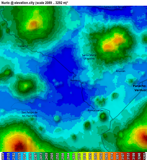
| Scale [m] | 2089..2967 m | 2089..3292 m | × |
| Scale [ft] | 6854..9734 ft | 6854..10801 ft | × |
| Average | 2228.5 m = 7311 ft | 2359.3 m = 7740 ft | × |
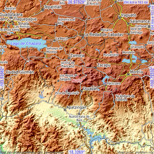
| Width | 9.2 km = 5.7 mi | 18.41 km = 11.4 mi | 294.5 km = 183 mi |
| Height | 9.2 km = 5.7 mi | 18.41 km = 11.4 mi | 294.5 km = 183 mi |
| ↑Max Latitude | 19.697939° | 19.739307° | 20.97529° |
| Latitude at center | 19.65656° | 19.65656° | 19.65656° |
| ↓Min Latitude | 19.61517° | 19.57377° | 18.3269° |
| ← Min Longitude | -102.173515° | -102.217461° | -103.53582° |
| Longitude center | -102.12957° | -102.12957° | -102.12957° |
| →Max Longitude | -102.085625° | -102.041679° | -100.72332° |
Nearby cities:
Cities around Nurío sort by population:
• Paracho de Verduzco elevation 2226 m
8.5 km,  96°
96°
• San Lorenzo 2109 m
14.5 km,  171°
171°
• Charapán 2368 m
12.8 km,  267°
267°
• Tanaco 2195 m
10.5 km,  28°
28°
• Cocucho 2426 m
7.6 km,  304°
304°
• Cherán Atzicuirín (Cheranástico) 2327 m
12.9 km,  67°
67°
• Corupo 2291 m
12.2 km,  244°
244°
• Ahuirán 2263 m
6 km,  80°
80°
• San Felipe de los Herreros 2246 m
7 km,  230°
230°
• Aranza 2192 m
11.1 km,  85°
85°
• Pomacuarán 2241 m
4.8 km,  143°
143°
• Santa María Urapicho 2314 m
3.3 km, 33°
Multilingual:
 En español:
Nurío elevación 2182 m.
 En France:
Nurío élévation 2182 m.


Sources and notes:
- [note 1] Map square and city borders are not equal. Map elevation data is calculated only from area inside that square.
- [src 1] Elevation data from geonames database provided with same terms of usage.
- [src 2] The elevation map of Nurío is generated using elevation data from NASA's 3 arcsec (90m) resolution SRTM data.
- [src 3] Base (background) map © OpenStreetMap contributors tiles are generated by Geofabrik and OpenTopoMap.
Copyright & License:
This Nurío Elevation Map is licensed under CC BY-SA. You may reuse any part from this page, if you give a proper credit by linking to this URL:
 More info on terms of use page.