Palo Alto elevation
Palo Alto (Aguascalientes, El Llano), Mexico elevation is 2026 meters and Palo Alto elevation in feet is 6647 ft above sea level [src 1]. Palo Alto is a seat of a second-order administrative division (feature code) with elevation that is 712 meters (2336 ft) bigger than average city elevation in Mexico.
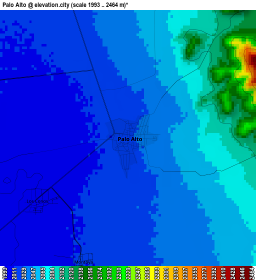
Below is the Elevation map of Palo Alto, which displays elevation range with different colors. Scale of the first map is from 1993 to 2464 m (6539 to 8084 ft) with average elevation of 2042.6 meters (=6701 ft) [note 1]
These maps also provides idea of topography and contour of this city, they are displayed at different zoom levels. More info about maps, scale and edge coordinates you can find below images.
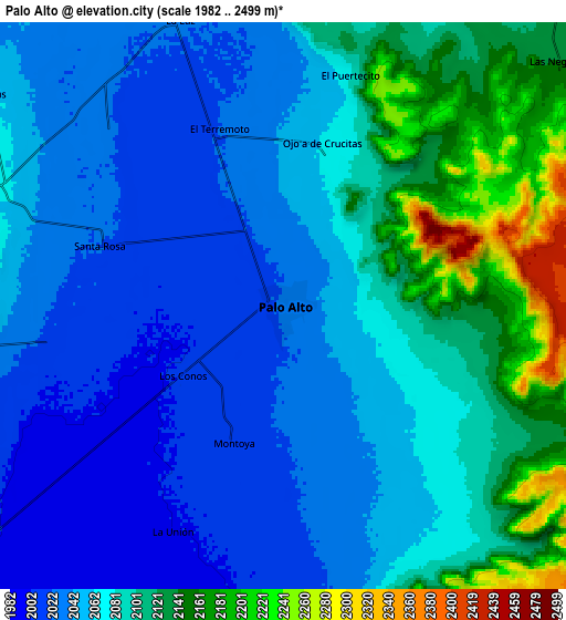
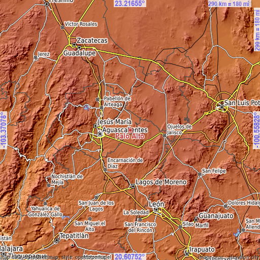
| \ | Map #1 | Map #2 | Topo.Map |
| Scale [m] | 1993..2464 m | 1982..2499 m | × |
| Scale [ft] | 6539..8084 ft | 6503..8199 ft | × |
| Average | 2042.6 m = 6701 ft | 2074.7 m = 6807 ft | × |
| Width | 9.07 km = 5.6 mi | 18.13 km = 11.3 mi | 290.1 km = 180.3 mi |
| Height | 9.07 km = 5.6 mi | 18.13 km = 11.3 mi | 290.1 km = 180.3 mi |
| ↑Max Latitude | 21.958773° | 21.999524° | 23.21655° |
| Latitude at center | 21.91801° | 21.91801° | 21.91801° |
| ↓Min Latitude | 21.877235° | 21.836449° | 20.60752° |
| ← Min Longitude | -102.008475° | -102.052421° | -103.37078° |
| Longitude center | -101.96453° | -101.96453° | -101.96453° |
| →Max Longitude | -101.920585° | -101.876639° | -100.55828° |
Nearby cities:
Cities around Palo Alto sort by population:
• Villa Juárez elevation 1987 m
22.4 km,  331°
331°
• Jaltomate 1929 m
21.6 km,  300°
300°
• Los Azulitos 2013 m
8 km,  180°
180°
• Chinampas 2122 m
17.8 km,  120°
120°
• Betulia 1994 m
18.5 km,  197°
197°
• Pilotos 2036 m
13.3 km,  2°
2°
• El Tule 1974 m
22.6 km,  324°
324°
• La Presa 2090 m
22.1 km,  135°
135°
• Los Conos 2003 m
3.9 km,  233°
233°
• Ojo de Agua de Crucitas 2066 m
5.3 km,  14°
14°
• Santa Rosa (El Huizache) 2022 m
6.2 km,  287°
287°
• Agua Gorda 2102 m
21.4 km, 11°
Multilingual:
 En español:
Palo Alto elevación 2026 m.
 En France:
Palo Alto élévation 2026 m.
 Auf Deutsch:
Palo Alto höhe über dem Meeresspiegel ist 2026 m.

Sources and notes:
- [note 1] Map square and city borders are not equal. Map elevation data is calculated only from area inside that square.
- [src 1] Elevation data from geonames database provided with same terms of usage.
- [src 2] The elevation map of Palo Alto is generated using elevation data from NASA's 3 arcsec (90m) resolution SRTM data.
- [src 3] Base (background) map © OpenStreetMap contributors tiles are generated by Geofabrik and OpenTopoMap.
Copyright & License:
This Palo Alto Elevation Map is licensed under CC BY-SA. You may reuse any part from this page, if you give a proper credit by linking to this URL:
 More info on terms of use page.