Jaltomate elevation
Jaltomate (Aguascalientes), Mexico elevation is 1929 meters and Jaltomate elevation in feet is 6329 ft above sea level [src 1]. Jaltomate is a populated place (feature code) with elevation that is 615 meters (2018 ft) bigger than average city elevation in Mexico.
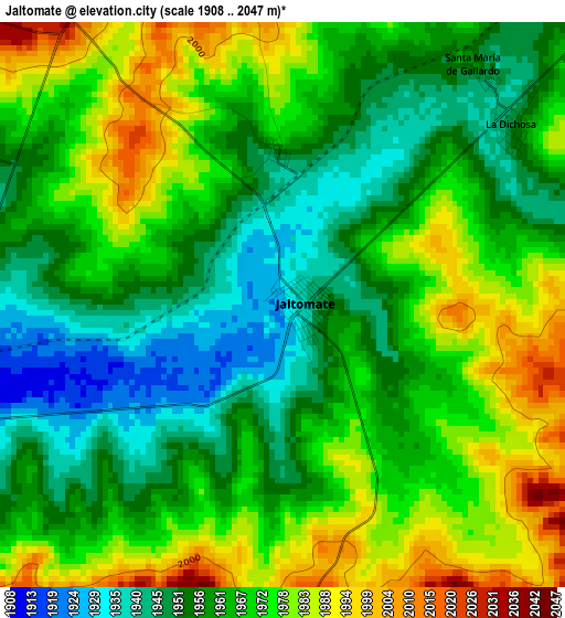
Below is the Elevation map of Jaltomate, which displays elevation range with different colors. Scale of the first map is from 1908 to 2047 m (6260 to 6716 ft) with average elevation of 1965.7 meters (=6449 ft) [note 1]
These maps also provides idea of topography and contour of this city, they are displayed at different zoom levels. More info about maps, scale and edge coordinates you can find below images.
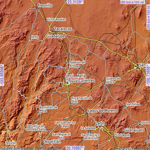
| \ | Map #1 | Topo.Map |
| Scale [m] | 1908..2047 m | × |
| Scale [ft] | 6260..6716 ft | × |
| Average | 1965.7 m = 6449 ft | × |
| Width | 9.06 km = 5.6 mi | 289.9 km = 180.1 mi |
| Height | 9.06 km = 5.6 mi | 289.9 km = 180.1 mi |
| ↑Max Latitude | 22.056015° | 23.3129° |
| Latitude at center | 22.01528° | 22.01528° |
| ↓Min Latitude | 21.974533° | 20.70567° |
| ← Min Longitude | -102.189775° | -103.55208° |
| Longitude center | -102.14583° | -102.14583° |
| →Max Longitude | -102.101885° | -100.73958° |
Nearby cities:
Cities around Jaltomate sort by population:
• San Francisco de los Romo elevation 1897 m
14.7 km,  298°
298°
• Villa Juárez 1987 m
11.8 km,  41°
41°
• Ex-Viñedos Guadalupe 1917 m
14.6 km,  244°
244°
• Cartagena [Fraccionamiento] 1911 m
15 km, 244°
• Macario J. Gómez [Colonia] 1941 m
11.5 km,  250°
250°
• Puertecito de la Virgen 1937 m
14.1 km, 244°
• Paseos de la Providencia [Fraccionamiento] 1904 m
13.6 km,  274°
274°
• Cumbres III 1969 m
14 km,  222°
222°
• La Escondida 1911 m
11.9 km,  281°
281°
• El Tule 1974 m
9.5 km, 36°
• Santa Isabel [Fraccionamiento] 1891 m
14.5 km, 300°
• Ejido la Guayana (Rancho Seco) 1897 m
13.7 km, 253°
Multilingual:
 En español:
Jaltomate elevación 1929 m.
 En France:
Jaltomate élévation 1929 m.
 Auf Deutsch:
Jaltomate höhe über dem Meeresspiegel ist 1929 m.

Sources and notes:
- [note 1] Map square and city borders are not equal. Map elevation data is calculated only from area inside that square.
- [src 1] Elevation data from geonames database provided with same terms of usage.
- [src 2] The elevation map of Jaltomate is generated using elevation data from NASA's 3 arcsec (90m) resolution SRTM data.
- [src 3] Base (background) map © OpenStreetMap contributors tiles are generated by Geofabrik and OpenTopoMap.
Copyright & License:
This Jaltomate Elevation Map is licensed under CC BY-SA. You may reuse any part from this page, if you give a proper credit by linking to this URL:
 More info on terms of use page.