Villa Juárez elevation
Villa Juárez (Aguascalientes, Asientos), Mexico elevation is 1987 meters and Villa Juárez elevation in feet is 6519 ft above sea level [src 1]. Villa Juárez is a populated place (feature code) with elevation that is 673 meters (2208 ft) bigger than average city elevation in Mexico.
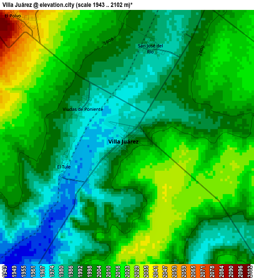
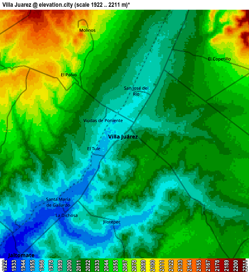
Below is the Elevation map of Villa Juárez, which displays elevation range with different colors. Scale of the first map is from 1943 to 2102 m (6375 to 6896 ft) with average elevation of 2000 meters (=6562 ft) [note 1]
These maps also provides idea of topography and contour of this city, they are displayed at different zoom levels. More info about maps, scale and edge coordinates you can find below images.
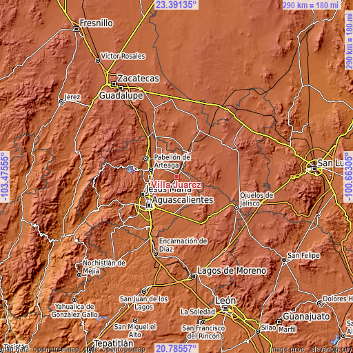
| \ | Map #1 | Map #2 | Topo.Map |
| Scale [m] | 1943..2102 m | 1922..2211 m | × |
| Scale [ft] | 6375..6896 ft | 6306..7254 ft | × |
| Average | 2000 m = 6562 ft | 2023.5 m = 6639 ft | × |
| Width | 9.05 km = 5.6 mi | 18.11 km = 11.3 mi | 289.7 km = 180 mi |
| Height | 9.05 km = 5.6 mi | 18.11 km = 11.3 mi | 289.8 km = 180.1 mi |
| ↑Max Latitude | 22.135182° | 22.175883° | 23.39135° |
| Latitude at center | 22.09447° | 22.09447° | 22.09447° |
| ↓Min Latitude | 22.053746° | 22.01301° | 20.78557° |
| ← Min Longitude | -102.113245° | -102.157191° | -103.47555° |
| Longitude center | -102.0693° | -102.0693° | -102.0693° |
| →Max Longitude | -102.025355° | -101.981409° | -100.66305° |
Nearby cities:
Cities around Villa Juárez sort by population:
• Villa García elevation 2103 m
13.9 km,  57°
57°
• Asientos 2160 m
16.1 km,  352°
352°
• Ciénega Grande 2012 m
12.2 km,  24°
24°
• Jaltomate 1929 m
11.8 km,  221°
221°
• Lázaro Cárdenas 2000 m
9.6 km,  26°
26°
• El Copetillo 2064 m
8.9 km,  52°
52°
• Crisóstomos 2027 m
16.8 km, 26°
• Pilotos 2036 m
13 km,  119°
119°
• Bimbaletes Aguascalientes (El Álamo) 2018 m
16.4 km, 18°
• Molinos 2091 m
8 km,  340°
340°
• El Tule 1974 m
2.5 km,  243°
243°
• Agua Gorda 2102 m
15.3 km,  84°
84°
Multilingual:
 En español:
Villa Juárez elevación 1987 m.
 En France:
Villa Juárez élévation 1987 m.
 Auf Deutsch:
Villa Juárez höhe über dem Meeresspiegel ist 1987 m.

Sources and notes:
- [note 1] Map square and city borders are not equal. Map elevation data is calculated only from area inside that square.
- [src 1] Elevation data from geonames database provided with same terms of usage.
- [src 2] The elevation map of Villa Juárez is generated using elevation data from NASA's 3 arcsec (90m) resolution SRTM data.
- [src 3] Base (background) map © OpenStreetMap contributors tiles are generated by Geofabrik and OpenTopoMap.
Copyright & License:
This Villa Juárez Elevation Map is licensed under CC BY-SA. You may reuse any part from this page, if you give a proper credit by linking to this URL:
 More info on terms of use page.