Pegueros elevation
Pegueros (Jalisco, Tepatitlán de Morelos), Mexico elevation is 1888 meters and Pegueros elevation in feet is 6194 ft above sea level [src 1]. Pegueros is a populated place (feature code) with elevation that is 574 meters (1883 ft) bigger than average city elevation in Mexico.
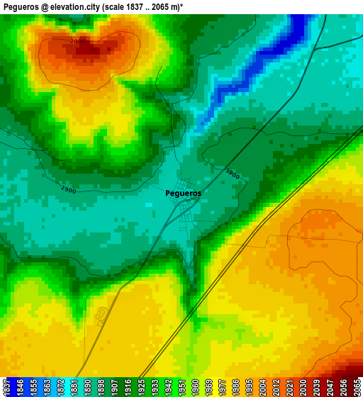
Below is the Elevation map of Pegueros, which displays elevation range with different colors. Scale of the first map is from 1837 to 2065 m (6027 to 6775 ft) with average elevation of 1939.2 meters (=6362 ft) [note 1]
These maps also provides idea of topography and contour of this city, they are displayed at different zoom levels. More info about maps, scale and edge coordinates you can find below images.
| \ | Map #1 | Map #2 | Topo.Map |
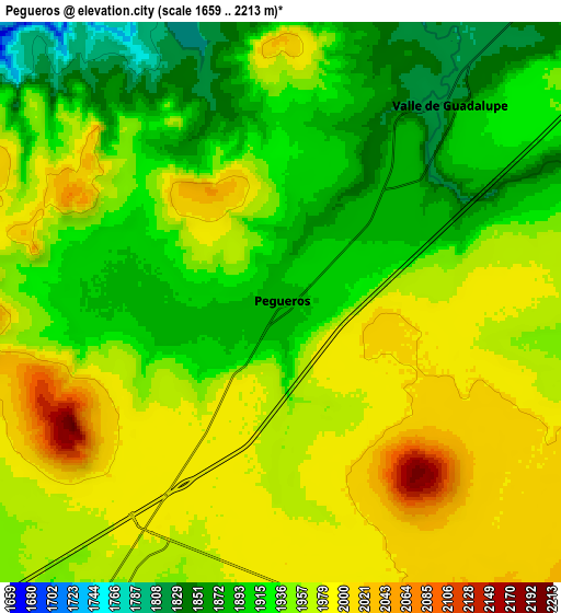
| Scale [m] | 1837..2065 m | 1659..2213 m | × |
| Scale [ft] | 6027..6775 ft | 5443..7260 ft | × |
| Average | 1939.2 m = 6362 ft | 1943.9 m = 6378 ft | × |
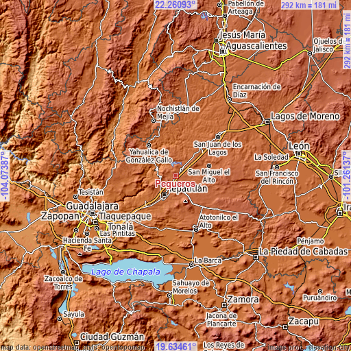
| Width | 9.13 km = 5.7 mi | 18.25 km = 11.3 mi | 292 km = 181.4 mi |
| Height | 9.13 km = 5.7 mi | 18.25 km = 11.3 mi | 292 km = 181.4 mi |
| ↑Max Latitude | 20.994564° | 21.035586° | 22.26093° |
| Latitude at center | 20.95353° | 20.95353° | 20.95353° |
| ↓Min Latitude | 20.912485° | 20.871429° | 19.63461° |
| ← Min Longitude | -102.711565° | -102.755511° | -104.07387° |
| Longitude center | -102.66762° | -102.66762° | -102.66762° |
| →Max Longitude | -102.623675° | -102.579729° | -101.26137° |
Nearby cities:
Cities around Pegueros sort by population:
• Tepatitlán de Morelos elevation 1825 m
18.2 km,  213°
213°
• Jalostotitlán 1763 m
31.8 km,  41°
41°
• San Miguel el Alto 1851 m
28.6 km,  72°
72°
• Capilla de Guadalupe 2058 m
16.1 km,  150°
150°
• Acatic 1684 m
31.8 km,  232°
232°
• San Ignacio Cerro Gordo 2076 m
26.9 km, 149°
• Valle de Guadalupe 1826 m
8.3 km, 39°
• El Zapote 1713 m
22.8 km,  321°
321°
• Santa María del Valle 2065 m
31 km,  105°
105°
• Cañadas de Obregón 1866 m
21.9 km,  354°
354°
• Mezcala 1673 m
18.5 km,  269°
269°
• Manalisco 1752 m
28.9 km,  294°
294°
Multilingual:
 En español:
Pegueros elevación 1888 m.
 En France:
Pegueros élévation 1888 m.
 Auf Deutsch:
Pegueros höhe über dem Meeresspiegel ist 1888 m.

Sources and notes:
- [note 1] Map square and city borders are not equal. Map elevation data is calculated only from area inside that square.
- [src 1] Elevation data from geonames database provided with same terms of usage.
- [src 2] The elevation map of Pegueros is generated using elevation data from NASA's 3 arcsec (90m) resolution SRTM data.
- [src 3] Base (background) map © OpenStreetMap contributors tiles are generated by Geofabrik and OpenTopoMap.
Copyright & License:
This Pegueros Elevation Map is licensed under CC BY-SA. You may reuse any part from this page, if you give a proper credit by linking to this URL:
 More info on terms of use page.