Salitral de Carrera elevation
Salitral de Carrera (San Luis Potosí, Villa de Ramos), Mexico elevation is 2039 meters and Salitral de Carrera elevation in feet is 6690 ft above sea level [src 1]. Salitral de Carrera is a populated place (feature code) with elevation that is 725 meters (2379 ft) bigger than average city elevation in Mexico.
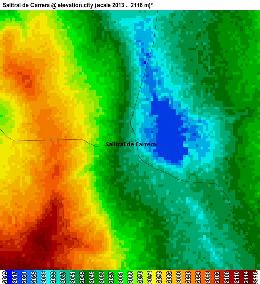
Below is the Elevation map of Salitral de Carrera, which displays elevation range with different colors. Scale of the first map is from 2013 to 2118 m (6604 to 6949 ft) with average elevation of 2059 meters (=6755 ft) [note 1]
These maps also provides idea of topography and contour of this city, they are displayed at different zoom levels. More info about maps, scale and edge coordinates you can find below images.
| \ | Map #1 | Map #2 | Topo.Map |
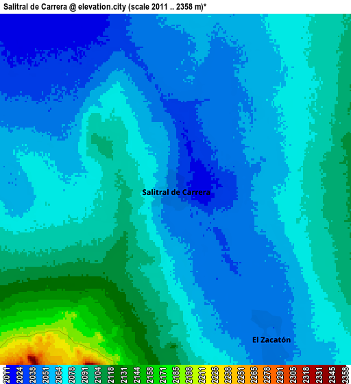
| Scale [m] | 2013..2118 m | 2011..2358 m | × |
| Scale [ft] | 6604..6949 ft | 6598..7736 ft | × |
| Average | 2059 m = 6755 ft | 2072.4 m = 6799 ft | × |
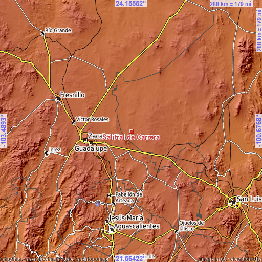
| Width | 9 km = 5.6 mi | 18.01 km = 11.2 mi | 288.1 km = 179 mi |
| Height | 9 km = 5.6 mi | 18.01 km = 11.2 mi | 288.1 km = 179 mi |
| ↑Max Latitude | 22.906536° | 22.94701° | 24.15552° |
| Latitude at center | 22.86605° | 22.86605° | 22.86605° |
| ↓Min Latitude | 22.825552° | 22.785042° | 21.56422° |
| ← Min Longitude | -102.126995° | -102.170941° | -103.4893° |
| Longitude center | -102.08305° | -102.08305° | -102.08305° |
| →Max Longitude | -102.039105° | -101.995159° | -100.6768° |
Nearby cities:
Cities around Salitral de Carrera sort by population:
• Dulce Grande elevation 1988 m
17.7 km,  328°
328°
• Los Zacatones 2051 m
11 km,  14°
14°
• El Barril 1969 m
24.3 km,  342°
342°
• General Pánfilo Natera 2105 m
22.6 km,  187°
187°
• El Saucito (El Horno) 2128 m
15.1 km,  184°
184°
• San José el Saladillo (El Saladillo) 2035 m
20.7 km,  167°
167°
• Hernández 2035 m
19.2 km, 14°
• Villa de Ramos 2206 m
18.1 km,  102°
102°
• La Tesorera 2139 m
19.1 km, 190°
• La Luz 2049 m
23.3 km,  273°
273°
• Sauz de Calera 2074 m
10.7 km, 270°
• Guanajuatillo 2186 m
17.7 km,  200°
200°
Multilingual:
 En español:
Salitral de Carrera elevación 2039 m.
 En France:
Salitral de Carrera élévation 2039 m.
 Auf Deutsch:
Salitral de Carrera höhe über dem Meeresspiegel ist 2039 m.
 На русском:
Salitral de Carrera высота над уровнем моря 2039 м
Sources and notes:
- [note 1] Map square and city borders are not equal. Map elevation data is calculated only from area inside that square.
- [src 1] Elevation data from geonames database provided with same terms of usage.
- [src 2] The elevation map of Salitral de Carrera is generated using elevation data from NASA's 3 arcsec (90m) resolution SRTM data.
- [src 3] Base (background) map © OpenStreetMap contributors tiles are generated by Geofabrik and OpenTopoMap.
Copyright & License:
This Salitral de Carrera Elevation Map is licensed under CC BY-SA. You may reuse any part from this page, if you give a proper credit by linking to this URL:
 More info on terms of use page.