General Pánfilo Natera elevation
General Pánfilo Natera (Zacatecas), Mexico elevation is 2105 meters and General Pánfilo Natera elevation in feet is 6906 ft above sea level [src 1]. General Pánfilo Natera is a seat of a second-order administrative division (feature code) with elevation that is 791 meters (2595 ft) bigger than average city elevation in Mexico.
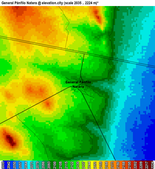
Below is the Elevation map of General Pánfilo Natera, which displays elevation range with different colors. Scale of the first map is from 2035 to 2224 m (6677 to 7297 ft) with average elevation of 2114.5 meters (=6937 ft) [note 1]
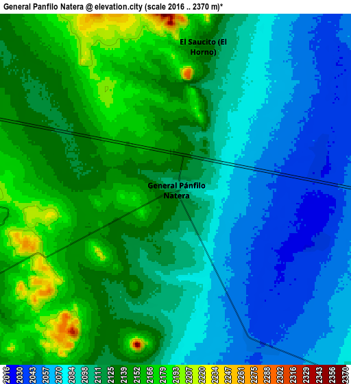
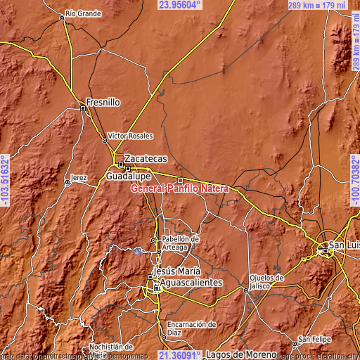
These maps also provides idea of topography and contour of this city, they are displayed at different zoom levels. More info about maps, scale and edge coordinates you can find below images.
| \ | Map #1 | Map #2 | Topo.Map |
| Scale [m] | 2035..2224 m | 2016..2370 m | × |
| Scale [ft] | 6677..7297 ft | 6614..7776 ft | × |
| Average | 2114.5 m = 6937 ft | 2112.2 m = 6930 ft | × |
| Width | 9.02 km = 5.6 mi | 18.04 km = 11.2 mi | 288.6 km = 179.3 mi |
| Height | 9.02 km = 5.6 mi | 18.04 km = 11.2 mi | 288.6 km = 179.3 mi |
| ↑Max Latitude | 22.705156° | 22.745689° | 23.95604° |
| Latitude at center | 22.66461° | 22.66461° | 22.66461° |
| ↓Min Latitude | 22.624052° | 22.583483° | 21.36091° |
| ← Min Longitude | -102.154015° | -102.197961° | -103.51632° |
| Longitude center | -102.11007° | -102.11007° | -102.11007° |
| →Max Longitude | -102.066125° | -102.022179° | -100.70382° |
Nearby cities:
Cities around General Pánfilo Natera sort by population:
• El Saucito (El Horno) elevation 2128 m
7.5 km,  11°
11°
• San José el Saladillo (El Saladillo) 2035 m
7.8 km,  73°
73°
• Santa Elena 2047 m
9 km,  153°
153°
• San Pablo 2061 m
11.7 km,  174°
174°
• La Capilla 2144 m
13.3 km,  280°
280°
• San Cristóbal 2073 m
15.1 km,  237°
237°
• Bajío de San Nicolás 2100 m
15.3 km,  136°
136°
• La Tesorera 2139 m
3.7 km,  349°
349°
• El Tule 2034 m
7.8 km,  109°
109°
• Pozo de Jarillas 2160 m
9.1 km,  261°
261°
• Guanajuatillo 2186 m
6.7 km,  329°
329°
• Cerrito de la Cruz 2088 m
16.7 km,  267°
267°
Multilingual:
 En español:
General Pánfilo Natera elevación 2105 m.
 En France:
General Pánfilo Natera élévation 2105 m.
 Auf Deutsch:
General Pánfilo Natera höhe über dem Meeresspiegel ist 2105 m.
 На русском:
General Pánfilo Natera высота над уровнем моря 2105 м
Sources and notes:
- [note 1] Map square and city borders are not equal. Map elevation data is calculated only from area inside that square.
- [src 1] Elevation data from geonames database provided with same terms of usage.
- [src 2] The elevation map of General Pánfilo Natera is generated using elevation data from NASA's 3 arcsec (90m) resolution SRTM data.
- [src 3] Base (background) map © OpenStreetMap contributors tiles are generated by Geofabrik and OpenTopoMap.
Copyright & License:
This General Pánfilo Natera Elevation Map is licensed under CC BY-SA. You may reuse any part from this page, if you give a proper credit by linking to this URL:
 More info on terms of use page.