Tarandacuao elevation
Tarandacuao (Guanajuato), Mexico elevation is 1945 meters and Tarandacuao elevation in feet is 6381 ft above sea level [src 1]. Tarandacuao is a seat of a second-order administrative division (feature code) with elevation that is 631 meters (2070 ft) bigger than average city elevation in Mexico.
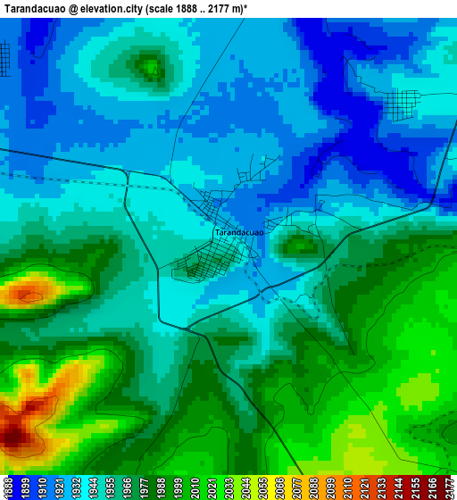
Below is the Elevation map of Tarandacuao, which displays elevation range with different colors. Scale of the first map is from 1888 to 2177 m (6194 to 7142 ft) with average elevation of 1961.7 meters (=6436 ft) [note 1]
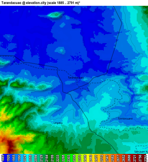
These maps also provides idea of topography and contour of this city, they are displayed at different zoom levels. More info about maps, scale and edge coordinates you can find below images.
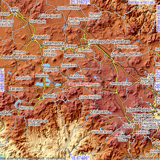
| \ | Map #1 | Map #2 | Topo.Map |
| Scale [m] | 1888..2177 m | 1885..2791 m | × |
| Scale [ft] | 6194..7142 ft | 6184..9157 ft | × |
| Average | 1961.7 m = 6436 ft | 2020.3 m = 6628 ft | × |
| Width | 9.18 km = 5.7 mi | 18.37 km = 11.4 mi | 293.8 km = 182.6 mi |
| Height | 9.18 km = 5.7 mi | 18.37 km = 11.4 mi | 293.9 km = 182.6 mi |
| ↑Max Latitude | 20.042229° | 20.083508° | 21.31673° |
| Latitude at center | 20.00094° | 20.00094° | 20.00094° |
| ↓Min Latitude | 19.95964° | 19.918329° | 18.67406° |
| ← Min Longitude | -100.562505° | -100.606451° | -101.92481° |
| Longitude center | -100.51856° | -100.51856° | -100.51856° |
| →Max Longitude | -100.474615° | -100.430669° | -99.11231° |
Nearby cities:
Cities around Tarandacuao sort by population:
• Maravatío de Ocampo elevation 2019 m
14.5 km,  147°
147°
• Jerécuaro 1967 m
17.1 km,  3°
3°
• Tungareo 2029 m
18.9 km,  122°
122°
• Santiago Puriatzícuaro 2487 m
15 km,  209°
209°
• Puroagua 2041 m
11.1 km,  38°
38°
• Ucareo 2553 m
20.9 km,  236°
236°
• Santa Elena 2032 m
19.6 km,  143°
143°
• Uripitio 2021 m
5.7 km,  201°
201°
• Estanzuela de Romero 2022 m
20.5 km, 4°
• Tziritzícuaro 1973 m
7.9 km,  128°
128°
• Huajúmbaro 2564 m
17.1 km, 211°
• Ojo de Agua de Mendoza 1988 m
19.1 km,  343°
343°
Multilingual:
 En español:
Tarandacuao elevación 1945 m.
 En France:
Tarandacuao élévation 1945 m.
 Auf Deutsch:
Tarandacuao höhe über dem Meeresspiegel ist 1945 m.

Sources and notes:
- [note 1] Map square and city borders are not equal. Map elevation data is calculated only from area inside that square.
- [src 1] Elevation data from geonames database provided with same terms of usage.
- [src 2] The elevation map of Tarandacuao is generated using elevation data from NASA's 3 arcsec (90m) resolution SRTM data.
- [src 3] Base (background) map © OpenStreetMap contributors tiles are generated by Geofabrik and OpenTopoMap.
Copyright & License:
This Tarandacuao Elevation Map is licensed under CC BY-SA. You may reuse any part from this page, if you give a proper credit by linking to this URL:
 More info on terms of use page.