Santiago Puriatzícuaro elevation
Santiago Puriatzícuaro (Michoacán, Maravatío), Mexico elevation is 2487 meters and Santiago Puriatzícuaro elevation in feet is 8159 ft above sea level [src 1]. Santiago Puriatzícuaro is a populated place (feature code) with elevation that is 1173 meters (3848 ft) bigger than average city elevation in Mexico.
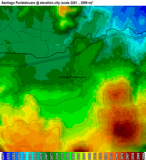
Below is the Elevation map of Santiago Puriatzícuaro, which displays elevation range with different colors. Scale of the first map is from 2201 to 2999 m (7221 to 9839 ft) with average elevation of 2556.8 meters (=8388 ft) [note 1]
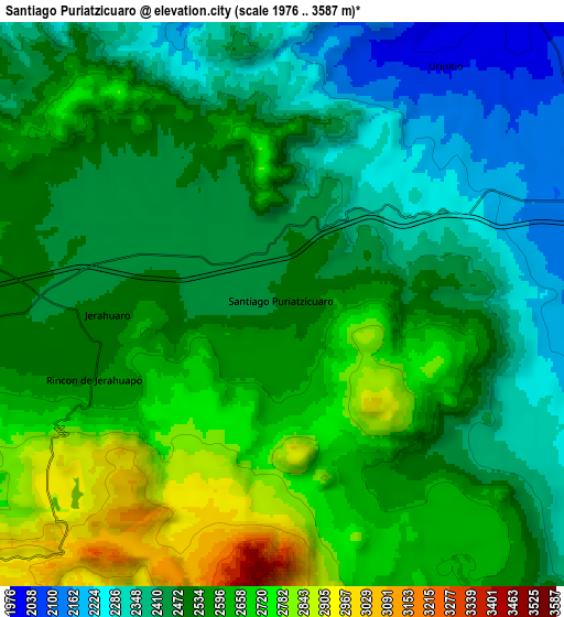
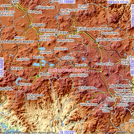
These maps also provides idea of topography and contour of this city, they are displayed at different zoom levels. More info about maps, scale and edge coordinates you can find below images.
| \ | Map #1 | Map #2 | Topo.Map |
| Scale [m] | 2201..2999 m | 1976..3587 m | × |
| Scale [ft] | 7221..9839 ft | 6483..11768 ft | × |
| Average | 2556.8 m = 8388 ft | 2525.1 m = 8284 ft | × |
| Width | 9.19 km = 5.7 mi | 18.38 km = 11.4 mi | 294.1 km = 182.7 mi |
| Height | 9.19 km = 5.7 mi | 18.38 km = 11.4 mi | 294.1 km = 182.7 mi |
| ↑Max Latitude | 19.92438° | 19.96569° | 21.19986° |
| Latitude at center | 19.88306° | 19.88306° | 19.88306° |
| ↓Min Latitude | 19.841729° | 19.800387° | 18.55522° |
| ← Min Longitude | -100.632555° | -100.676501° | -101.99486° |
| Longitude center | -100.58861° | -100.58861° | -100.58861° |
| →Max Longitude | -100.544665° | -100.500719° | -99.18236° |
Nearby cities:
Cities around Santiago Puriatzícuaro sort by population:
• Maravatío de Ocampo elevation 2019 m
15.1 km,  86°
86°
• Tarandacuao 1945 m
15 km,  29°
29°
• Tzintzingareo 2268 m
17.1 km,  140°
140°
• Ucareo 2553 m
10.3 km,  279°
279°
• Santa Elena 2032 m
19 km,  98°
98°
• San Isidro Alta Huerta 2190 m
18.4 km,  196°
196°
• Uripitio 2021 m
9.4 km, 34°
• Tziritzícuaro 1973 m
15.8 km,  58°
58°
• Huajúmbaro 2564 m
2.2 km,  227°
227°
• Ojo de Agua de Bucio 2558 m
18.5 km, 231°
• Tierras Coloradas (San Pedro) 2186 m
19.2 km, 198°
• Los Desmontes 2054 m
17.7 km,  297°
297°
Multilingual:
 En español:
Santiago Puriatzícuaro elevación 2487 m.
 En France:
Santiago Puriatzícuaro élévation 2487 m.
 Auf Deutsch:
Santiago Puriatzícuaro höhe über dem Meeresspiegel ist 2487 m.
 На русском:
Santiago Puriatzícuaro высота над уровнем моря 2487 м
Sources and notes:
- [note 1] Map square and city borders are not equal. Map elevation data is calculated only from area inside that square.
- [src 1] Elevation data from geonames database provided with same terms of usage.
- [src 2] The elevation map of Santiago Puriatzícuaro is generated using elevation data from NASA's 3 arcsec (90m) resolution SRTM data.
- [src 3] Base (background) map © OpenStreetMap contributors tiles are generated by Geofabrik and OpenTopoMap.
Copyright & License:
This Santiago Puriatzícuaro Elevation Map is licensed under CC BY-SA. You may reuse any part from this page, if you give a proper credit by linking to this URL:
 More info on terms of use page.