La Paz elevation
La Paz (Jalisco, Ojuelos de Jalisco), Mexico elevation is 2127 meters and La Paz elevation in feet is 6978 ft above sea level [src 1]. La Paz is a populated place (feature code) with elevation that is 813 meters (2667 ft) bigger than average city elevation in Mexico.
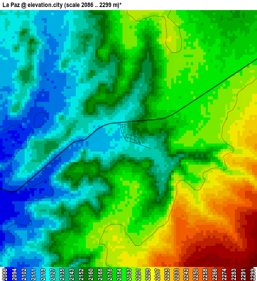
Below is the Elevation map of La Paz, which displays elevation range with different colors. Scale of the first map is from 2086 to 2299 m (6844 to 7543 ft) with average elevation of 2167.6 meters (=7112 ft) [note 1]
These maps also provides idea of topography and contour of this city, they are displayed at different zoom levels. More info about maps, scale and edge coordinates you can find below images.
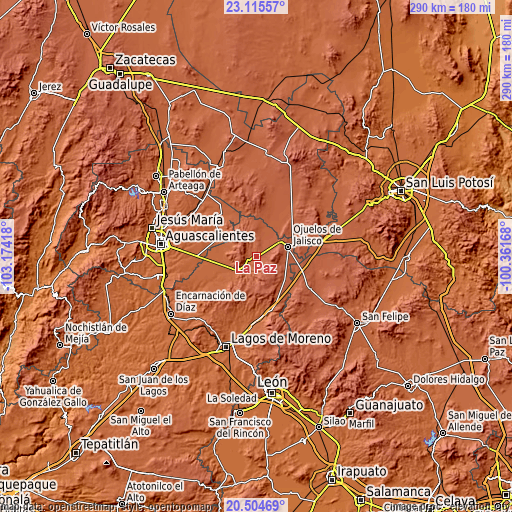
| \ | Map #1 | Topo.Map |
| Scale [m] | 2086..2299 m | × |
| Scale [ft] | 6844..7543 ft | × |
| Average | 2167.6 m = 7112 ft | × |
| Width | 9.07 km = 5.6 mi | 290.3 km = 180.4 mi |
| Height | 9.07 km = 5.6 mi | 290.3 km = 180.4 mi |
| ↑Max Latitude | 21.856872° | 23.11557° |
| Latitude at center | 21.81608° | 21.81608° |
| ↓Min Latitude | 21.775276° | 20.50469° |
| ← Min Longitude | -101.811875° | -103.17418° |
| Longitude center | -101.76793° | -101.76793° |
| →Max Longitude | -101.723985° | -100.36168° |
Nearby cities:
Cities around La Paz sort by population:
• Ojuelos de Jalisco elevation 2226 m
18.9 km,  72°
72°
• Palo Alto 2026 m
23.2 km,  299°
299°
• Matancillas (San Isidro Matancillas) 2180 m
14.7 km,  55°
55°
• Los Azulitos 2013 m
20.6 km,  279°
279°
• Chinampas 2122 m
5.4 km, 295°
• Francisco Primo de Verdad (Ciénega de Mata) 2086 m
10 km,  217°
217°
• Matanzas 2209 m
23.4 km,  150°
150°
• La Presa 2090 m
6.6 km,  227°
227°
• San Cristóbal 2019 m
23.3 km, 230°
• Vaquerías 2279 m
12.9 km,  114°
114°
• Guadalupe Victoria 2195 m
20.1 km,  129°
129°
• Gachupines 2189 m
22 km, 105°
Multilingual:
 En español:
La Paz elevación 2127 m.
 En France:
La Paz élévation 2127 m.


Sources and notes:
- [note 1] Map square and city borders are not equal. Map elevation data is calculated only from area inside that square.
- [src 1] Elevation data from geonames database provided with same terms of usage.
- [src 2] The elevation map of La Paz is generated using elevation data from NASA's 3 arcsec (90m) resolution SRTM data.
- [src 3] Base (background) map © OpenStreetMap contributors tiles are generated by Geofabrik and OpenTopoMap.
Copyright & License:
This La Paz Elevation Map is licensed under CC BY-SA. You may reuse any part from this page, if you give a proper credit by linking to this URL:
 More info on terms of use page.