Pochutla elevation
Pochutla (Guerrero, Ahuacuotzingo), Mexico elevation is 1156 meters and Pochutla elevation in feet is 3793 ft above sea level [src 1]. Pochutla is a populated place (feature code) with elevation that is 158 meters (518 ft) smaller than average city elevation in Mexico.
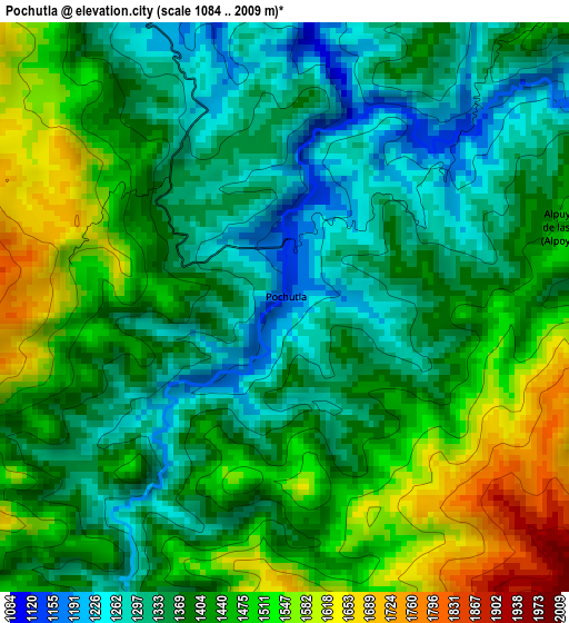
Below is the Elevation map of Pochutla, which displays elevation range with different colors. Scale of the first map is from 1084 to 2009 m (3556 to 6591 ft) with average elevation of 1411.3 meters (=4630 ft) [note 1]
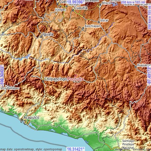
These maps also provides idea of topography and contour of this city, they are displayed at different zoom levels. More info about maps, scale and edge coordinates you can find below images.
| \ | Map #1 | Topo.Map |
| Scale [m] | 1084..2009 m | × |
| Scale [ft] | 3556..6591 ft | × |
| Average | 1411.3 m = 4630 ft | × |
| Width | 9.31 km = 5.8 mi | 298 km = 185.2 mi |
| Height | 9.31 km = 5.8 mi | 298 km = 185.2 mi |
| ↑Max Latitude | 17.70094° | 18.99396° |
| Latitude at center | 17.65907° | 17.65907° |
| ↓Min Latitude | 17.617191° | 16.31421° |
| ← Min Longitude | -98.941925° | -100.30423° |
| Longitude center | -98.89798° | -98.89798° |
| →Max Longitude | -98.854035° | -97.49173° |
Nearby cities:
Cities around Pochutla sort by population:
• Olinalá elevation 1339 m
21.4 km,  51°
51°
• Ahuacuotzingo 1480 m
7.3 km,  327°
327°
• Atlixtac 1679 m
11.3 km,  199°
199°
• Chiepetepec 1789 m
20.3 km,  120°
120°
• Pantitlán 1830 m
22.5 km,  264°
264°
• Tlatlauquitepec 2111 m
14.4 km,  148°
148°
• Alpuyecancingo de las Montañas 1483 m
5.1 km,  74°
74°
• Ayotzinapa 1598 m
18.3 km,  128°
128°
• Xocoyolzintla 1290 m
10.7 km,  303°
303°
• Chiaucingo 1378 m
23.2 km, 66°
• Oztotitlán 1269 m
13.5 km,  276°
276°
• Tecolcuautla 1059 m
15.1 km,  339°
339°
Multilingual:
 En español:
Pochutla, Pochultla elevación 1156 m.
 En France:
Pochutla élévation 1156 m.
 Auf Deutsch:
Pochutla höhe über dem Meeresspiegel ist 1156 m.

Sources and notes:
- [note 1] Map square and city borders are not equal. Map elevation data is calculated only from area inside that square.
- [src 1] Elevation data from geonames database provided with same terms of usage.
- [src 2] The elevation map of Pochutla is generated using elevation data from NASA's 3 arcsec (90m) resolution SRTM data.
- [src 3] Base (background) map © OpenStreetMap contributors tiles are generated by Geofabrik and OpenTopoMap.
Copyright & License:
This Pochutla Elevation Map is licensed under CC BY-SA. You may reuse any part from this page, if you give a proper credit by linking to this URL:
 More info on terms of use page.