Olinalá elevation
Olinalá (Guerrero), Mexico elevation is 1339 meters and Olinalá elevation in feet is 4393 ft above sea level [src 1]. Olinalá is a seat of a second-order administrative division (feature code) with elevation that is 25 meters (82 ft) bigger than average city elevation in Mexico.
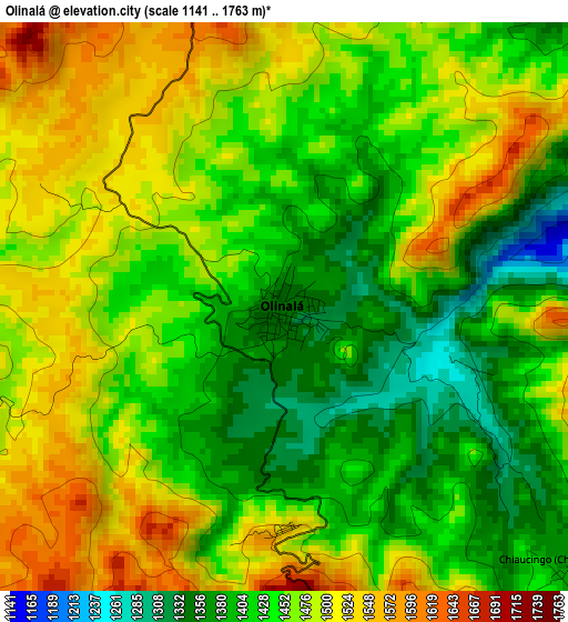
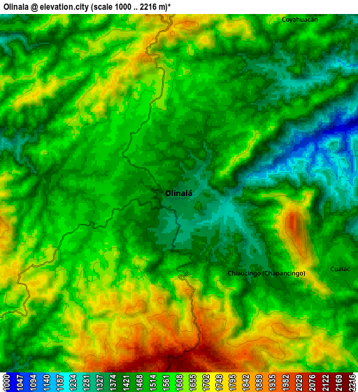
Below is the Elevation map of Olinalá, which displays elevation range with different colors. Scale of the first map is from 1141 to 1763 m (3743 to 5784 ft) with average elevation of 1453.6 meters (=4769 ft) [note 1]
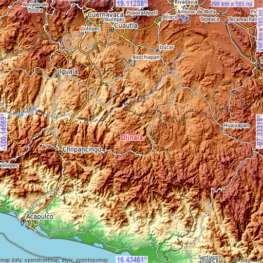
These maps also provides idea of topography and contour of this city, they are displayed at different zoom levels. More info about maps, scale and edge coordinates you can find below images.
| \ | Map #1 | Map #2 | Topo.Map |
| Scale [m] | 1141..1763 m | 1000..2216 m | × |
| Scale [ft] | 3743..5784 ft | 3281..7270 ft | × |
| Average | 1453.6 m = 4769 ft | 1539.7 m = 5052 ft | × |
| Width | 9.31 km = 5.8 mi | 18.61 km = 11.6 mi | 297.8 km = 185 mi |
| Height | 9.31 km = 5.8 mi | 18.61 km = 11.6 mi | 297.8 km = 185 mi |
| ↑Max Latitude | 17.820452° | 17.862284° | 19.11258° |
| Latitude at center | 17.77861° | 17.77861° | 17.77861° |
| ↓Min Latitude | 17.736758° | 17.694897° | 16.43461° |
| ← Min Longitude | -98.783385° | -98.827331° | -100.14569° |
| Longitude center | -98.73944° | -98.73944° | -98.73944° |
| →Max Longitude | -98.695495° | -98.651549° | -97.33319° |
Nearby cities:
Cities around Olinalá sort by population:
• Huamuxtitlán elevation 894 m
18.8 km,  81°
81°
• Ahuacuotzingo 1480 m
21.9 km,  250°
250°
• Alpuyecancingo de las Montañas 1483 m
16.9 km,  224°
224°
• Cualác 1458 m
9.2 km,  115°
115°
• San Antonio Coyahuacán 1546 m
11.2 km,  34°
34°
• Chiaucingo 1378 m
6 km,  132°
132°
• Tlaquiltepec 931 m
21 km,  104°
104°
• Pochutla 1156 m
21.4 km,  231°
231°
• Zumpango 1172 m
18.4 km,  18°
18°
• Coyahualco 914 m
18.8 km, 102°
• Santa Cruz 900 m
17.9 km,  93°
93°
• Coachimalco 1812 m
18.1 km,  160°
160°
Multilingual:
 En español:
Olinalá elevación 1339 m.
 En France:
Olinalá élévation 1339 m.
 Auf Deutsch:
Olinalá höhe über dem Meeresspiegel ist 1339 m.

Sources and notes:
- [note 1] Map square and city borders are not equal. Map elevation data is calculated only from area inside that square.
- [src 1] Elevation data from geonames database provided with same terms of usage.
- [src 2] The elevation map of Olinalá is generated using elevation data from NASA's 3 arcsec (90m) resolution SRTM data.
- [src 3] Base (background) map © OpenStreetMap contributors tiles are generated by Geofabrik and OpenTopoMap.
Copyright & License:
This Olinalá Elevation Map is licensed under CC BY-SA. You may reuse any part from this page, if you give a proper credit by linking to this URL:
 More info on terms of use page.