Xpujil elevation
Xpujil (Campeche, Calakmul), Mexico elevation is 248 meters and Xpujil elevation in feet is 814 ft above sea level [src 1]. Xpujil is a seat of a second-order administrative division (feature code) with elevation that is 1066 meters (3497 ft) smaller than average city elevation in Mexico.
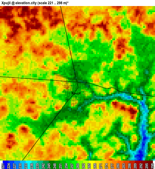
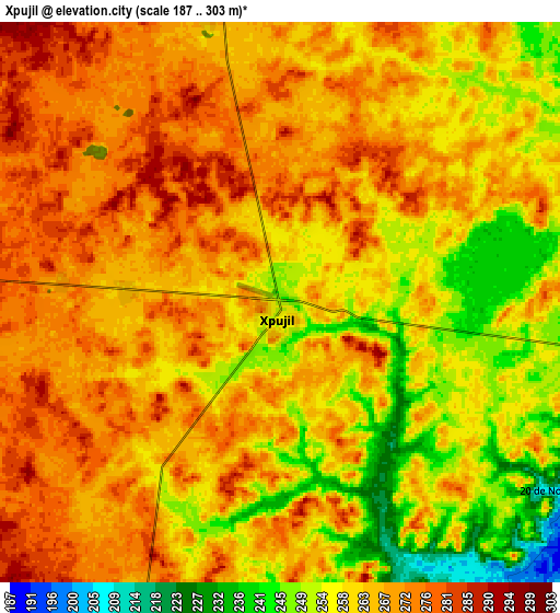
Below is the Elevation map of Xpujil, which displays elevation range with different colors. Scale of the first map is from 221 to 298 m (725 to 978 ft) with average elevation of 264.7 meters (=868 ft) [note 1]
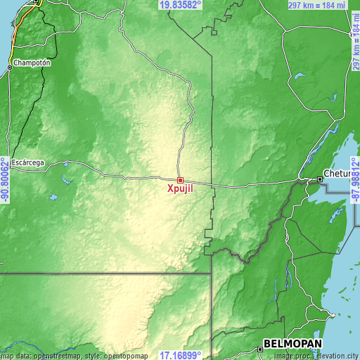
These maps also provides idea of topography and contour of this city, they are displayed at different zoom levels. More info about maps, scale and edge coordinates you can find below images.
| \ | Map #1 | Map #2 | Topo.Map |
| Scale [m] | 221..298 m | 187..303 m | × |
| Scale [ft] | 725..978 ft | 614..994 ft | × |
| Average | 264.7 m = 868 ft | 263.6 m = 865 ft | × |
| Width | 9.27 km = 5.8 mi | 18.53 km = 11.5 mi | 296.5 km = 184.2 mi |
| Height | 9.27 km = 5.8 mi | 18.53 km = 11.5 mi | 296.5 km = 184.2 mi |
| ↑Max Latitude | 18.549267° | 18.590925° | 19.83582° |
| Latitude at center | 18.5076° | 18.5076° | 18.5076° |
| ↓Min Latitude | 18.465922° | 18.424235° | 17.16899° |
| ← Min Longitude | -89.438315° | -89.482261° | -90.80062° |
| Longitude center | -89.39437° | -89.39437° | -89.39437° |
| →Max Longitude | -89.350425° | -89.306479° | -87.98812° |
Nearby cities:
Cities around Xpujil sort by population:
• Nicolás Bravo elevation 100 m
49.5 km,  96°
96°
• Javier Rojo Gómez 47 m
79.6 km,  109°
109°
• Álvaro Obregón 34 m
81.7 km, 106°
• Cacao 54 m
81.6 km,  115°
115°
• Ukúm 131 m
81.9 km,  4°
4°
• Pucté 38 m
82.6 km, 111°
• Caobas 130 m
31.3 km, 102°
• Morocoy 73 m
62.4 km,  80°
80°
• Xmabén 132 m
81.4 km,  5°
5°
• Constitución 84 m
79.3 km,  279°
279°
• Zoh-Laguna 275 m
9.8 km,  345°
345°
• Cocoyol 41 m
83.5 km, 117°
Multilingual:
 En español:
Xpujil elevación 248 m.
 En France:
Xpujil élévation 248 m.


Sources and notes:
- [note 1] Map square and city borders are not equal. Map elevation data is calculated only from area inside that square.
- [src 1] Elevation data from geonames database provided with same terms of usage.
- [src 2] The elevation map of Xpujil is generated using elevation data from NASA's 3 arcsec (90m) resolution SRTM data.
- [src 3] Base (background) map © OpenStreetMap contributors tiles are generated by Geofabrik and OpenTopoMap.
Copyright & License:
This Xpujil Elevation Map is licensed under CC BY-SA. You may reuse any part from this page, if you give a proper credit by linking to this URL:
 More info on terms of use page.