Chimalpa y Tlalayote elevation
Chimalpa y Tlalayote (Hidalgo, Apan), Mexico elevation is 2483 meters and Chimalpa y Tlalayote elevation in feet is 8146 ft above sea level [src 1]. Chimalpa y Tlalayote is a populated place (feature code) with elevation that is 1169 meters (3835 ft) bigger than average city elevation in Mexico.
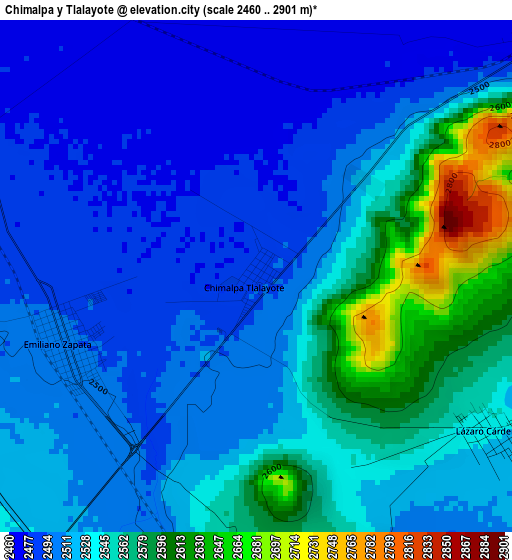
Below is the Elevation map of Chimalpa y Tlalayote, which displays elevation range with different colors. Scale of the first map is from 2460 to 2901 m (8071 to 9518 ft) with average elevation of 2528.3 meters (=8295 ft) [note 1]
These maps also provides idea of topography and contour of this city, they are displayed at different zoom levels. More info about maps, scale and edge coordinates you can find below images.
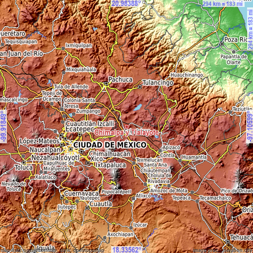
| \ | Map #1 | Topo.Map |
| Scale [m] | 2460..2901 m | × |
| Scale [ft] | 8071..9518 ft | × |
| Average | 2528.3 m = 8295 ft | × |
| Width | 9.2 km = 5.7 mi | 294.5 km = 183 mi |
| Height | 9.2 km = 5.7 mi | 294.5 km = 183 mi |
| ↑Max Latitude | 19.706597° | 20.98388° |
| Latitude at center | 19.66522° | 19.66522° |
| ↓Min Latitude | 19.623832° | 18.33562° |
| ← Min Longitude | -98.556185° | -99.91849° |
| Longitude center | -98.51224° | -98.51224° |
| →Max Longitude | -98.468295° | -97.10599° |
Nearby cities:
Cities around Chimalpa y Tlalayote sort by population:
• Calpulalpan elevation 2592 m
10.4 km,  215°
215°
• Apan 2489 m
8.2 km,  51°
51°
• Emiliano Zapata 2496 m
3.6 km,  251°
251°
• Almoloya 2536 m
12.2 km,  69°
69°
• Francisco Villa 2546 m
10.2 km,  149°
149°
• Lázaro Cárdenas 2530 m
5.1 km,  123°
123°
• Santa Bárbara 2510 m
6 km,  271°
271°
• Irolo 2456 m
11.7 km,  311°
311°
• La Laguna 2490 m
7.8 km,  9°
9°
• Santa Clara 2493 m
7.8 km,  298°
298°
• José María Morelos (San José) 2504 m
7 km,  285°
285°
• Zotoluca 2513 m
6.1 km,  178°
178°
Multilingual:
 En español:
Chimalpa Tlalayote elevación 2483 m.
 En France:
Chimalpa y Tlalayote élévation 2483 m.
 Auf Deutsch:
Chimalpa y Tlalayote höhe über dem Meeresspiegel ist 2483 m.
 На русском:
Chimalpa y Tlalayote высота над уровнем моря 2483 м
Sources and notes:
- [note 1] Map square and city borders are not equal. Map elevation data is calculated only from area inside that square.
- [src 1] Elevation data from geonames database provided with same terms of usage.
- [src 2] The elevation map of Chimalpa y Tlalayote is generated using elevation data from NASA's 3 arcsec (90m) resolution SRTM data.
- [src 3] Base (background) map © OpenStreetMap contributors tiles are generated by Geofabrik and OpenTopoMap.
Copyright & License:
This Chimalpa y Tlalayote Elevation Map is licensed under CC BY-SA. You may reuse any part from this page, if you give a proper credit by linking to this URL:
 More info on terms of use page.