Calpulalpan elevation
Calpulalpan (Tlaxcala), Mexico elevation is 2592 meters and Calpulalpan elevation in feet is 8504 ft above sea level [src 1]. Calpulalpan is a seat of a second-order administrative division (feature code) with elevation that is 1278 meters (4193 ft) bigger than average city elevation in Mexico.
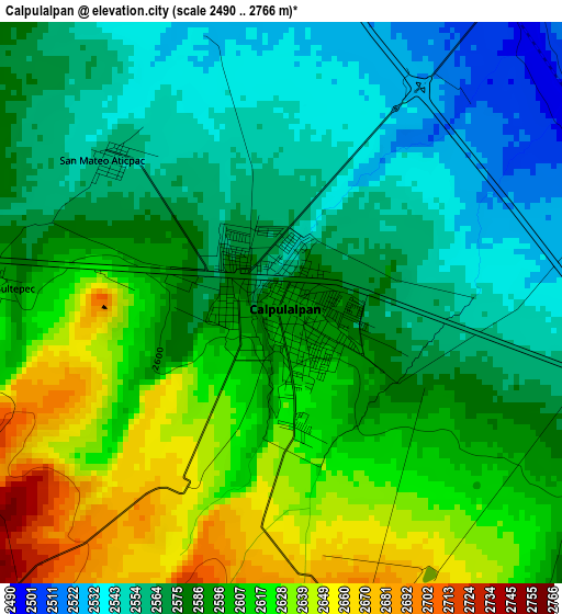
Below is the Elevation map of Calpulalpan, which displays elevation range with different colors. Scale of the first map is from 2490 to 2766 m (8169 to 9075 ft) with average elevation of 2589.9 meters (=8497 ft) [note 1]
These maps also provides idea of topography and contour of this city, they are displayed at different zoom levels. More info about maps, scale and edge coordinates you can find below images.
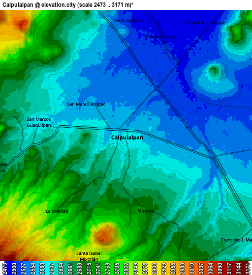
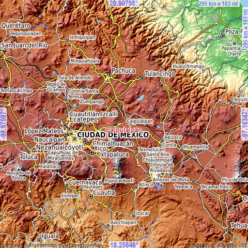
| \ | Map #1 | Map #2 | Topo.Map |
| Scale [m] | 2490..2766 m | 2473..3171 m | × |
| Scale [ft] | 8169..9075 ft | 8114..10404 ft | × |
| Average | 2589.9 m = 8497 ft | 2641.7 m = 8667 ft | × |
| Width | 9.21 km = 5.7 mi | 18.41 km = 11.4 mi | 294.6 km = 183.1 mi |
| Height | 9.21 km = 5.7 mi | 18.41 km = 11.4 mi | 294.6 km = 183.1 mi |
| ↑Max Latitude | 19.630067° | 19.671453° | 20.90798° |
| Latitude at center | 19.58867° | 19.58867° | 19.58867° |
| ↓Min Latitude | 19.547263° | 19.505845° | 18.25846° |
| ← Min Longitude | -98.613665° | -98.657611° | -99.97597° |
| Longitude center | -98.56972° | -98.56972° | -98.56972° |
| →Max Longitude | -98.525775° | -98.481829° | -97.16347° |
Nearby cities:
Cities around Calpulalpan sort by population:
• Ciudad de Nanacamilpa elevation 2745 m
11.1 km,  161°
161°
• Emiliano Zapata 2496 m
7.8 km,  19°
19°
• Santiago Cuaula 2664 m
8.5 km,  279°
279°
• Chimalpa y Tlalayote 2483 m
10.4 km,  35°
35°
• Mazapa 2716 m
5.5 km,  165°
165°
• San Marcos Guaquilpan 2597 m
6.3 km, 280°
• Santa Bárbara 2510 m
8.7 km,  0°
0°
• Francisco I. Madero 2634 m
11.2 km,  132°
132°
• José María Morelos (San José) 2504 m
10.5 km,  356°
356°
• San Felipe Sultepec 2607 m
4.8 km,  272°
272°
• La Soledad 2746 m
7.5 km,  221°
221°
• Zotoluca 2513 m
6.6 km,  68°
68°
Multilingual:
 En español:
Calpulalpan elevación 2592 m.
 En France:
Calpulalpan élévation 2592 m.
 Auf Deutsch:
Calpulalpan höhe über dem Meeresspiegel ist 2592 m.

Sources and notes:
- [note 1] Map square and city borders are not equal. Map elevation data is calculated only from area inside that square.
- [src 1] Elevation data from geonames database provided with same terms of usage.
- [src 2] The elevation map of Calpulalpan is generated using elevation data from NASA's 3 arcsec (90m) resolution SRTM data.
- [src 3] Base (background) map © OpenStreetMap contributors tiles are generated by Geofabrik and OpenTopoMap.
Copyright & License:
This Calpulalpan Elevation Map is licensed under CC BY-SA. You may reuse any part from this page, if you give a proper credit by linking to this URL:
 More info on terms of use page.