El Porvenir elevation
El Porvenir (Oaxaca, San Juan Cotzocón), Mexico elevation is 99 meters and El Porvenir elevation in feet is 325 ft above sea level [src 1]. El Porvenir is a populated place (feature code) with elevation that is 1215 meters (3986 ft) smaller than average city elevation in Mexico.
Below is the Elevation map of El Porvenir, which displays elevation range with different colors. Scale of the first map is from 50 to 127 m (164 to 417 ft) with average elevation of 89.8 meters (=295 ft) [note 1]
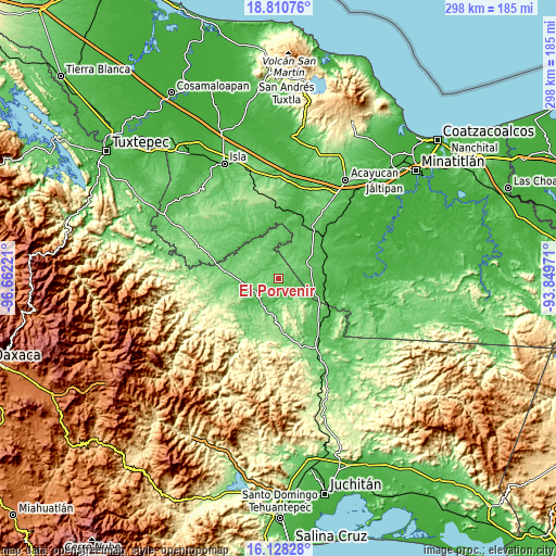
These maps also provides idea of topography and contour of this city, they are displayed at different zoom levels. More info about maps, scale and edge coordinates you can find below images.
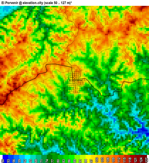
| \ | Map #1 | Topo.Map |
| Scale [m] | 50..127 m | × |
| Scale [ft] | 164..417 ft | × |
| Average | 89.8 m = 295 ft | × |
| Width | 9.32 km = 5.8 mi | 298.3 km = 185.4 mi |
| Height | 9.32 km = 5.8 mi | 298.3 km = 185.4 mi |
| ↑Max Latitude | 17.516372° | 18.81076° |
| Latitude at center | 17.47446° | 17.47446° |
| ↓Min Latitude | 17.432538° | 16.12828° |
| ← Min Longitude | -95.299905° | -96.66221° |
| Longitude center | -95.25596° | -95.25596° |
| →Max Longitude | -95.212015° | -93.84971° |
Nearby cities:
Cities around El Porvenir sort by population:
• Jesús Carranza elevation 41 m
24.7 km,  100°
100°
• María Lombardo de Caso 104 m
18.5 km,  261°
261°
• Nuevo Ixcatlán 75 m
26.8 km,  313°
313°
• Suchilapan del Río 42 m
30.1 km,  109°
109°
• San Felipe Cihualtepec 82 m
11.9 km,  271°
271°
• Jaltepec de Candayoc 70 m
21.4 km,  231°
231°
• Achotal de Moreno 43 m
31.9 km,  23°
23°
• Constitución Mexicana 72 m
19.4 km,  219°
219°
• Nuevo San Martín 74 m
30.7 km,  292°
292°
• Los Ángeles 46 m
13.1 km,  132°
132°
• El Paraíso 91 m
12.9 km,  69°
69°
• San José de las Flores 57 m
20.4 km, 227°
Multilingual:
 En español:
El Porvenir elevación 99 m.
 En France:
El Porvenir élévation 99 m.
 Auf Deutsch:
El Porvenir höhe über dem Meeresspiegel ist 99 m.

Sources and notes:
- [note 1] Map square and city borders are not equal. Map elevation data is calculated only from area inside that square.
- [src 1] Elevation data from geonames database provided with same terms of usage.
- [src 2] The elevation map of El Porvenir is generated using elevation data from NASA's 3 arcsec (90m) resolution SRTM data.
- [src 3] Base (background) map © OpenStreetMap contributors tiles are generated by Geofabrik and OpenTopoMap.
Copyright & License:
This El Porvenir Elevation Map is licensed under CC BY-SA. You may reuse any part from this page, if you give a proper credit by linking to this URL:
 More info on terms of use page.