Jesús Carranza elevation
Jesús Carranza (Veracruz), Mexico elevation is 41 meters and Jesús Carranza elevation in feet is 135 ft above sea level [src 1]. Jesús Carranza is a seat of a second-order administrative division (feature code) with elevation that is 1273 meters (4177 ft) smaller than average city elevation in Mexico.
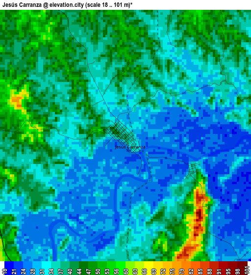
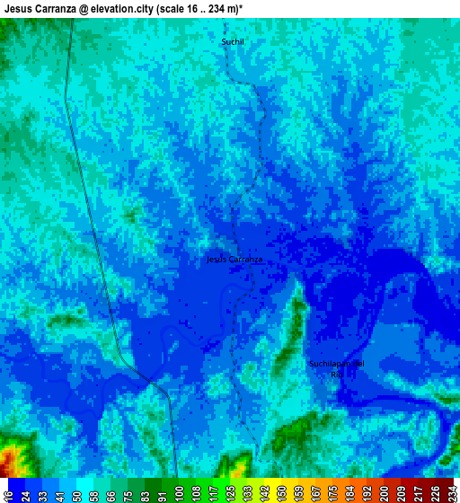
Below is the Elevation map of Jesús Carranza, which displays elevation range with different colors. Scale of the first map is from 18 to 101 m (59 to 331 ft) with average elevation of 36.6 meters (=120 ft) [note 1]
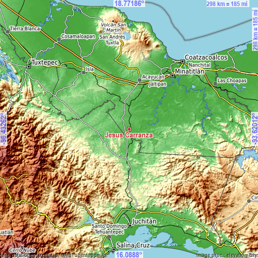
These maps also provides idea of topography and contour of this city, they are displayed at different zoom levels. More info about maps, scale and edge coordinates you can find below images.
| \ | Map #1 | Map #2 | Topo.Map |
| Scale [m] | 18..101 m | 16..234 m | × |
| Scale [ft] | 59..331 ft | 52..768 ft | × |
| Average | 36.6 m = 120 ft | 45.8 m = 150 ft | × |
| Width | 9.32 km = 5.8 mi | 18.65 km = 11.6 mi | 298.3 km = 185.4 mi |
| Height | 9.32 km = 5.8 mi | 18.65 km = 11.6 mi | 298.4 km = 185.4 mi |
| ↑Max Latitude | 17.477181° | 17.519093° | 18.77186° |
| Latitude at center | 17.43526° | 17.43526° | 17.43526° |
| ↓Min Latitude | 17.393329° | 17.351388° | 16.0888° |
| ← Min Longitude | -95.070315° | -95.114261° | -96.43262° |
| Longitude center | -95.02637° | -95.02637° | -95.02637° |
| →Max Longitude | -94.982425° | -94.938479° | -93.62012° |
Nearby cities:
Cities around Jesús Carranza sort by population:
• Palomares elevation 118 m
33.2 km,  186°
186°
• Suchilapan del Río 42 m
6.8 km,  143°
143°
• Donaji 77 m
23.1 km, 187°
• San Felipe Cihualtepec 82 m
36.5 km,  277°
277°
• El Porvenir 99 m
24.7 km, 280°
• Achotal de Moreno 43 m
35.4 km,  341°
341°
• Vicente Guerrero 47 m
33.3 km,  78°
78°
• El Juile 37 m
34.6 km,  6°
6°
• Los Ángeles 46 m
15.4 km,  253°
253°
• Medias Aguas 63 m
25.9 km,  359°
359°
• Venustiano Carranza (Peña Blanca) 15 m
36.9 km,  51°
51°
• El Paraíso 91 m
15.3 km,  306°
306°
Multilingual:
 En español:
Jesús Carranza elevación 41 m.
 En France:
Jesús Carranza élévation 41 m.
 Auf Deutsch:
Jesús Carranza höhe über dem Meeresspiegel ist 41 m.

Sources and notes:
- [note 1] Map square and city borders are not equal. Map elevation data is calculated only from area inside that square.
- [src 1] Elevation data from geonames database provided with same terms of usage.
- [src 2] The elevation map of Jesús Carranza is generated using elevation data from NASA's 3 arcsec (90m) resolution SRTM data.
- [src 3] Base (background) map © OpenStreetMap contributors tiles are generated by Geofabrik and OpenTopoMap.
Copyright & License:
This Jesús Carranza Elevation Map is licensed under CC BY-SA. You may reuse any part from this page, if you give a proper credit by linking to this URL:
 More info on terms of use page.