Palomares elevation
Palomares (Oaxaca, Matías Romero Avendaño), Mexico elevation is 118 meters and Palomares elevation in feet is 387 ft above sea level [src 1]. Palomares is a populated place (feature code) with elevation that is 1196 meters (3924 ft) smaller than average city elevation in Mexico.
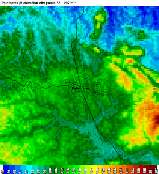
Below is the Elevation map of Palomares, which displays elevation range with different colors. Scale of the first map is from 53 to 207 m (174 to 679 ft) with average elevation of 106.3 meters (=349 ft) [note 1]
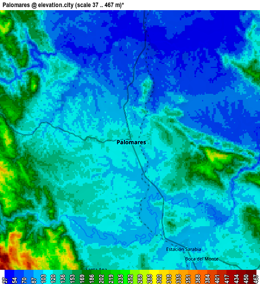
These maps also provides idea of topography and contour of this city, they are displayed at different zoom levels. More info about maps, scale and edge coordinates you can find below images.
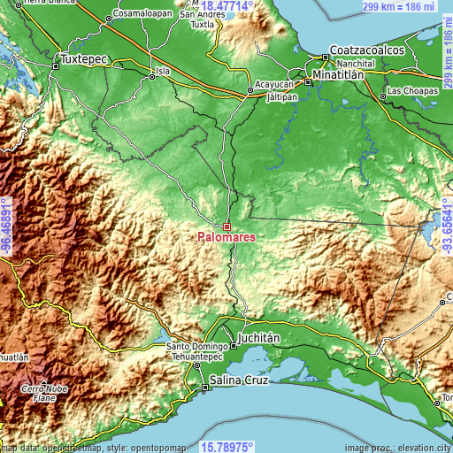
| \ | Map #1 | Map #2 | Topo.Map |
| Scale [m] | 53..207 m | 37..467 m | × |
| Scale [ft] | 174..679 ft | 121..1532 ft | × |
| Average | 106.3 m = 349 ft | 115.4 m = 379 ft | × |
| Width | 9.34 km = 5.8 mi | 18.68 km = 11.6 mi | 298.8 km = 185.7 mi |
| Height | 9.34 km = 5.8 mi | 18.68 km = 11.6 mi | 298.8 km = 185.7 mi |
| ↑Max Latitude | 17.180289° | 17.222269° | 18.47714° |
| Latitude at center | 17.1383° | 17.1383° | 17.1383° |
| ↓Min Latitude | 17.096301° | 17.054293° | 15.78975° |
| ← Min Longitude | -95.106605° | -95.150551° | -96.46891° |
| Longitude center | -95.06266° | -95.06266° | -95.06266° |
| →Max Longitude | -95.018715° | -94.974769° | -93.65641° |
Nearby cities:
Cities around Palomares sort by population:
• San Juan Guichicovi elevation 264 m
19.9 km,  189°
189°
• Donaji 77 m
10.2 km,  5°
5°
• Cuauhtémoc 106 m
19.3 km,  102°
102°
• Estación Mogoñé 103 m
16.2 km,  170°
170°
• Santa Ana 133 m
9.6 km, 194°
• Río Pachiñe 148 m
18.9 km,  180°
180°
• Piedra Blanca 114 m
17.5 km,  162°
162°
• Zacatal 550 m
26.6 km,  214°
214°
• Encinal Colorado 280 m
15 km,  198°
198°
• El Chocolate 261 m
23.1 km, 187°
• Zarzal 109 m
14.1 km, 168°
• Paso Real de Sarabia 112 m
7.4 km, 166°
Multilingual:
 En español:
Palomares elevación 118 m.
 En France:
Palomares élévation 118 m.
 Auf Deutsch:
Palomares höhe über dem Meeresspiegel ist 118 m.

Sources and notes:
- [note 1] Map square and city borders are not equal. Map elevation data is calculated only from area inside that square.
- [src 1] Elevation data from geonames database provided with same terms of usage.
- [src 2] The elevation map of Palomares is generated using elevation data from NASA's 3 arcsec (90m) resolution SRTM data.
- [src 3] Base (background) map © OpenStreetMap contributors tiles are generated by Geofabrik and OpenTopoMap.
Copyright & License:
This Palomares Elevation Map is licensed under CC BY-SA. You may reuse any part from this page, if you give a proper credit by linking to this URL:
 More info on terms of use page.