Ahuatepec Pueblo elevation
Ahuatepec Pueblo (Guerrero, Tlapa de Comonfort), Mexico elevation is 1414 meters and Ahuatepec Pueblo elevation in feet is 4639 ft above sea level [src 1]. Ahuatepec Pueblo is a populated place (feature code) with elevation that is 100 meters (328 ft) bigger than average city elevation in Mexico.
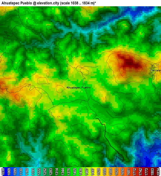
Below is the Elevation map of Ahuatepec Pueblo, which displays elevation range with different colors. Scale of the first map is from 1038 to 1834 m (3406 to 6017 ft) with average elevation of 1372.7 meters (=4504 ft) [note 1]
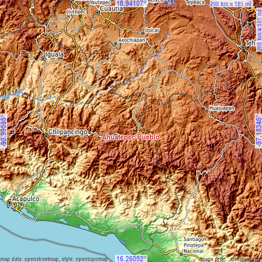
These maps also provides idea of topography and contour of this city, they are displayed at different zoom levels. More info about maps, scale and edge coordinates you can find below images.
| \ | Map #1 | Topo.Map |
| Scale [m] | 1038..1834 m | × |
| Scale [ft] | 3406..6017 ft | × |
| Average | 1372.7 m = 4504 ft | × |
| Width | 9.31 km = 5.8 mi | 298 km = 185.2 mi |
| Height | 9.31 km = 5.8 mi | 298.1 km = 185.2 mi |
| ↑Max Latitude | 17.647652° | 18.94107° |
| Latitude at center | 17.60577° | 17.60577° |
| ↓Min Latitude | 17.563878° | 16.26052° |
| ← Min Longitude | -98.633645° | -99.99595° |
| Longitude center | -98.5897° | -98.5897° |
| →Max Longitude | -98.545755° | -97.18345° |
Nearby cities:
Cities around Ahuatepec Pueblo sort by population:
• Tlapa de Comonfort elevation 1092 m
6.9 km,  167°
167°
• Xalpatlahuac 1547 m
15.1 km,  186°
186°
• Alpoyeca 965 m
11.1 km,  49°
49°
• Xalatzala 1703 m
14.8 km, 173°
• Atlamajac 1061 m
7.2 km,  141°
141°
• San Miguel Axoxuca 1383 m
9.9 km,  230°
230°
• Ixcateopan 1000 m
8.1 km,  80°
80°
• Tlatzala 1498 m
4.4 km, 76°
• Tlaquiltepec 931 m
14.7 km,  17°
17°
• Atlamajalcingo del Río 1150 m
11.2 km,  218°
218°
• Colonia Constitución 1208 m
7.8 km, 187°
• Coachimalco 1812 m
9.9 km,  282°
282°
Multilingual:
 En español:
Ahuatepec Pueblo elevación 1414 m.
 En France:
Ahuatepec Pueblo élévation 1414 m.
 Auf Deutsch:
Ahuatepec Pueblo höhe über dem Meeresspiegel ist 1414 m.

Sources and notes:
- [note 1] Map square and city borders are not equal. Map elevation data is calculated only from area inside that square.
- [src 1] Elevation data from geonames database provided with same terms of usage.
- [src 2] The elevation map of Ahuatepec Pueblo is generated using elevation data from NASA's 3 arcsec (90m) resolution SRTM data.
- [src 3] Base (background) map © OpenStreetMap contributors tiles are generated by Geofabrik and OpenTopoMap.
Copyright & License:
This Ahuatepec Pueblo Elevation Map is licensed under CC BY-SA. You may reuse any part from this page, if you give a proper credit by linking to this URL:
 More info on terms of use page.