Atlatlahucan elevation
Atlatlahucan (Morelos), Mexico elevation is 1637 meters and Atlatlahucan elevation in feet is 5371 ft above sea level [src 1]. Atlatlahucan is a seat of a second-order administrative division (feature code) with elevation that is 323 meters (1060 ft) bigger than average city elevation in Mexico.
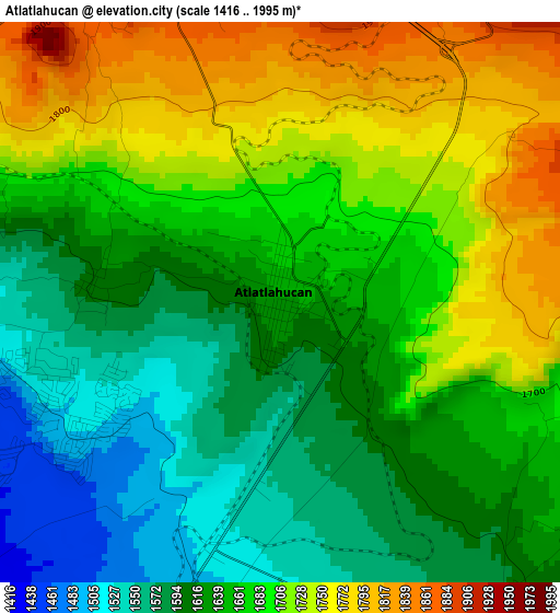
Below is the Elevation map of Atlatlahucan, which displays elevation range with different colors. Scale of the first map is from 1416 to 1995 m (4646 to 6545 ft) with average elevation of 1661.3 meters (=5450 ft) [note 1]
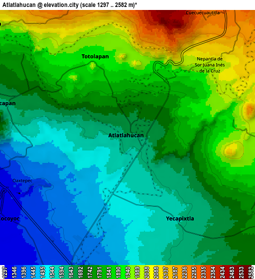
These maps also provides idea of topography and contour of this city, they are displayed at different zoom levels. More info about maps, scale and edge coordinates you can find below images.
| \ | Map #1 | Map #2 | Topo.Map |
| Scale [m] | 1416..1995 m | 1297..2582 m | × |
| Scale [ft] | 4646..6545 ft | 4255..8471 ft | × |
| Average | 1661.3 m = 5450 ft | 1742.5 m = 5717 ft | × |
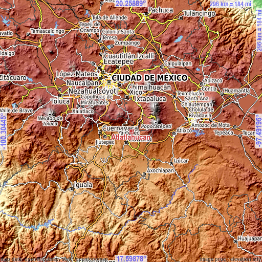
| Width | 9.24 km = 5.7 mi | 18.49 km = 11.5 mi | 295.8 km = 183.8 mi |
| Height | 9.24 km = 5.7 mi | 18.49 km = 11.5 mi | 295.8 km = 183.8 mi |
| ↑Max Latitude | 18.975692° | 19.017244° | 20.25889° |
| Latitude at center | 18.93413° | 18.93413° | 18.93413° |
| ↓Min Latitude | 18.892557° | 18.850974° | 17.59878° |
| ← Min Longitude | -98.942145° | -98.986091° | -100.30445° |
| Longitude center | -98.8982° | -98.8982° | -98.8982° |
| →Max Longitude | -98.854255° | -98.810309° | -97.49195° |
Nearby cities:
Cities around Atlatlahucan sort by population:
• Yecapixtla elevation 1590 m
6.6 km,  148°
148°
• Oaxtepec 1461 m
6.4 km,  253°
253°
• Totolapan 1902 m
6.1 km,  337°
337°
• Nepantla de Sor Juana Inés de la Cruz 1991 m
7.9 km,  49°
49°
• Achichipico 1940 m
7.8 km,  78°
78°
• Nepopualco 2043 m
8.6 km,  327°
327°
• Tlaltetelco (San Miguel Tlaltetelco) 1715 m
2.3 km,  27°
27°
• Cuauhtempan (San Andrés Cuauhtempan) 1860 m
6.8 km,  311°
311°
• San Juan Texcalpan 1603 m
3.2 km,  273°
273°
• Emiliano Zapata (Casahuates) 1518 m
6.4 km, 266°
• Yecapixteca 1501 m
5.8 km,  184°
184°
• Colonia San Francisco 1523 m
4.3 km,  187°
187°
Multilingual:
 En español:
Atlatlahucan elevación 1637 m.
 En France:
Atlatlahucan élévation 1637 m.
 Auf Deutsch:
Atlatlahucan höhe über dem Meeresspiegel ist 1637 m.

Sources and notes:
- [note 1] Map square and city borders are not equal. Map elevation data is calculated only from area inside that square.
- [src 1] Elevation data from geonames database provided with same terms of usage.
- [src 2] The elevation map of Atlatlahucan is generated using elevation data from NASA's 3 arcsec (90m) resolution SRTM data.
- [src 3] Base (background) map © OpenStreetMap contributors tiles are generated by Geofabrik and OpenTopoMap.
Copyright & License:
This Atlatlahucan Elevation Map is licensed under CC BY-SA. You may reuse any part from this page, if you give a proper credit by linking to this URL:
 More info on terms of use page.