Yecapixtla elevation
Yecapixtla (Morelos), Mexico elevation is 1590 meters and Yecapixtla elevation in feet is 5217 ft above sea level [src 1]. Yecapixtla is a populated place (feature code) with elevation that is 276 meters (906 ft) bigger than average city elevation in Mexico.
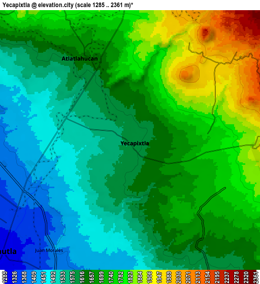
Below is the Elevation map of Yecapixtla, which displays elevation range with different colors. Scale of the first map is from 1433 to 2102 m (4701 to 6896 ft) with average elevation of 1621.8 meters (=5321 ft) [note 1]
These maps also provides idea of topography and contour of this city, they are displayed at different zoom levels. More info about maps, scale and edge coordinates you can find below images.

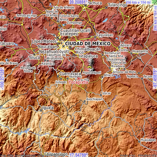
| \ | Map #1 | Map #2 | Topo.Map |
| Scale [m] | 1433..2102 m | 1285..2361 m | × |
| Scale [ft] | 4701..6896 ft | 4216..7746 ft | × |
| Average | 1621.8 m = 5321 ft | 1655.6 m = 5432 ft | × |
| Width | 9.25 km = 5.7 mi | 18.49 km = 11.5 mi | 295.9 km = 183.9 mi |
| Height | 9.25 km = 5.7 mi | 18.49 km = 11.5 mi | 295.9 km = 183.9 mi |
| ↑Max Latitude | 18.924905° | 18.96647° | 20.20851° |
| Latitude at center | 18.88333° | 18.88333° | 18.88333° |
| ↓Min Latitude | 18.841745° | 18.800149° | 17.54759° |
| ← Min Longitude | -98.908945° | -98.952891° | -100.27125° |
| Longitude center | -98.865° | -98.865° | -98.865° |
| →Max Longitude | -98.821055° | -98.777109° | -97.45875° |
Nearby cities:
Cities around Yecapixtla sort by population:
• Atlatlahucan elevation 1637 m
6.6 km,  328°
328°
• Ocuituco 1934 m
9.7 km,  93°
93°
• Jumiltepec 2148 m
9.9 km,  70°
70°
• Xochitlán 1764 m
5.6 km,  83°
83°
• Achichipico 1940 m
8.3 km,  29°
29°
• Texcala 2011 m
9.3 km,  52°
52°
• Tlaltetelco (San Miguel Tlaltetelco) 1715 m
8 km,  342°
342°
• Mixtlalcingo 1413 m
9.6 km,  202°
202°
• San Juan Texcalpan 1603 m
8.9 km,  310°
310°
• Yecapixteca 1501 m
4 km,  268°
268°
• Tierra Larga (Campo Nuevo) 1382 m
9 km,  256°
256°
• Colonia San Francisco 1523 m
4.3 km,  289°
289°
Multilingual:
 En español:
Yecapixtla elevación 1590 m.
 En France:
Yecapixtla élévation 1590 m.
 Auf Deutsch:
Yecapixtla höhe über dem Meeresspiegel ist 1590 m.

Sources and notes:
- [note 1] Map square and city borders are not equal. Map elevation data is calculated only from area inside that square.
- [src 1] Elevation data from geonames database provided with same terms of usage.
- [src 2] The elevation map of Yecapixtla is generated using elevation data from NASA's 3 arcsec (90m) resolution SRTM data.
- [src 3] Base (background) map © OpenStreetMap contributors tiles are generated by Geofabrik and OpenTopoMap.
Copyright & License:
This Yecapixtla Elevation Map is licensed under CC BY-SA. You may reuse any part from this page, if you give a proper credit by linking to this URL:
 More info on terms of use page.