San Juan Texcalpan elevation
San Juan Texcalpan (Morelos, Atlatlahucan), Mexico elevation is 1603 meters and San Juan Texcalpan elevation in feet is 5259 ft above sea level [src 1]. San Juan Texcalpan is a populated place (feature code) with elevation that is 289 meters (948 ft) bigger than average city elevation in Mexico.
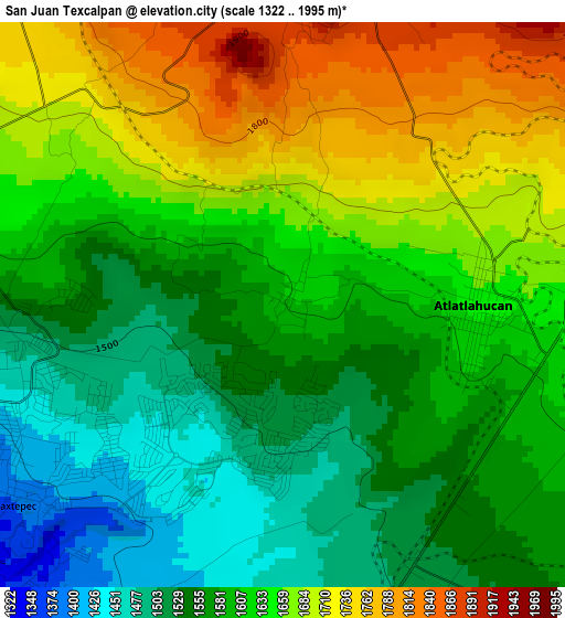
Below is the Elevation map of San Juan Texcalpan, which displays elevation range with different colors. Scale of the first map is from 1322 to 1995 m (4337 to 6545 ft) with average elevation of 1611.6 meters (=5287 ft) [note 1]
These maps also provides idea of topography and contour of this city, they are displayed at different zoom levels. More info about maps, scale and edge coordinates you can find below images.
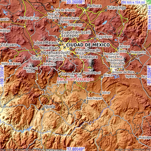
| \ | Map #1 | Topo.Map |
| Scale [m] | 1322..1995 m | × |
| Scale [ft] | 4337..6545 ft | × |
| Average | 1611.6 m = 5287 ft | × |
| Width | 9.24 km = 5.7 mi | 295.8 km = 183.8 mi |
| Height | 9.24 km = 5.7 mi | 295.8 km = 183.8 mi |
| ↑Max Latitude | 18.977392° | 20.26058° |
| Latitude at center | 18.93583° | 18.93583° |
| ↓Min Latitude | 18.894258° | 17.60049° |
| ← Min Longitude | -98.972835° | -100.33514° |
| Longitude center | -98.92889° | -98.92889° |
| →Max Longitude | -98.884945° | -97.52264° |
Nearby cities:
Cities around San Juan Texcalpan sort by population:
• Cocoyoc elevation 1327 m
8 km,  224°
224°
• Tlayacapan 1637 m
5.9 km,  291°
291°
• Atlatlahucan 1637 m
3.2 km,  93°
93°
• Oaxtepec 1461 m
3.5 km,  235°
235°
• Totolapan 1902 m
5.5 km,  8°
8°
• Nepopualco 2043 m
7.2 km,  348°
348°
• Narciso Mendoza 1352 m
8.1 km,  212°
212°
• Tlaltetelco (San Miguel Tlaltetelco) 1715 m
4.7 km,  67°
67°
• Cuauhtempan (San Andrés Cuauhtempan) 1860 m
4.7 km,  336°
336°
• Emiliano Zapata (Casahuates) 1518 m
3.2 km,  259°
259°
• Yecapixteca 1501 m
6.6 km,  155°
155°
• Colonia San Francisco 1523 m
5.2 km,  148°
148°
Multilingual:
 En español:
San Juan Texcalpan elevación 1603 m.
 En France:
San Juan Texcalpan élévation 1603 m.
 Auf Deutsch:
San Juan Texcalpan höhe über dem Meeresspiegel ist 1603 m.
 На русском:
San Juan Texcalpan высота над уровнем моря 1603 м
Sources and notes:
- [note 1] Map square and city borders are not equal. Map elevation data is calculated only from area inside that square.
- [src 1] Elevation data from geonames database provided with same terms of usage.
- [src 2] The elevation map of San Juan Texcalpan is generated using elevation data from NASA's 3 arcsec (90m) resolution SRTM data.
- [src 3] Base (background) map © OpenStreetMap contributors tiles are generated by Geofabrik and OpenTopoMap.
Copyright & License:
This San Juan Texcalpan Elevation Map is licensed under CC BY-SA. You may reuse any part from this page, if you give a proper credit by linking to this URL:
 More info on terms of use page.