Calnali elevation
Calnali (Hidalgo), Mexico elevation is 929 meters and Calnali elevation in feet is 3048 ft above sea level [src 1]. Calnali is a populated place (feature code) with elevation that is 385 meters (1263 ft) smaller than average city elevation in Mexico.
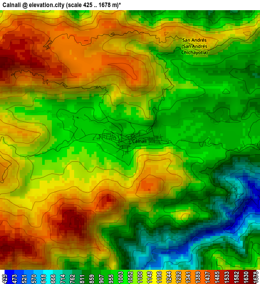
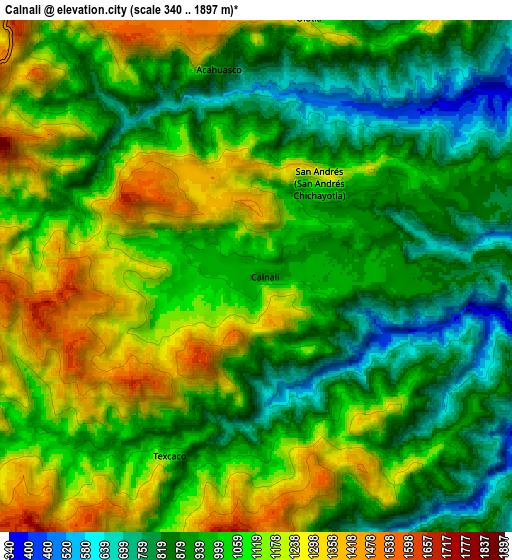
Below is the Elevation map of Calnali, which displays elevation range with different colors. Scale of the first map is from 425 to 1678 m (1394 to 5505 ft) with average elevation of 1090.3 meters (=3577 ft) [note 1]
These maps also provides idea of topography and contour of this city, they are displayed at different zoom levels. More info about maps, scale and edge coordinates you can find below images.
| \ | Map #1 | Map #2 | Topo.Map |
| Scale [m] | 425..1678 m | 340..1897 m | × |
| Scale [ft] | 1394..5505 ft | 1115..6224 ft | × |
| Average | 1090.3 m = 3577 ft | 1026.9 m = 3369 ft | × |
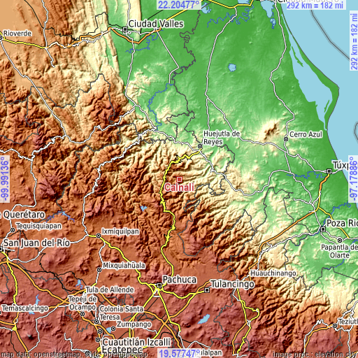
| Width | 9.13 km = 5.7 mi | 18.26 km = 11.3 mi | 292.1 km = 181.5 mi |
| Height | 9.13 km = 5.7 mi | 18.26 km = 11.3 mi | 292.1 km = 181.5 mi |
| ↑Max Latitude | 20.937919° | 20.978957° | 22.20477° |
| Latitude at center | 20.89687° | 20.89687° | 20.89687° |
| ↓Min Latitude | 20.85581° | 20.814738° | 19.57747° |
| ← Min Longitude | -98.629055° | -98.673001° | -99.99136° |
| Longitude center | -98.58511° | -98.58511° | -98.58511° |
| →Max Longitude | -98.541165° | -98.497219° | -97.17886° |
Nearby cities:
Cities around Calnali sort by population:
• Tlanchinol elevation 1540 m
12.9 km,  324°
324°
• Papatlatla 296 m
13.8 km,  87°
87°
• Chatipán 443 m
15 km,  23°
23°
• San Francisco 1034 m
16.9 km,  37°
37°
• Zoquitipán 297 m
15.9 km, 85°
• Acahuasco 888 m
7.4 km,  350°
350°
• San Andrés (San Andrés Chichayotla) 1164 m
4 km,  34°
34°
• Xochicoatlán 1681 m
16.6 km,  216°
216°
• Ixtlahuaca 1426 m
12.4 km,  263°
263°
• Xoxolpa 629 m
16.9 km,  97°
97°
• Texcaco 1073 m
7.1 km,  206°
206°
• Chichatla 1095 m
8.2 km,  326°
326°
Multilingual:
 En español:
Calnali elevación 929 m.
 En France:
Calnali élévation 929 m.


Sources and notes:
- [note 1] Map square and city borders are not equal. Map elevation data is calculated only from area inside that square.
- [src 1] Elevation data from geonames database provided with same terms of usage.
- [src 2] The elevation map of Calnali is generated using elevation data from NASA's 3 arcsec (90m) resolution SRTM data.
- [src 3] Base (background) map © OpenStreetMap contributors tiles are generated by Geofabrik and OpenTopoMap.
Copyright & License:
This Calnali Elevation Map is licensed under CC BY-SA. You may reuse any part from this page, if you give a proper credit by linking to this URL:
 More info on terms of use page.