Tlanchinol elevation
Tlanchinol (Hidalgo), Mexico elevation is 1540 meters and Tlanchinol elevation in feet is 5052 ft above sea level [src 1]. Tlanchinol is a populated place (feature code) with elevation that is 226 meters (741 ft) bigger than average city elevation in Mexico.
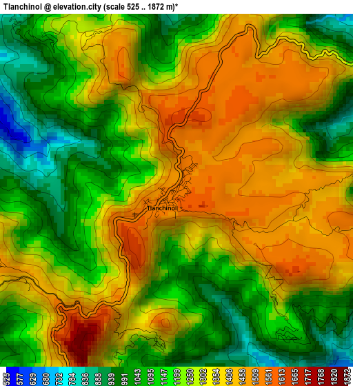
Below is the Elevation map of Tlanchinol, which displays elevation range with different colors. Scale of the first map is from 525 to 1872 m (1722 to 6142 ft) with average elevation of 1256.5 meters (=4122 ft) [note 1]
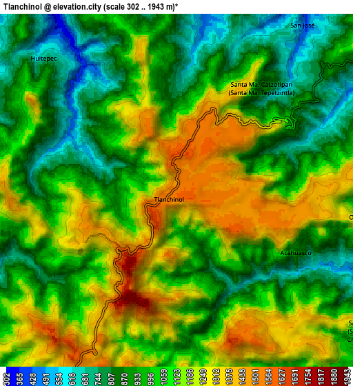
These maps also provides idea of topography and contour of this city, they are displayed at different zoom levels. More info about maps, scale and edge coordinates you can find below images.
| \ | Map #1 | Map #2 | Topo.Map |
| Scale [m] | 525..1872 m | 302..1943 m | × |
| Scale [ft] | 1722..6142 ft | 991..6375 ft | × |
| Average | 1256.5 m = 4122 ft | 1057.6 m = 3470 ft | × |
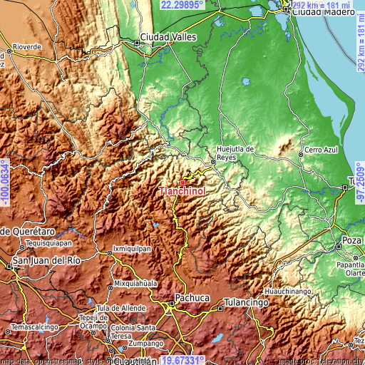
| Width | 9.12 km = 5.7 mi | 18.25 km = 11.3 mi | 291.9 km = 181.4 mi |
| Height | 9.12 km = 5.7 mi | 18.25 km = 11.3 mi | 292 km = 181.4 mi |
| ↑Max Latitude | 21.032923° | 21.073935° | 22.29895° |
| Latitude at center | 20.9919° | 20.9919° | 20.9919° |
| ↓Min Latitude | 20.950866° | 20.90982° | 19.67331° |
| ← Min Longitude | -98.701095° | -98.745041° | -100.0634° |
| Longitude center | -98.65715° | -98.65715° | -98.65715° |
| →Max Longitude | -98.613205° | -98.569259° | -97.2509° |
Nearby cities:
Cities around Tlanchinol sort by population:
• Calnali elevation 929 m
12.9 km,  144°
144°
• Chatipán 443 m
13.8 km,  76°
76°
• Hueyapa 989 m
10.9 km,  342°
342°
• Huitepec 697 m
9.7 km,  315°
315°
• Acahuasco 888 m
7.1 km,  117°
117°
• San Andrés (San Andrés Chichayotla) 1164 m
12.1 km,  126°
126°
• Jalpa 250 m
14.3 km, 335°
• Ixtlahuaca 1426 m
13 km,  201°
201°
• Pueblo Hidalgo 603 m
13.8 km,  350°
350°
• San José 431 m
10.8 km,  37°
37°
• Chichatla 1095 m
4.7 km, 142°
• Acoxcatlán 1137 m
12.7 km,  260°
260°
Multilingual:
 En español:
Tlanchinol elevación 1540 m.
 En France:
Tlanchinol élévation 1540 m.
 Auf Deutsch:
Tlanchinol höhe über dem Meeresspiegel ist 1540 m.

Sources and notes:
- [note 1] Map square and city borders are not equal. Map elevation data is calculated only from area inside that square.
- [src 1] Elevation data from geonames database provided with same terms of usage.
- [src 2] The elevation map of Tlanchinol is generated using elevation data from NASA's 3 arcsec (90m) resolution SRTM data.
- [src 3] Base (background) map © OpenStreetMap contributors tiles are generated by Geofabrik and OpenTopoMap.
Copyright & License:
This Tlanchinol Elevation Map is licensed under CC BY-SA. You may reuse any part from this page, if you give a proper credit by linking to this URL:
 More info on terms of use page.