Copalillo elevation
Copalillo (Guerrero), Mexico elevation is 886 meters and Copalillo elevation in feet is 2907 ft above sea level [src 1]. Copalillo is a seat of a second-order administrative division (feature code) with elevation that is 428 meters (1404 ft) smaller than average city elevation in Mexico.
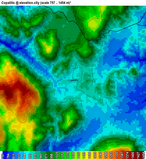
Below is the Elevation map of Copalillo, which displays elevation range with different colors. Scale of the first map is from 757 to 1454 m (2484 to 4770 ft) with average elevation of 959 meters (=3146 ft) [note 1]
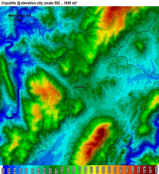
These maps also provides idea of topography and contour of this city, they are displayed at different zoom levels. More info about maps, scale and edge coordinates you can find below images.
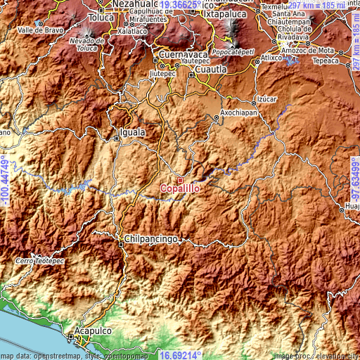
| \ | Map #1 | Map #2 | Topo.Map |
| Scale [m] | 757..1454 m | 592..1658 m | × |
| Scale [ft] | 2484..4770 ft | 1942..5440 ft | × |
| Average | 959 m = 3146 ft | 917.9 m = 3011 ft | × |
| Width | 9.29 km = 5.8 mi | 18.58 km = 11.5 mi | 297.3 km = 184.7 mi |
| Height | 9.29 km = 5.8 mi | 18.58 km = 11.5 mi | 297.4 km = 184.8 mi |
| ↑Max Latitude | 18.076051° | 18.117823° | 19.36625° |
| Latitude at center | 18.03427° | 18.03427° | 18.03427° |
| ↓Min Latitude | 17.992479° | 17.950677° | 16.69214° |
| ← Min Longitude | -99.085185° | -99.129131° | -100.44749° |
| Longitude center | -99.04124° | -99.04124° | -99.04124° |
| →Max Longitude | -98.997295° | -98.953349° | -97.63499° |
Nearby cities:
Cities around Copalillo sort by population:
• Tulimán elevation 1101 m
22.7 km,  268°
268°
• Atenango del Río 635 m
10.6 km,  318°
318°
• San Juan Totolcintla 585 m
33.4 km,  244°
244°
• Huachinantla 867 m
28.6 km,  15°
15°
• San Francisco Oxtutla 614 m
10 km,  143°
143°
• Chaucingo 838 m
30.6 km,  345°
345°
• San Miguel de las Palmas 1153 m
29.5 km,  325°
325°
• Xochitepec 1382 m
27.7 km,  38°
38°
• Paso Morelos 1108 m
27.4 km, 319°
• Tecolcuautla 1059 m
29.3 km,  160°
160°
• Tlalcozotitlán 574 m
19.3 km,  209°
209°
• Tequicuilco 749 m
18.3 km,  295°
295°
Multilingual:
 En español:
Copalillo elevación 886 m.
 En France:
Copalillo élévation 886 m.
 Auf Deutsch:
Copalillo höhe über dem Meeresspiegel ist 886 m.

Sources and notes:
- [note 1] Map square and city borders are not equal. Map elevation data is calculated only from area inside that square.
- [src 1] Elevation data from geonames database provided with same terms of usage.
- [src 2] The elevation map of Copalillo is generated using elevation data from NASA's 3 arcsec (90m) resolution SRTM data.
- [src 3] Base (background) map © OpenStreetMap contributors tiles are generated by Geofabrik and OpenTopoMap.
Copyright & License:
This Copalillo Elevation Map is licensed under CC BY-SA. You may reuse any part from this page, if you give a proper credit by linking to this URL:
 More info on terms of use page.