El Higo elevation
El Higo (Veracruz), Mexico elevation is 34 meters and El Higo elevation in feet is 112 ft above sea level [src 1]. El Higo is a seat of a second-order administrative division (feature code) with elevation that is 1280 meters (4199 ft) smaller than average city elevation in Mexico.
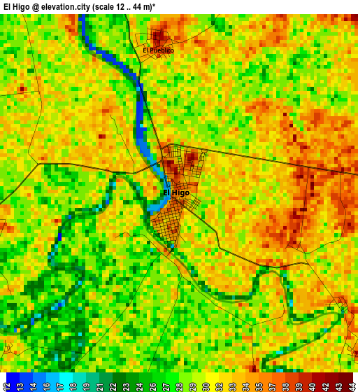
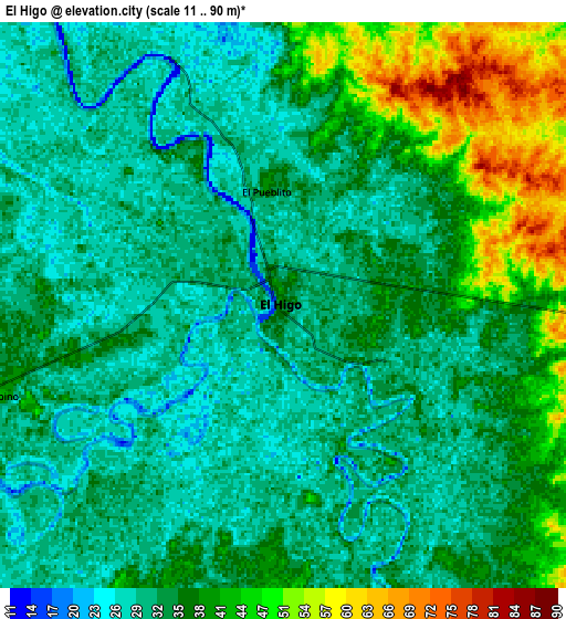
Below is the Elevation map of El Higo, which displays elevation range with different colors. Scale of the first map is from 12 to 44 m (39 to 144 ft) with average elevation of 30.4 meters (=100 ft) [note 1]
These maps also provides idea of topography and contour of this city, they are displayed at different zoom levels. More info about maps, scale and edge coordinates you can find below images.
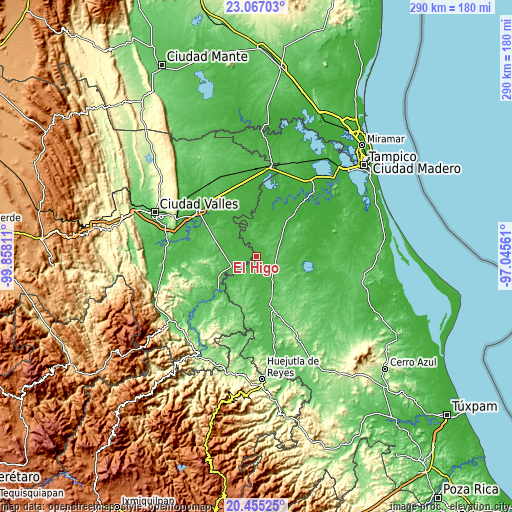
| \ | Map #1 | Map #2 | Topo.Map |
| Scale [m] | 12..44 m | 11..90 m | × |
| Scale [ft] | 39..144 ft | 36..295 ft | × |
| Average | 30.4 m = 100 ft | 35.7 m = 117 ft | × |
| Width | 9.08 km = 5.6 mi | 18.15 km = 11.3 mi | 290.4 km = 180.4 mi |
| Height | 9.08 km = 5.6 mi | 18.15 km = 11.3 mi | 290.4 km = 180.4 mi |
| ↑Max Latitude | 21.807886° | 21.848681° | 23.06703° |
| Latitude at center | 21.76708° | 21.76708° | 21.76708° |
| ↓Min Latitude | 21.726262° | 21.685433° | 20.45525° |
| ← Min Longitude | -98.495805° | -98.539751° | -99.85811° |
| Longitude center | -98.45186° | -98.45186° | -98.45186° |
| →Max Longitude | -98.407915° | -98.363969° | -97.04561° |
Nearby cities:
Cities around El Higo sort by population:
• Tempoal de Sánchez elevation 64 m
28.2 km,  166°
166°
• Tanquián de Escobedo 59 m
28.2 km,  230°
230°
• San Vicente Tancuayalab 49 m
15 km,  249°
249°
• Nuevo Tampaón 41 m
34.8 km,  340°
340°
• Corozal 131 m
26.7 km,  203°
203°
• San Francisco Cuayalab 184 m
27.7 km,  262°
262°
• Oviedo 20 m
31.3 km,  9°
9°
• Plan de Iguala 21 m
30 km,  357°
357°
• Aquiles Serdán 17 m
33.5 km,  69°
69°
• Ejido los Huastecos 38 m
29.6 km,  316°
316°
• El Molino 27 m
22.9 km,  43°
43°
• El Pueblito 40 m
3.7 km,  351°
351°
Multilingual:
 En español:
El Higo elevación 34 m.
 En France:
El Higo élévation 34 m.


Sources and notes:
- [note 1] Map square and city borders are not equal. Map elevation data is calculated only from area inside that square.
- [src 1] Elevation data from geonames database provided with same terms of usage.
- [src 2] The elevation map of El Higo is generated using elevation data from NASA's 3 arcsec (90m) resolution SRTM data.
- [src 3] Base (background) map © OpenStreetMap contributors tiles are generated by Geofabrik and OpenTopoMap.
Copyright & License:
This El Higo Elevation Map is licensed under CC BY-SA. You may reuse any part from this page, if you give a proper credit by linking to this URL:
 More info on terms of use page.