Tanquián de Escobedo elevation
Tanquián de Escobedo (San Luis Potosí), Mexico elevation is 59 meters and Tanquián de Escobedo elevation in feet is 194 ft above sea level [src 1]. Tanquián de Escobedo is a seat of a second-order administrative division (feature code) with elevation that is 1255 meters (4117 ft) smaller than average city elevation in Mexico.
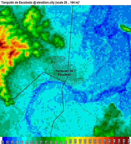
Below is the Elevation map of Tanquián de Escobedo, which displays elevation range with different colors. Scale of the first map is from 28 to 164 m (92 to 538 ft) with average elevation of 57.7 meters (=189 ft) [note 1]
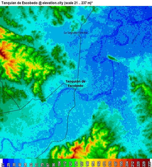
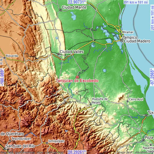
These maps also provides idea of topography and contour of this city, they are displayed at different zoom levels. More info about maps, scale and edge coordinates you can find below images.
| \ | Map #1 | Map #2 | Topo.Map |
| Scale [m] | 28..164 m | 21..237 m | × |
| Scale [ft] | 92..538 ft | 69..778 ft | × |
| Average | 57.7 m = 189 ft | 68.5 m = 225 ft | × |
| Width | 9.09 km = 5.6 mi | 18.17 km = 11.3 mi | 290.7 km = 180.6 mi |
| Height | 9.09 km = 5.6 mi | 18.17 km = 11.3 mi | 290.7 km = 180.6 mi |
| ↑Max Latitude | 21.646722° | 21.687562° | 22.90731° |
| Latitude at center | 21.60587° | 21.60587° | 21.60587° |
| ↓Min Latitude | 21.565007° | 21.524132° | 20.29261° |
| ← Min Longitude | -98.706695° | -98.750641° | -100.069° |
| Longitude center | -98.66275° | -98.66275° | -98.66275° |
| →Max Longitude | -98.618805° | -98.574859° | -97.2565° |
Nearby cities:
Cities around Tanquián de Escobedo sort by population:
• San Vicente Tancuayalab elevation 49 m
14.8 km,  31°
31°
• Tampamolón Corona 99 m
17 km,  252°
252°
• San Martín Chalchicuautla 188 m
26.2 km,  178°
178°
• Coxcatlán 141 m
26.3 km, 254°
• Corozal 131 m
13 km,  120°
120°
• Tampacán 140 m
23.7 km,  196°
196°
• San Francisco Cuayalab 184 m
15.2 km,  338°
338°
• Tanlajás 136 m
24 km,  285°
285°
• Chiconamel 252 m
27.1 km,  192°
192°
• Tocoy 260 m
21.8 km,  279°
279°
• San Nicolás 154 m
14.3 km,  303°
303°
• San Antonio 221 m
24.9 km,  273°
273°
Multilingual:
 En español:
Tanquián de Escobedo elevación 59 m.
 En France:
Tanquián de Escobedo élévation 59 m.
 Auf Deutsch:
Tanquián de Escobedo höhe über dem Meeresspiegel ist 59 m.
 На русском:
Tanquián de Escobedo высота над уровнем моря 59 м
Sources and notes:
- [note 1] Map square and city borders are not equal. Map elevation data is calculated only from area inside that square.
- [src 1] Elevation data from geonames database provided with same terms of usage.
- [src 2] The elevation map of Tanquián de Escobedo is generated using elevation data from NASA's 3 arcsec (90m) resolution SRTM data.
- [src 3] Base (background) map © OpenStreetMap contributors tiles are generated by Geofabrik and OpenTopoMap.
Copyright & License:
This Tanquián de Escobedo Elevation Map is licensed under CC BY-SA. You may reuse any part from this page, if you give a proper credit by linking to this URL:
 More info on terms of use page.