Esperanza elevation
Esperanza (Puebla), Mexico elevation is 2456 meters and Esperanza elevation in feet is 8058 ft above sea level [src 1]. Esperanza is a seat of a second-order administrative division (feature code) with elevation that is 1142 meters (3747 ft) bigger than average city elevation in Mexico.
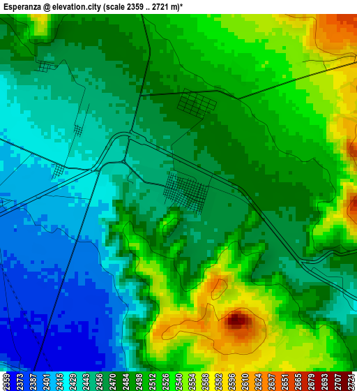
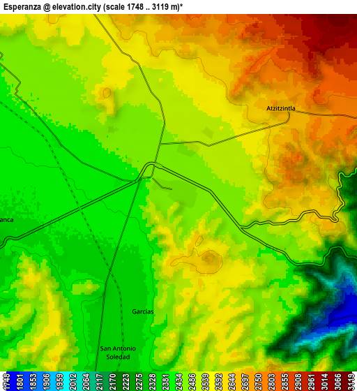
Below is the Elevation map of Esperanza, which displays elevation range with different colors. Scale of the first map is from 2359 to 2721 m (7740 to 8927 ft) with average elevation of 2480.3 meters (=8137 ft) [note 1]
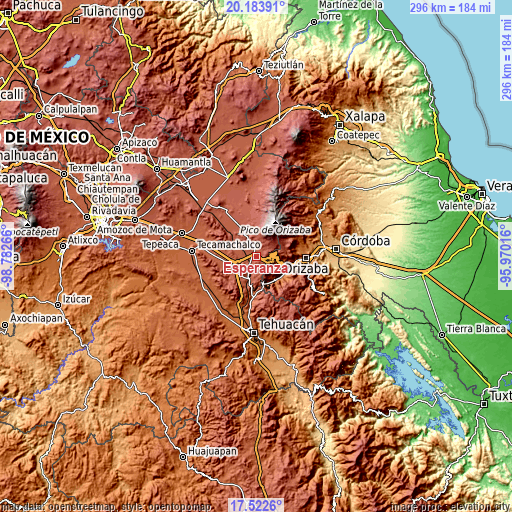
These maps also provides idea of topography and contour of this city, they are displayed at different zoom levels. More info about maps, scale and edge coordinates you can find below images.
| \ | Map #1 | Map #2 | Topo.Map |
| Scale [m] | 2359..2721 m | 1748..3119 m | × |
| Scale [ft] | 7740..8927 ft | 5735..10233 ft | × |
| Average | 2480.3 m = 8137 ft | 2504.7 m = 8218 ft | × |
| Width | 9.25 km = 5.7 mi | 18.5 km = 11.5 mi | 295.9 km = 183.9 mi |
| Height | 9.25 km = 5.7 mi | 18.5 km = 11.5 mi | 295.9 km = 183.9 mi |
| ↑Max Latitude | 18.900111° | 18.941682° | 20.18391° |
| Latitude at center | 18.85853° | 18.85853° | 18.85853° |
| ↓Min Latitude | 18.816939° | 18.775337° | 17.5226° |
| ← Min Longitude | -97.420355° | -97.464301° | -98.78266° |
| Longitude center | -97.37641° | -97.37641° | -97.37641° |
| →Max Longitude | -97.332465° | -97.288519° | -95.97016° |
Nearby cities:
Cities around Esperanza sort by population:
• Maltrata elevation 1720 m
11.9 km,  116°
116°
• Morelos Cañada 2297 m
14.5 km,  198°
198°
• Cuesta Blanca 2370 m
9.7 km,  261°
261°
• Huiloapan 2248 m
13.6 km,  152°
152°
• Atzitzintla 2693 m
7.1 km,  50°
50°
• San Antonio Soledad 2337 m
8.9 km, 201°
• Santa María Techachalco 2536 m
14.5 km,  316°
316°
• Santa Cruz Texmalaquilla 3119 m
13.3 km,  44°
44°
• San José Cuyachapa 2625 m
6.6 km,  93°
93°
• Los Garcías 2369 m
6.4 km, 196°
• Paso Carretas 2738 m
14.8 km,  62°
62°
• Aquila 1838 m
10 km,  134°
134°
Multilingual:
 En español:
Esperanza elevación 2456 m.
 En France:
Esperanza élévation 2456 m.
 Auf Deutsch:
Esperanza höhe über dem Meeresspiegel ist 2456 m.

Sources and notes:
- [note 1] Map square and city borders are not equal. Map elevation data is calculated only from area inside that square.
- [src 1] Elevation data from geonames database provided with same terms of usage.
- [src 2] The elevation map of Esperanza is generated using elevation data from NASA's 3 arcsec (90m) resolution SRTM data.
- [src 3] Base (background) map © OpenStreetMap contributors tiles are generated by Geofabrik and OpenTopoMap.
Copyright & License:
This Esperanza Elevation Map is licensed under CC BY-SA. You may reuse any part from this page, if you give a proper credit by linking to this URL:
 More info on terms of use page.