Jacala elevation
Jacala (Hidalgo, Jacala de Ledezma), Mexico elevation is 1360 meters and Jacala elevation in feet is 4462 ft above sea level [src 1]. Jacala is a populated place (feature code) with elevation that is 46 meters (151 ft) bigger than average city elevation in Mexico.
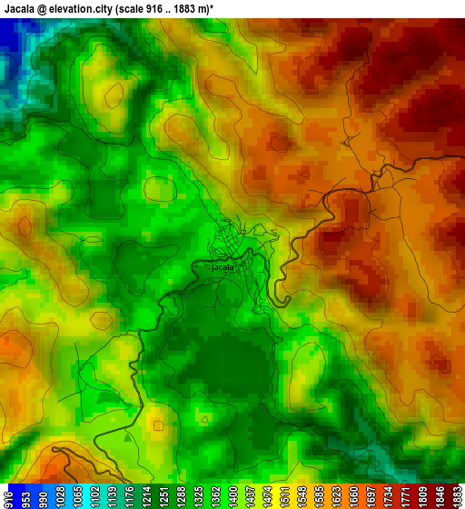
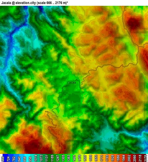
Below is the Elevation map of Jacala, which displays elevation range with different colors. Scale of the first map is from 916 to 1883 m (3005 to 6178 ft) with average elevation of 1475.9 meters (=4842 ft) [note 1]
These maps also provides idea of topography and contour of this city, they are displayed at different zoom levels. More info about maps, scale and edge coordinates you can find below images.
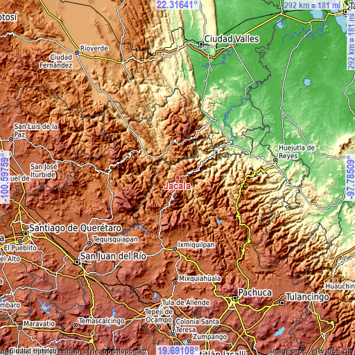
| \ | Map #1 | Map #2 | Topo.Map |
| Scale [m] | 916..1883 m | 666..2176 m | × |
| Scale [ft] | 3005..6178 ft | 2185..7139 ft | × |
| Average | 1475.9 m = 4842 ft | 1439.4 m = 4722 ft | × |
| Width | 9.12 km = 5.7 mi | 18.25 km = 11.3 mi | 291.9 km = 181.4 mi |
| Height | 9.12 km = 5.7 mi | 18.25 km = 11.3 mi | 291.9 km = 181.4 mi |
| ↑Max Latitude | 21.050538° | 21.091545° | 22.31641° |
| Latitude at center | 21.00952° | 21.00952° | 21.00952° |
| ↓Min Latitude | 20.96849° | 20.92745° | 19.69108° |
| ← Min Longitude | -99.235285° | -99.279231° | -100.59759° |
| Longitude center | -99.19134° | -99.19134° | -99.19134° |
| →Max Longitude | -99.147395° | -99.103449° | -97.78509° |
Nearby cities:
Cities around Jacala sort by population:
• Zimapan elevation 1779 m
36.1 km,  213°
213°
• Chapulhuacán 942 m
34.1 km,  61°
61°
• Pisaflores 267 m
28.2 km,  43°
43°
• Texcapa 1056 m
36.2 km,  75°
75°
• Landa de Matamoros 1027 m
23.6 km,  325°
325°
• Santa Ana de Allende 1344 m
24.8 km, 59°
• San Juan Ahuehueco 1039 m
29.7 km, 83°
• Agua Zarca 1364 m
25.6 km,  24°
24°
• La Reforma 416 m
34 km, 77°
• Tepehuacán de Guerrero 876 m
36.3 km,  89°
89°
• Cuazahuatl 1358 m
31.6 km, 88°
• Francisco I. Madero 1922 m
33.6 km,  203°
203°
Multilingual:
 En español:
Jacala elevación 1360 m.
 En France:
Jacala élévation 1360 m.


Sources and notes:
- [note 1] Map square and city borders are not equal. Map elevation data is calculated only from area inside that square.
- [src 1] Elevation data from geonames database provided with same terms of usage.
- [src 2] The elevation map of Jacala is generated using elevation data from NASA's 3 arcsec (90m) resolution SRTM data.
- [src 3] Base (background) map © OpenStreetMap contributors tiles are generated by Geofabrik and OpenTopoMap.
Copyright & License:
This Jacala Elevation Map is licensed under CC BY-SA. You may reuse any part from this page, if you give a proper credit by linking to this URL:
 More info on terms of use page.