Las Vigas de Ramírez elevation
Las Vigas de Ramírez (Veracruz), Mexico elevation is 2438 meters and Las Vigas de Ramírez elevation in feet is 7999 ft above sea level [src 1]. Las Vigas de Ramírez is a seat of a second-order administrative division (feature code) with elevation that is 1124 meters (3688 ft) bigger than average city elevation in Mexico.
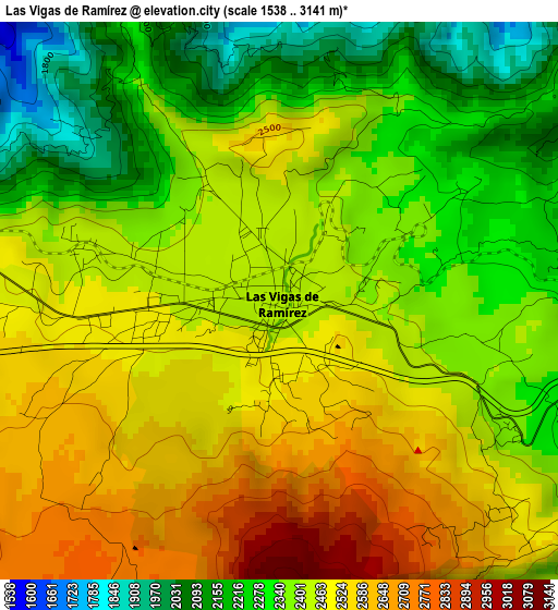
Below is the Elevation map of Las Vigas de Ramírez, which displays elevation range with different colors. Scale of the first map is from 1538 to 3141 m (5046 to 10305 ft) with average elevation of 2415.2 meters (=7924 ft) [note 1]
These maps also provides idea of topography and contour of this city, they are displayed at different zoom levels. More info about maps, scale and edge coordinates you can find below images.
| \ | Map #1 | Map #2 | Topo.Map |
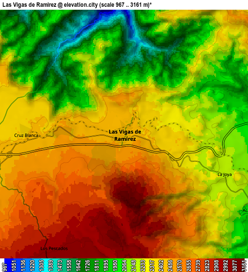
| Scale [m] | 1538..3141 m | 967..3161 m | × |
| Scale [ft] | 5046..10305 ft | 3173..10371 ft | × |
| Average | 2415.2 m = 7924 ft | 2306.2 m = 7566 ft | × |
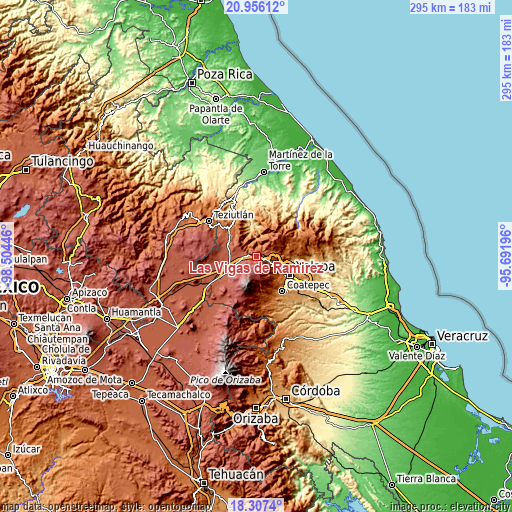
| Width | 9.2 km = 5.7 mi | 18.41 km = 11.4 mi | 294.5 km = 183 mi |
| Height | 9.2 km = 5.7 mi | 18.41 km = 11.4 mi | 294.5 km = 183 mi |
| ↑Max Latitude | 19.678604° | 19.719977° | 20.95612° |
| Latitude at center | 19.63722° | 19.63722° | 19.63722° |
| ↓Min Latitude | 19.595825° | 19.55442° | 18.3074° |
| ← Min Longitude | -97.142155° | -97.186101° | -98.50446° |
| Longitude center | -97.09821° | -97.09821° | -97.09821° |
| →Max Longitude | -97.054265° | -97.010319° | -95.69196° |
Nearby cities:
Cities around Las Vigas de Ramírez sort by population:
• Rafael Lucio elevation 1827 m
12.3 km,  113°
113°
• Colonia Libertad 2442 m
12.8 km,  290°
290°
• Centro de Readaptación Social 2378 m
12.9 km,  263°
263°
• Sierra de Agua 2419 m
11.3 km,  251°
251°
• Cruz Blanca 2394 m
7.2 km,  270°
270°
• Acajete 2028 m
10.8 km,  121°
121°
• Los Pescados 2988 m
10 km,  211°
211°
• Tlacolulan 1755 m
10.6 km,  71°
71°
• La Joya 2169 m
8 km, 111°
• Barrio de San Miguel 2417 m
2.8 km,  284°
284°
• Tatatila 2061 m
6.4 km,  347°
347°
• Las Minas 1353 m
7.8 km,  320°
320°
Multilingual:
 En español:
Las Vigas de Ramírez elevación 2438 m.
 En France:
Las Vigas de Ramírez élévation 2438 m.
 Auf Deutsch:
Las Vigas de Ramírez höhe über dem Meeresspiegel ist 2438 m.
 На русском:
Las Vigas de Ramírez высота над уровнем моря 2438 м
Sources and notes:
- [note 1] Map square and city borders are not equal. Map elevation data is calculated only from area inside that square.
- [src 1] Elevation data from geonames database provided with same terms of usage.
- [src 2] The elevation map of Las Vigas de Ramírez is generated using elevation data from NASA's 3 arcsec (90m) resolution SRTM data.
- [src 3] Base (background) map © OpenStreetMap contributors tiles are generated by Geofabrik and OpenTopoMap.
Copyright & License:
This Las Vigas de Ramírez Elevation Map is licensed under CC BY-SA. You may reuse any part from this page, if you give a proper credit by linking to this URL:
 More info on terms of use page.