San Juan Amecac elevation
San Juan Amecac (Puebla, Atzitzihuacán), Mexico elevation is 2079 meters and San Juan Amecac elevation in feet is 6821 ft above sea level [src 1]. San Juan Amecac is a populated place (feature code) with elevation that is 765 meters (2510 ft) bigger than average city elevation in Mexico.
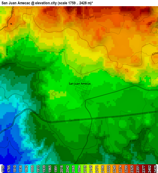
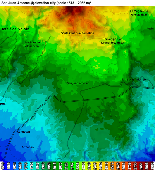
Below is the Elevation map of San Juan Amecac, which displays elevation range with different colors. Scale of the first map is from 1759 to 2428 m (5771 to 7966 ft) with average elevation of 2073.9 meters (=6804 ft) [note 1]
These maps also provides idea of topography and contour of this city, they are displayed at different zoom levels. More info about maps, scale and edge coordinates you can find below images.
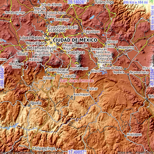
| \ | Map #1 | Map #2 | Topo.Map |
| Scale [m] | 1759..2428 m | 1513..2962 m | × |
| Scale [ft] | 5771..7966 ft | 4964..9718 ft | × |
| Average | 2073.9 m = 6804 ft | 2037.9 m = 6686 ft | × |
| Width | 9.25 km = 5.7 mi | 18.5 km = 11.5 mi | 296 km = 183.9 mi |
| Height | 9.25 km = 5.7 mi | 18.5 km = 11.5 mi | 296 km = 183.9 mi |
| ↑Max Latitude | 18.876277° | 18.917854° | 20.16026° |
| Latitude at center | 18.83469° | 18.83469° | 18.83469° |
| ↓Min Latitude | 18.793093° | 18.751485° | 17.49857° |
| ← Min Longitude | -98.703035° | -98.746981° | -100.06534° |
| Longitude center | -98.65909° | -98.65909° | -98.65909° |
| →Max Longitude | -98.615145° | -98.571199° | -97.25284° |
Nearby cities:
Cities around San Juan Amecac sort by population:
• Tetela del Volcán elevation 2222 m
9.9 km,  311°
311°
• Hueyapan 2360 m
6.6 km,  338°
338°
• Tlacotepec 1775 m
9.3 km,  256°
256°
• Tochimilco 2055 m
11.1 km,  55°
55°
• San Antonio Alpanocan 2096 m
7.2 km, 310°
• Metepec 2052 m
10.4 km,  298°
298°
• Acteopan 1666 m
9.7 km,  216°
216°
• Cohuecán 1706 m
8.7 km,  228°
228°
• Santa Cruz Cuautomatitla 2519 m
6.1 km,  359°
359°
• Tecuanipa 2291 m
6.7 km,  39°
39°
• Tulcingo 1964 m
6.7 km,  87°
87°
• Santiago Atzitzihuacán 1820 m
8.2 km,  97°
97°
Multilingual:
 En español:
San Juan Amecac elevación 2079 m.
 En France:
San Juan Amecac élévation 2079 m.
 Auf Deutsch:
San Juan Amecac höhe über dem Meeresspiegel ist 2079 m.

Sources and notes:
- [note 1] Map square and city borders are not equal. Map elevation data is calculated only from area inside that square.
- [src 1] Elevation data from geonames database provided with same terms of usage.
- [src 2] The elevation map of San Juan Amecac is generated using elevation data from NASA's 3 arcsec (90m) resolution SRTM data.
- [src 3] Base (background) map © OpenStreetMap contributors tiles are generated by Geofabrik and OpenTopoMap.
Copyright & License:
This San Juan Amecac Elevation Map is licensed under CC BY-SA. You may reuse any part from this page, if you give a proper credit by linking to this URL:
 More info on terms of use page.