Tlanalapa elevation
Tlanalapa (Hidalgo), Mexico elevation is 2457 meters and Tlanalapa elevation in feet is 8061 ft above sea level [src 1]. Tlanalapa is a seat of a second-order administrative division (feature code) with elevation that is 1143 meters (3750 ft) bigger than average city elevation in Mexico.
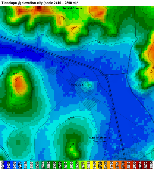
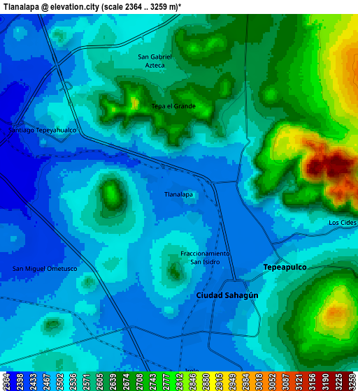
Below is the Elevation map of Tlanalapa, which displays elevation range with different colors. Scale of the first map is from 2416 to 2890 m (7927 to 9482 ft) with average elevation of 2520.3 meters (=8269 ft) [note 1]
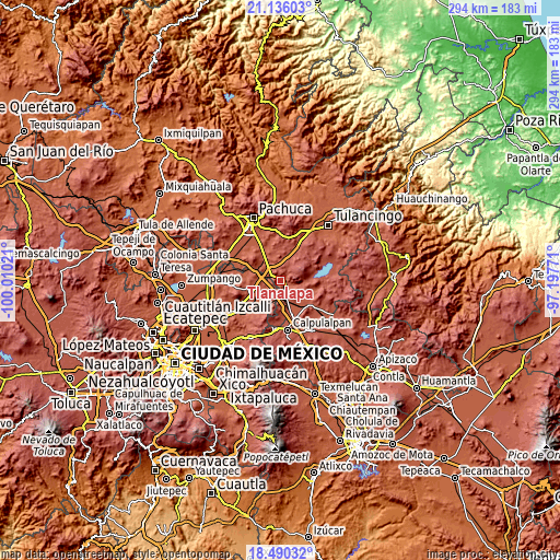
These maps also provides idea of topography and contour of this city, they are displayed at different zoom levels. More info about maps, scale and edge coordinates you can find below images.
| \ | Map #1 | Map #2 | Topo.Map |
| Scale [m] | 2416..2890 m | 2364..3259 m | × |
| Scale [ft] | 7927..9482 ft | 7756..10692 ft | × |
| Average | 2520.3 m = 8269 ft | 2563.3 m = 8410 ft | × |
| Width | 9.19 km = 5.7 mi | 18.39 km = 11.4 mi | 294.2 km = 182.8 mi |
| Height | 9.19 km = 5.7 mi | 18.39 km = 11.4 mi | 294.2 km = 182.8 mi |
| ↑Max Latitude | 19.860017° | 19.901343° | 21.13603° |
| Latitude at center | 19.81868° | 19.81868° | 19.81868° |
| ↓Min Latitude | 19.777332° | 19.735974° | 18.49032° |
| ← Min Longitude | -98.647905° | -98.691851° | -100.01021° |
| Longitude center | -98.60396° | -98.60396° | -98.60396° |
| →Max Longitude | -98.560015° | -98.516069° | -97.19771° |
Nearby cities:
Cities around Tlanalapa sort by population:
• Ciudad Sahagun elevation 2455 m
5.7 km,  147°
147°
• Tepeapulco 2504 m
6.3 km,  122°
122°
• Zempoala 2460 m
12.6 km,  329°
329°
• Jaltepec 2539 m
10.4 km,  197°
197°
• San Felipe Teotitlán 2457 m
10.3 km,  261°
261°
• Nopaltepec 2451 m
12 km,  248°
248°
• Santiago Tepeyahualco 2458 m
7.6 km,  295°
295°
• Santo Tomas 2655 m
10.1 km,  21°
21°
• Irolo 2456 m
9.4 km,  175°
175°
• Los Cides 2515 m
9.1 km,  100°
100°
• San Isidro 2468 m
3.5 km,  158°
158°
• San Gabriel Azteca 2562 m
7 km,  349°
349°
Multilingual:
 En español:
Tlanalapa elevación 2457 m.
 En France:
Tlanalapa élévation 2457 m.
 Auf Deutsch:
Tlanalapa höhe über dem Meeresspiegel ist 2457 m.

Sources and notes:
- [note 1] Map square and city borders are not equal. Map elevation data is calculated only from area inside that square.
- [src 1] Elevation data from geonames database provided with same terms of usage.
- [src 2] The elevation map of Tlanalapa is generated using elevation data from NASA's 3 arcsec (90m) resolution SRTM data.
- [src 3] Base (background) map © OpenStreetMap contributors tiles are generated by Geofabrik and OpenTopoMap.
Copyright & License:
This Tlanalapa Elevation Map is licensed under CC BY-SA. You may reuse any part from this page, if you give a proper credit by linking to this URL:
 More info on terms of use page.