San Felipe Teotitlán elevation
San Felipe Teotitlán (Morelos), Mexico elevation is 2457 meters and San Felipe Teotitlán elevation in feet is 8061 ft above sea level [src 1]. San Felipe Teotitlán is a populated place (feature code) with elevation that is 1143 meters (3750 ft) bigger than average city elevation in Mexico.
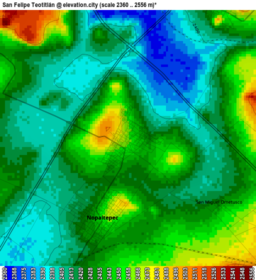
Below is the Elevation map of San Felipe Teotitlán, which displays elevation range with different colors. Scale of the first map is from 2360 to 2556 m (7743 to 8386 ft) with average elevation of 2425 meters (=7956 ft) [note 1]
These maps also provides idea of topography and contour of this city, they are displayed at different zoom levels. More info about maps, scale and edge coordinates you can find below images.
| \ | Map #1 | Map #2 | Topo.Map |
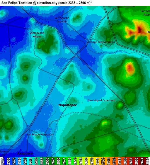
| Scale [m] | 2360..2556 m | 2333..2896 m | × |
| Scale [ft] | 7743..8386 ft | 7654..9501 ft | × |
| Average | 2425 m = 7956 ft | 2451.3 m = 8042 ft | × |
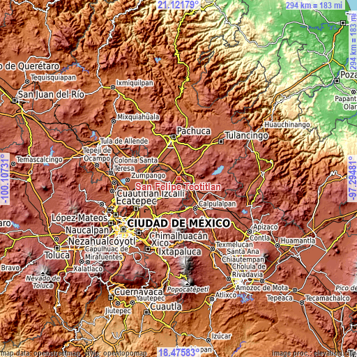
| Width | 9.19 km = 5.7 mi | 18.39 km = 11.4 mi | 294.2 km = 182.8 mi |
| Height | 9.19 km = 5.7 mi | 18.39 km = 11.4 mi | 294.2 km = 182.8 mi |
| ↑Max Latitude | 19.845651° | 19.886981° | 21.12179° |
| Latitude at center | 19.80431° | 19.80431° | 19.80431° |
| ↓Min Latitude | 19.762958° | 19.721596° | 18.47583° |
| ← Min Longitude | -98.745005° | -98.788951° | -100.10731° |
| Longitude center | -98.70106° | -98.70106° | -98.70106° |
| →Max Longitude | -98.657115° | -98.613169° | -97.29481° |
Nearby cities:
Cities around San Felipe Teotitlán sort by population:
• Tlanalapa elevation 2457 m
10.3 km,  81°
81°
• Jaltepec 2539 m
10.8 km,  140°
140°
• Santa María Actipac 2450 m
7.4 km,  320°
320°
• Nopaltepec 2451 m
3.1 km,  198°
198°
• Axapusco 2351 m
10.7 km,  214°
214°
• Santo Domingo Aztacameca 2477 m
7.4 km,  250°
250°
• Santiago Tepeyahualco 2458 m
5.9 km,  33°
33°
• San Miguel Atepoxco 2415 m
7.8 km, 211°
• Colonia los Remedios 2409 m
12.2 km,  230°
230°
• San Agustín Zapotlán 2382 m
8 km,  350°
350°
• San Isidro 2468 m
11.6 km,  98°
98°
• San Gabriel Azteca 2562 m
12.3 km,  46°
46°
Multilingual:
 En español:
San Felipe Teotitlán elevación 2457 m.
 En France:
San Felipe Teotitlán élévation 2457 m.
 Auf Deutsch:
San Felipe Teotitlán höhe über dem Meeresspiegel ist 2457 m.
 На русском:
San Felipe Teotitlán высота над уровнем моря 2457 м
Sources and notes:
- [note 1] Map square and city borders are not equal. Map elevation data is calculated only from area inside that square.
- [src 1] Elevation data from geonames database provided with same terms of usage.
- [src 2] The elevation map of San Felipe Teotitlán is generated using elevation data from NASA's 3 arcsec (90m) resolution SRTM data.
- [src 3] Base (background) map © OpenStreetMap contributors tiles are generated by Geofabrik and OpenTopoMap.
Copyright & License:
This San Felipe Teotitlán Elevation Map is licensed under CC BY-SA. You may reuse any part from this page, if you give a proper credit by linking to this URL:
 More info on terms of use page.