Arkalyk elevation
Arkalyk (Qostanay), Kazakhstan elevation is 349 meters and Arkalyk elevation in feet is 1145 ft above sea level [src 1]. Arkalyk is a populated place (feature code) with elevation that is 9 meters (30 ft) smaller than average city elevation in Kazakhstan.
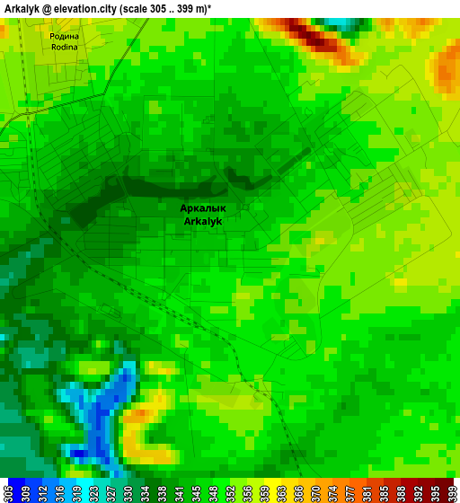
Below is the Elevation map of Arkalyk, which displays elevation range with different colors. Scale of the first map is from 305 to 399 m (1001 to 1309 ft) with average elevation of 347.7 meters (=1141 ft) [note 1]
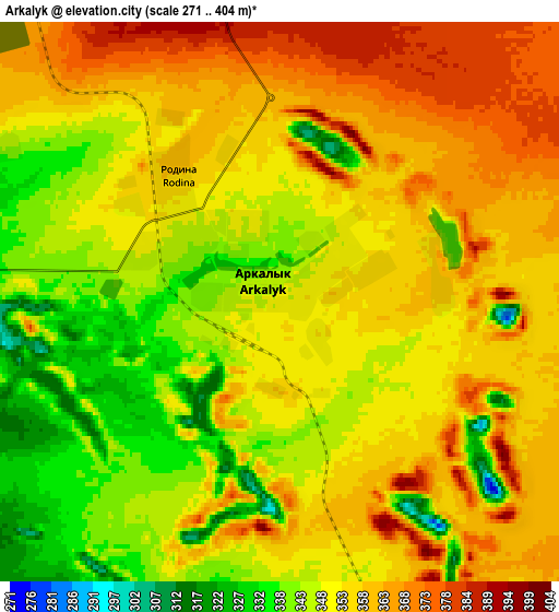
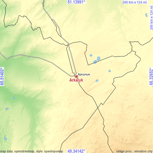
These maps also provides idea of topography and contour of this city, they are displayed at different zoom levels. More info about maps, scale and edge coordinates you can find below images.
| \ | Map #1 | Map #2 | Topo.Map |
| Scale [m] | 305..399 m | 271..404 m | × |
| Scale [ft] | 1001..1309 ft | 889..1325 ft | × |
| Average | 347.7 m = 1141 ft | 352.4 m = 1156 ft | × |
| Width | 6.25 km = 3.9 mi | 12.5 km = 7.8 mi | 200 km = 124.3 mi |
| Height | 6.25 km = 3.9 mi | 12.5 km = 7.8 mi | 200 km = 124.3 mi |
| ↑Max Latitude | 50.277243° | 50.305319° | 51.13991° |
| Latitude at center | 50.24915° | 50.24915° | 50.24915° |
| ↓Min Latitude | 50.221041° | 50.192915° | 49.34142° |
| ← Min Longitude | 66.876325° | 66.832379° | 65.51402° |
| Longitude center | 66.92027° | 66.92027° | 66.92027° |
| →Max Longitude | 66.964215° | 67.008161° | 68.32652° |
Nearby cities:
Cities around Arkalyk sort by population:
• Zhezqazghan elevation 330 m
281 km,  167°
167°
• Atbasar 283 m
200.3 km,  30°
30°
• Derzhavīnsk 247 m
103.7 km,  335°
335°
• Esil 221 m
193 km,  349°
349°
• Astrakhan 302 m
247 km,  54°
54°
• Shantobe 385 m
260.1 km,  19°
19°
• Torghay 105 m
254.2 km,  254°
254°
• Zhaqsy 392 m
186.8 km,  8°
8°
• Egindiköl 340 m
201.4 km,  63°
63°
• Krasnogorskiy 202 m
223.7 km, 352°
• Shubarköl 442 m
204 km,  138°
138°
• Atbasar 280 m
198.7 km, 29°
Multilingual:
 En español:
Arkalyk elevación 349 m.
 En France:
Arkalyk élévation 349 m.


Sources and notes:
- [note 1] Map square and city borders are not equal. Map elevation data is calculated only from area inside that square.
- [src 1] Elevation data from geonames database provided with same terms of usage.
- [src 2] The elevation map of Arkalyk is generated using elevation data from NASA's 3 arcsec (90m) resolution SRTM data.
- [src 3] Base (background) map © OpenStreetMap contributors tiles are generated by Geofabrik and OpenTopoMap.
Copyright & License:
This Arkalyk Elevation Map is licensed under CC BY-SA. You may reuse any part from this page, if you give a proper credit by linking to this URL:
 More info on terms of use page.