Torghay elevation
Torghay (Qostanay), Kazakhstan elevation is 105 meters and Torghay elevation in feet is 344 ft above sea level [src 1]. Torghay is a populated place (feature code) with elevation that is 253 meters (830 ft) smaller than average city elevation in Kazakhstan.
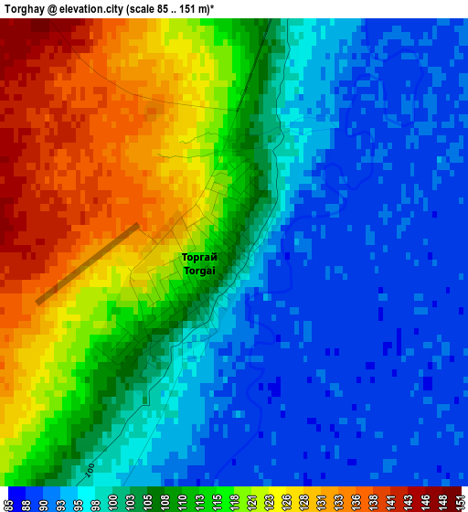
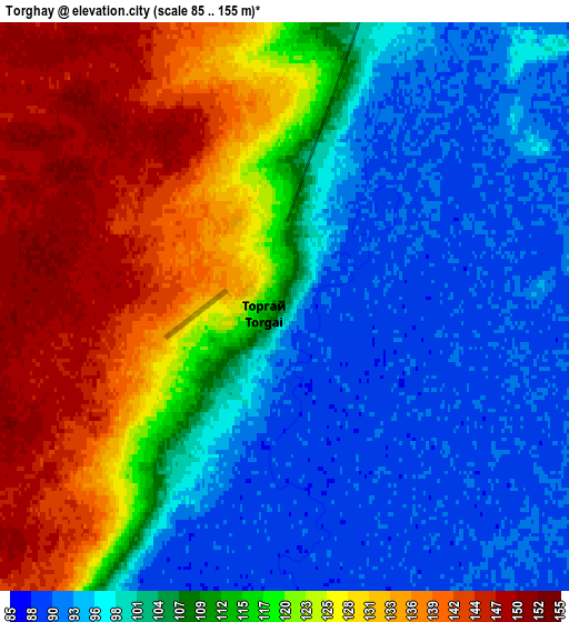
Below is the Elevation map of Torghay, which displays elevation range with different colors. Scale of the first map is from 85 to 151 m (279 to 495 ft) with average elevation of 107.1 meters (=351 ft) [note 1]
These maps also provides idea of topography and contour of this city, they are displayed at different zoom levels. More info about maps, scale and edge coordinates you can find below images.
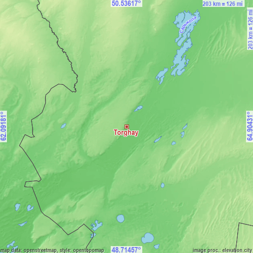
| \ | Map #1 | Map #2 | Topo.Map |
| Scale [m] | 85..151 m | 85..155 m | × |
| Scale [ft] | 279..495 ft | 279..509 ft | × |
| Average | 107.1 m = 351 ft | 111.9 m = 367 ft | × |
| Width | 6.33 km = 3.9 mi | 12.66 km = 7.9 mi | 202.5 km = 125.8 mi |
| Height | 6.33 km = 3.9 mi | 12.66 km = 7.9 mi | 202.5 km = 125.8 mi |
| ↑Max Latitude | 49.662344° | 49.690781° | 50.53617° |
| Latitude at center | 49.63389° | 49.63389° | 49.63389° |
| ↓Min Latitude | 49.60542° | 49.576933° | 48.71457° |
| ← Min Longitude | 63.454115° | 63.410169° | 62.09181° |
| Longitude center | 63.49806° | 63.49806° | 63.49806° |
| →Max Longitude | 63.542005° | 63.585951° | 64.90431° |
Nearby cities:
Cities around Torghay sort by population:
• Dzhetygara elevation 271 m
326.7 km,  330°
330°
• Arkalyk 349 m
254.2 km,  74°
74°
• Lisakovsk 192 m
331.3 km,  347°
347°
• Aral 57 m
343 km,  203°
203°
• Derzhavīnsk 247 m
257.8 km,  50°
50°
• Esil 221 m
329.3 km,  38°
38°
• Sekseūil 73 m
331.7 km,  211°
211°
• Qusmuryn 114 m
322.9 km,  14°
14°
• Tobol 207 m
346 km, 349°
• Ordzhonikidze 228 m
335.9 km,  338°
338°
• Yrghyz 100 m
197.9 km,  235°
235°
• Krasnogorskiy 202 m
359.4 km, 36°
Multilingual:
 En español:
Torghay elevación 105 m.
 En France:
Torghay élévation 105 m.


Sources and notes:
- [note 1] Map square and city borders are not equal. Map elevation data is calculated only from area inside that square.
- [src 1] Elevation data from geonames database provided with same terms of usage.
- [src 2] The elevation map of Torghay is generated using elevation data from NASA's 3 arcsec (90m) resolution SRTM data.
- [src 3] Base (background) map © OpenStreetMap contributors tiles are generated by Geofabrik and OpenTopoMap.
Copyright & License:
This Torghay Elevation Map is licensed under CC BY-SA. You may reuse any part from this page, if you give a proper credit by linking to this URL:
 More info on terms of use page.