Cepina elevation
Cepina (Lombardy, Provincia di Sondrio), Italy elevation is 1156 meters and Cepina elevation in feet is 3793 ft above sea level [src 1]. Cepina is a seat of a third-order administrative division (feature code) with elevation that is 834 meters (2736 ft) bigger than average city elevation in Italy.
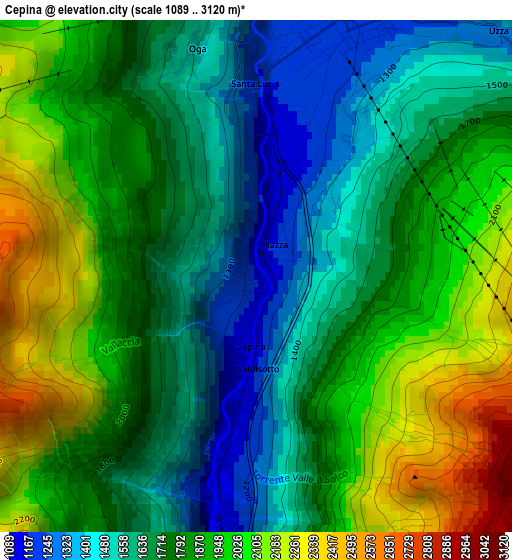
Below is the Elevation map of Cepina, which displays elevation range with different colors. Scale of the first map is from 1089 to 3120 m (3573 to 10236 ft) with average elevation of 1789.9 meters (=5872 ft) [note 1]
These maps also provides idea of topography and contour of this city, they are displayed at different zoom levels. More info about maps, scale and edge coordinates you can find below images.
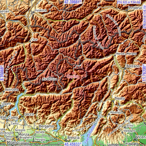
| \ | Map #1 | Topo.Map |
| Scale [m] | 1089..3120 m | × |
| Scale [ft] | 3573..10236 ft | × |
| Average | 1789.9 m = 5872 ft | × |
| Width | 6.73 km = 4.2 mi | 215.5 km = 133.9 mi |
| Height | 6.73 km = 4.2 mi | 215.5 km = 133.9 mi |
| ↑Max Latitude | 46.466367° | 47.39661° |
| Latitude at center | 46.43609° | 46.43609° |
| ↓Min Latitude | 46.405796° | 45.45833° |
| ← Min Longitude | 10.313185° | 8.95088° |
| Longitude center | 10.35713° | 10.35713° |
| →Max Longitude | 10.401075° | 11.76338° |
Nearby cities:
Cities around Cepina sort by population:
• Livigno elevation 1819 m
20.4 km,  303°
303°
• Grosio 666 m
16.4 km,  202°
202°
• Bormio 1204 m
3.6 km,  16°
16°
• Valdisotto 1165 m
0.2 km,  184°
184°
• San Nicolò 1335 m
5 km,  53°
53°
• Sondalo 880 m
12 km,  191°
191°
• Grosotto 603 m
18.7 km, 203°
• Sant'Antonio 1330 m
5.4 km,  58°
58°
• Vezza d'Oglio 1035 m
22.2 km,  171°
171°
• Isolaccia 1356 m
7.6 km,  320°
320°
• Mazzo di Valtellina 553 m
21.4 km, 201°
• Vione 1244 m
22 km,  161°
161°
Multilingual:
 En español:
Cepina elevación 1156 m.
 En France:
Cepina élévation 1156 m.


Sources and notes:
- [note 1] Map square and city borders are not equal. Map elevation data is calculated only from area inside that square.
- [src 1] Elevation data from geonames database provided with same terms of usage.
- [src 2] The elevation map of Cepina is generated using elevation data from NASA's 3 arcsec (90m) resolution SRTM data.
- [src 3] Base (background) map © OpenStreetMap contributors tiles are generated by Geofabrik and OpenTopoMap.
Copyright & License:
This Cepina Elevation Map is licensed under CC BY-SA. You may reuse any part from this page, if you give a proper credit by linking to this URL:
 More info on terms of use page.