Vezza d'Oglio elevation
Vezza d'Oglio (Lombardy, Provincia di Brescia), Italy elevation is 1035 meters and Vezza d'Oglio elevation in feet is 3396 ft above sea level [src 1]. Vezza d'Oglio is a seat of a third-order administrative division (feature code) with elevation that is 713 meters (2339 ft) bigger than average city elevation in Italy.
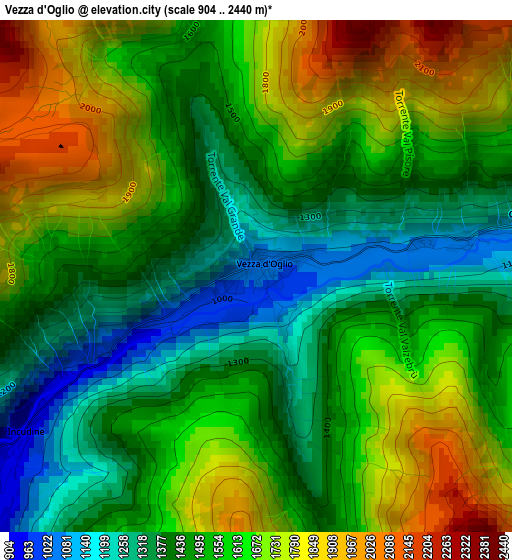
Below is the Elevation map of Vezza d'Oglio, which displays elevation range with different colors. Scale of the first map is from 904 to 2440 m (2966 to 8005 ft) with average elevation of 1556.4 meters (=5106 ft) [note 1]
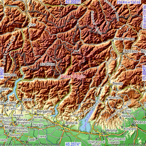
These maps also provides idea of topography and contour of this city, they are displayed at different zoom levels. More info about maps, scale and edge coordinates you can find below images.
| \ | Map #1 | Topo.Map |
| Scale [m] | 904..2440 m | × |
| Scale [ft] | 2966..8005 ft | × |
| Average | 1556.4 m = 5106 ft | × |
| Width | 6.76 km = 4.2 mi | 216.3 km = 134.4 mi |
| Height | 6.76 km = 4.2 mi | 216.3 km = 134.4 mi |
| ↑Max Latitude | 46.269057° | 47.2027° |
| Latitude at center | 46.23867° | 46.23867° |
| ↓Min Latitude | 46.208267° | 45.2574° |
| ← Min Longitude | 10.354305° | 8.992° |
| Longitude center | 10.39825° | 10.39825° |
| →Max Longitude | 10.442195° | 11.8045° |
Nearby cities:
Cities around Vezza d'Oglio sort by population:
• Grosio elevation 666 m
11.6 km,  305°
305°
• Edolo 672 m
8.4 km,  216°
216°
• Sondalo 880 m
11.5 km,  331°
331°
• Grosotto 603 m
11.7 km,  294°
294°
• Ponte di Legno 1247 m
8.9 km,  75°
75°
• Sonico 641 m
8.8 km,  204°
204°
• Mazzo di Valtellina 553 m
11.2 km,  280°
280°
• Tovo di Sant'Agata 530 m
11.7 km,  273°
273°
• Monno 1074 m
5.4 km,  236°
236°
• Temù 1167 m
5.4 km, 76°
• Incudine 933 m
3.7 km, 236°
• Vione 1244 m
4 km,  74°
74°
Multilingual:
 En español:
Vezza d'Oglio elevación 1035 m.
 En France:
Vezza d'Oglio élévation 1035 m.
 Auf Deutsch:
Vezza d'Oglio höhe über dem Meeresspiegel ist 1035 m.

Sources and notes:
- [note 1] Map square and city borders are not equal. Map elevation data is calculated only from area inside that square.
- [src 1] Elevation data from geonames database provided with same terms of usage.
- [src 2] The elevation map of Vezza d'Oglio is generated using elevation data from NASA's 3 arcsec (90m) resolution SRTM data.
- [src 3] Base (background) map © OpenStreetMap contributors tiles are generated by Geofabrik and OpenTopoMap.
Copyright & License:
This Vezza d'Oglio Elevation Map is licensed under CC BY-SA. You may reuse any part from this page, if you give a proper credit by linking to this URL:
 More info on terms of use page.